Bolivia - Part 2 of 2: Salar de Uyuni and 4x4 Offroading Andes Altiplano to Chile over Hito Cajón Mountain Pass

Salar de Uyuni, Bolivia: The world's largest salt flat, spanning over 4,086 square miles of the Bolivian Altiplano
Alright, buckle up, buttercups. After we finished part one of our Bolivian bonanza - which involved not falling out of a reed boat on Lake Titicaca and staring at ancient rocks in Tiwanaku (seriously, go read Part 1, it's good for you) - we pointed our travel-hungry noses toward Uyuni. The mission? To drive across the world's largest salt flat, the Salar de Uyuni, like a bunch of modern-day explorers, but with significantly less dysentery and much better Instagram opportunities. This included sleeping in hotels made of salt (licking the walls is optional, but tempting) and a multi-day, off-road 4x4 saga across the Andes altiplano and the Atacama Desert, all the way into Chile. It was less "Thelma & Louise" and more "Family Truckster on a geologic bender."
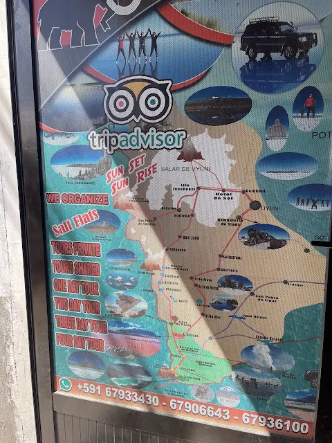
Here is a map of this part of our trip. I promise it's more exciting than the map of your local mall.
December 28, 2022
10:30 AM
Uyuni, Bolivia (20.4° S, 66.8° W, altitude 12,024 feet)
Our day started with the kind of enthusiasm usually reserved for root canals. We dragged ourselves out of bed at 4 AM for a 7:30 AM flight on Boliviana De Aviación from La Paz to Uyuni. Why so early? Because getting into Bolivia took approximately three ice ages at immigration (a thrilling saga detailed here), and I wasn't taking any chances. The check-in agent was confused we didn't have a guide and assigned us a minder, who periodically checked on us like we were escape-risk toddlers. The flight itself was lovely, with a layover in Cochabamba, though they confiscated our last aerosol of Lysol, declaring it a "fire hazard." I guess they've never seen me try to cook. The real show began on final approach to Uyuni's Joya Andina (Jewel of the Andes) airport, where we got our first mind-bending glimpse of the Salar de Uyuni - a salt flat so vast it could swallow the entire country of Lebanon and still have room for dessert.
Uyuni Joya Andina Airport Final Approach
https://www.youtube.com/watch?v=Bzoal_4_V1s
Geographical & Geological Sidebar: The Altiplano Playground Welcome to the Altiplano, a high plateau nestled between the eastern and western cordilleras of the Andes, averaging about 12,000 feet in elevation. This isn't just a big, flat, windy place. It's a complex basin that's been filling up with sediment, volcanic ash, and evaporated goodness for millions of years. The Salar de Uyuni is its crowning, salty jewel. It was formed when a giant prehistoric lake, Lake Minchin (and later Lake Tauca), evaporated like a forgotten puddle, leaving behind a crust of salt up to 30 feet thick in places. Beneath that crust? A soupy brine rich in lithium, magnesium, potassium, and boron. In fact, this single salt flat holds over half the world's known lithium reserves. So, when you're charging your fancy electric car, thank this bizarre, beautiful, and brutally bright white desert in Bolivia.

Salar de Uyuni from final approach to Uyuni Airport, Bolivia: Aerial view of the vast white expanse from the airplane window
The hospitality was top-notch, a genuine warmth that feels different from the scripted nice-ness you often get elsewhere. We collected our bags (miraculously, all there) and found our driver holding a placard outside. We were whisked away in a Toyota Land Cruiser toward our home for the night: the legendary, salt-constructed Hotel Luna Salada de Sal & Spa. On the way out of town, we passed a manual security checkpoint/toll booth where the attendant had to physically heave a lever to open the gate for each car. It was a solid bicep workout and probably the most secure gate in Bolivia, given the effort required.

Uyuni Joya Andina Airport, Uyuni, Bolivia: Modern terminal building at high altitude

Uyuni Joya Andina Airport, Uyuni, Bolivia: walking to arrival/departure hall

Uyuni Joya Andina Airport, Uyuni, Bolivia: View of the airport with arid landscape in the background
Cultural & Historical Pit Stop: The Town of Uyuni Nestled at a breath-stealing 12,000 feet, Uyuni wasn't always a tourism hub. It started as a trading post in the 1880s, thanks to its location at the intersection of trade routes from Argentina, Chile, and the Bolivian mines. Its real boom came with the railroads in the late 19th century, built primarily to haul silver and other minerals from the Potosí region to Pacific ports. That history is now literally rusting in its famous Train Cemetery. The town itself is a hardy, wind-swept place where the buildings are low and the people are resilient, having adapted to extreme conditions, economic shifts, and the whims of international mining markets. Today, its economy is buoyed by salt, lithium, and the endless stream of tourists like us coming to gawk at the great white nothing.

Checkpoint on Bolivia Ruta 30 towards Colchani from Uyuni: Manual gate control on the road out of town
The hotel was a half-hour drive northwest of the airport. The route took us on Ruta F30 and then onto a dusty, deserted dirt road from the village of Colchani. The area was eerily quiet, with closed gift shops - a sad, silent testimony to the gut-punch COVID-19 dealt to local tourism worldwide. It felt like driving through the set of a post-apocalyptic movie, but with better scenery.

Dirt road from Colchani to Salt Hotel, Salar de Uyuni, Uyuni, Bolivia: Deserted track leading to the salt hotel

Dirt road from Colchani to Salt Hotel, Salar de Uyuni, Uyuni, Bolivia: traditional handcrafts for sale

Dirt road from Colchani to Salt Hotel, Salar de Uyuni, Uyuni, Bolivia: Close-up of the rough, dusty path
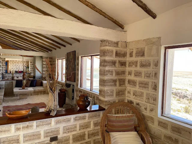
Hotel De Sal Luna Salada: the hotel made of salt

Hotel De Sal Luna Salada, Uyuni, Bolivia: The Hotel Made of Salt - Wide panoramic shot of the hotel exterior
This place had been on our bucket list ever since National Geographic taunted us with this video back in 2015. A hotel made of salt? On the edge of the world's largest salt flat? Sign us up. We finally saw the sign on the dirt road, took a right, and climbed a hill to find this architectural marvel made of compressed salt bricks, salt mortar, salt floors, salt furniture... you get the idea. It's like the Gingerbread House, but for people with high blood pressure.
Natgeo coverage of Hotel Luna Salada
Social & Architectural Deep Dive: The Salt Hotel Phenomenon Building with salt isn't just a gimmick; it's a practical use of the most abundant local material. The blocks are cut from the Salar, compressed, and bonded with a slurry of salt and water (effectively making a "salt cement"). The first salt hotel, Palacio de Sal, opened in the mid-90s but faced environmental issues (imagine the sewage system... or don't). Newer hotels like Luna Salada and Cruz Andina have more sustainable designs. The thermal properties are interesting: salt is a poor insulator, but the thick walls and incorporation of local volcanic rock (which absorbs daytime heat) help moderate the extreme temperature swings of the altiplano. Staying here is a lesson in adaptive architecture, where necessity and novelty meet in a crusty, crunchy, and surprisingly cozy package.

Dirt road from Colchani to Salt Hotel, Salar de Uyuni, Uyuni, Bolivia: Approaching the hotel with the salt flat visible ahead

Dirt road from Colchani to Salt Hotel, Salar de Uyuni, Uyuni, Bolivia: Another view of the desolate road leading to the hotel

Dirt road from Colchani to Salt Hotel, Salar de Uyuni, Uyuni, Bolivia: Rocky and dusty terrain near the hotel entrance

Hotel De Sal Luna Salada, Uyuni, Bolivia: The Hotel Made of Salt - View of the hotel's main entrance and salt-brick architecture

Hotel De Sal Luna Salada, Uyuni, Bolivia: The Hotel Made of Salt - Close-up of textured salt walls and windows

Hotel De Sal Luna Salada, Uyuni, Bolivia: The Hotel Made of Salt - Interior salt-brick corridor with rustic lighting

View of Salar de Uyuni from Hotel De Sal Luna Salada, Uyuni, Bolivia: The Hotel Made of Salt - Panoramic vista of the salt flat from a hotel window

Dirt road from Colchani to Salt Hotel, Salar de Uyuni, Uyuni, Bolivia: View back down the road toward Colchani village

Dirt road from Colchani to Salt Hotel, Salar de Uyuni, Uyuni, Bolivia: Final stretch of the road before reaching the hotel
Walking into the lobby was like entering a giant salt shaker designed by a very literal-minded architect. The floor crunched, the walls were gritty, the columns were lumpy, and even the couches dared you to lick them. And right outside the windows, stretching to infinity, was the Salar itself. It was utterly bizarre and completely awesome.

Hotel De Sal Luna Salada, Uyuni, Bolivia: The Hotel Made of Salt - Lobby area with salt-brick walls and rustic decor

Hotel De Sal Luna Salada, Uyuni, Bolivia: The Hotel Made of Salt - Another angle of the lobby showing seating area and salt textures

Hotel De Sal Luna Salada, Uyuni, Bolivia: The Hotel Made of Salt - Detail of a salt-brick column and wall texture

Hotel De Sal Luna Salada, Uyuni, Bolivia: The Hotel Made of Salt - View of a lounge area with large windows overlooking the Salar
The hotel was enormous. Our family suite, which was basically a small salt-brick mansion, was a ten-minute hike away at the other end of the building. Thank every deity ever imagined for the bellhop, because dragging luggage at 12,000 feet is a special kind of torture. The guy earned his tip just by breathing normally while carrying our stuff.

Hotel De Sal Luna Salada, Uyuni, Bolivia: The Hotel Made of Salt - Long hallway with salt floors and wooden walkways

Hotel De Sal Luna Salada, Uyuni, Bolivia: The Hotel Made of Salt - Another view of the interior corridor showing salt-brick construction

Hotel De Sal Luna Salada, Uyuni, Bolivia: The Hotel Made of Salt - Cozy nook with seating and a view of the salt flat
On the way to our suite, we passed lounges and cozy nooks with jaw-dropping views of the Salar. The floor was loose granular salt with laminate walkways - presumably to prevent guests from leaving a trail of white footprints like confused ghosts. The walls were solid salt bricks, held together with what I can only assume was salty determination.

Hotel De Sal Luna Salada, Uyuni, Bolivia: The Hotel Made of Salt - View from a lounge area with expansive windows and salt decor

Hotel De Sal Luna Salada, Uyuni, Bolivia: The Hotel Made of Salt - Seating area with salt-block walls and traditional textiles

Hotel De Sal Luna Salada, Uyuni, Bolivia: The Hotel Made of Salt - Another cozy corner with salt-brick architecture and wooden beams

Hotel De Sal Luna Salada, Uyuni, Bolivia: The Hotel Made of Salt - View down a long salt-brick hallway with natural light

Hotel De Sal Luna Salada, Uyuni, Bolivia: The Hotel Made of Salt - Interior showing a salt-brick archway and rustic decor

Hotel De Sal Luna Salada, Uyuni, Bolivia: The Hotel Made of Salt - Vertical shot of a salt-brick wall with textured surface
Hotel De Sal Luna Salada, Uyuni, Bolivia: The Hotel Made of Salt - View of a lounge with large windows and salt-block construction

Hotel De Sal Luna Salada, Uyuni, Bolivia: The Hotel Made of Salt - Another interior space with salt walls and traditional Bolivian artifacts

Hotel De Sal Luna Salada, Uyuni, Bolivia: The Hotel Made of Salt - Cozy seating area with a view of the salt flat through the window

Hotel De Sal Luna Salada, Uyuni, Bolivia: The Hotel Made of Salt - Detail of a salt-brick wall with embedded traditional craft items

Hotel De Sal Luna Salada, Uyuni, Bolivia: The Hotel Made of Salt - Another view of the hotel's interior showing salt-block architecture and decor
The hotel was also a museum of traditional Bolivian crafts, with beautiful artifacts everywhere. We spotted llamas and alpacas made of reed, reminding us of the incredible reed boat craftsmanship we saw on Lake Titicaca (seriously, go read Part 1, the plugging never ends).

Hotel De Sal Luna Salada, Uyuni, Bolivia: The Hotel Made of Salt - Display of traditional Bolivian reed crafts including llamas and alpacas

Hotel De Sal Luna Salada, Uyuni, Bolivia: The Hotel Made of Salt - Close-up of a reed llama sculpture, a traditional Bolivian craft

Hotel De Sal Luna Salada, Uyuni, Bolivia: The Hotel Made of Salt - Another angle of the reed craft display against a salt-brick wall

Hotel De Sal Luna Salada, Uyuni, Bolivia: The Hotel Made of Salt - Display case with traditional textiles and artifacts in the hotel
The family suite was practically its own zip code, with a private hallway, two bedrooms, and spacious living areas. It was the salt-brick palace of our dreams.

Hotel De Sal Luna Salada, Uyuni, Bolivia: The Hotel Made of Salt - Family suite living area with salt-brick walls and comfortable seating

Hotel De Sal Luna Salada, Uyuni, Bolivia: The Hotel Made of Salt - Bedroom in the family suite with salt-block headboard and rustic decor

Hotel De Sal Luna Salada, Uyuni, Bolivia: The Hotel Made of Salt - Another view of the bedroom showing salt-brick architecture and bedding

Hotel De Sal Luna Salada, Uyuni, Bolivia: The Hotel Made of Salt - Living area of the suite with salt-block walls and traditional textiles

Hotel De Sal Luna Salada, Uyuni, Bolivia: The Hotel Made of Salt - Additional seating area in the suite with a view of the salt flat

Hotel De Sal Luna Salada, Uyuni, Bolivia: The Hotel Made of Salt - Bedroom detail showing the salt-block headboard and nightstand

Hotel De Sal Luna Salada, Uyuni, Bolivia: The Hotel Made of Salt - View from the suite's window overlooking the Salar de Uyuni
Hotel De Sal Luna Salada, Uyuni, Bolivia: The Hotel Made of Salt - Bathroom area with salt-block walls and modern fixtures

Hotel De Sal Luna Salada, Uyuni, Bolivia: The Hotel Made of Salt - Another view of the suite's living space with salt-brick details
Even the king-sized beds were made of salt. I'm not kidding. The headboard was a solid slab of the stuff. Luckily, there was enough laminate flooring to prevent midnight bathroom trips from turning into a painful salt-granule foot massage.

Hotel De Sal Luna Salada, Uyuni, Bolivia: The Hotel Made of Salt - Close-up of the salt-block headboard in the bedroom
Colchani
14:02

Colchani, Bolivia: The small salt-processing village on the edge of the Salar de Uyuni
We headed back to the village of Colchani, a speck on the map with a population just over 1000. For centuries, the Quechua people here have survived by harvesting salt, a back-breaking tradition that once involved llama caravans trekking over 350 miles across the Andes Altiplano to barter for essentials. Think of it as the original DoorDash, but with more spitting and way slower delivery times.

Colchani, Bolivia: Street view of the village with traditional buildings and salt-processing facilities
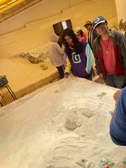
Now, things are a bit more modern. There's a cooperative, some machinery for iodization (because goiters are so last century), and trucks to ship the salt to Bolivia and beyond (Brazil is a big fan). We took a tour of a salt factory, which was less Willy Wonka and more "Science of Stuff That Makes Fries Taste Good."

Salt Bricks with layers showing rainfall: Stacked salt blocks displaying dark bands that indicate ancient rainfall patterns
Geological & Economic Deep Dive: The Salt of the Earth Let's geek out on salt for a second. The Salar de Uyuni isn't just a thin crust; it's a monster. The salt is at least 700 feet deep in the center (though some conservative estimates say 400 feet), covering over 4,086 square miles - that's larger than some countries. It contains an estimated 11 billion tonnes of salt. The Colchani cooperative extracts about 25,000 tonnes annually, which is like taking a single grain from a beach. The salt forms in distinct layers, each representing different climatic periods. The dark bands you see in salt bricks? Those are ancient rainfall, trapped in time like geologic tree rings. And it's not just table salt. This place is a treasure trove of lithium, potassium, boron, and magnesium. The "Lithium Triangle" of Bolivia, Chile, and Argentina holds about 75% of the world's lithium reserves, and the Salar de Uyuni is its crown jewel. Those compressed salt bricks aren't just for show; they're a legitimate, durable, and locally-sourced construction material used all over the region.
- The salt in Salar de Uyuni is at least 700 feet deep in the center, though the true depth is unknown and a lower depth of 400 feet is cited often.
- The largest salt flat in the world, the Salar covers an area of over 4,086 square miles.
- Of the at least 11 billion tonnes of salt in the Salar, 25,000 tonnes are extracted and processed every year at Colchani.
- There are 11 layers of salt ranging from 6 to 60 feet deep each. The top layer is around 32 feet.
- Rainwater results in salty brine collecting between the layers. The dark bands in blocks of extracted salt represent rainfall.
- Evaporating salt lakes 40,000 and 12,000 years ago left behind concentrated minerals in the Salar, including potassium, boron, magnesium and lithium.
- Salar de Uyuni by itself contains over half of the planet's lithium. Along with Salar del Hombre Muerto, Argentina and Salar de Atacama, Chile, 75% of the world's lithium deposits are in the salt lakes of the Andes altiplano.
- Compressed salt bricks are used for construction, including other salt hotels and buildings around the Salar.

Salt Factory, Colchani on Salar de Uyuni, Bolivia: Interior of the salt processing facility with piles of raw salt
Salt Factory, Colchani on Salar de Uyuni, Bolivia: Workers processing and bagging salt for distribution
Salt Factory, Colchani on Salar de Uyuni, Bolivia: Stacked bags of processed salt ready for shipment

Salt Factory, Colchani on Salar de Uyuni, Bolivia: Close-up of salt crystals and processing equipment

Salt Factory, Colchani on Salar de Uyuni, Bolivia: Piles of raw salt awaiting processing in the factory

Salt Factory, Colchani on Salar de Uyuni, Bolivia: Interior view showing salt bags and processing area
The factory also had a display of local mineral rocks, including Pyrite (FeS2), aka "fool's gold." You could buy plastic-wrapped chunks, little bags of Salar salt, and hand-sculpted salt figurines. It was the world's most mineral-rich gift shop.

Volcanic Mineral Rock, Salt Factory, Colchani on Salar de Uyuni, Bolivia: Display of pyrite (fool's gold) and other local minerals

Volcanic Mineral Rock, Salt Factory, Colchani on Salar de Uyuni, Bolivia: Close-up of mineral specimens including pyrite crystals

Volcanic Mineral Rock, Salt Factory, Colchani on Salar de Uyuni, Bolivia: Various volcanic rocks and minerals on display
Beyond the factory, Colchani boasts a Salt Museum and shops selling gorgeous, authentic llama and alpaca wool gear, hats, and handicrafts. I went full-on local and bought a llama wool poncho and a traditional hat, which I wore for the rest of the trip like a proud, slightly itchy, tourist. My wife picked up some delicate salt sculptures, which survived the journey home with the fragility of grenades.

Salt Museum, Colchani, Bolivia: Exterior of the salt museum building made of salt bricks

Salt flats landscape near Colchani, Bolivia: Expansive view of the Salar with distant mountains
Cultural & Social Context: Life on the Salar's Edge Life in villages like Colchani is a masterclass in adaptation. The Quechua communities here have a symbiotic relationship with the Salar. They don't just extract salt; they understand its rhythms - the dry season for harvesting, the wet season when the flat becomes a mirror and tourism shifts. Their economy is a three-legged stool: traditional salt gathering, burgeoning lithium industry jobs (though this brings complex issues of foreign investment and environmental impact), and tourism. The handicrafts - woven textiles, salt sculptures - are not just souvenirs but a continuation of artistic traditions and an important income stream. Eating in a local diner made of salt bricks isn't just a novelty; it's participating in an economy that has creatively turned its primary challenge (isolation, a harsh environment) into its unique selling point.

Llama wool poncho and traditional Bolivian hat purchased in Colchani: Traditional textiles bought as souvenirs
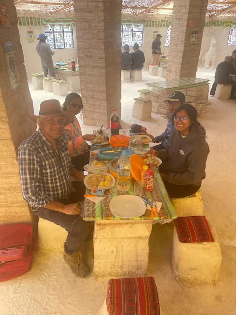
Before leaving, we had a fantastic lunch at a local salt-brick diner next to the museum. The food was hearty and delicious, a testament to the fact that Bolivian cuisine can make anything taste good, even when you're sitting in a building you're technically seasoning just by being there.

Local salt-brick diner next to the Salt Museum in Colchani: Traditional restaurant made of salt blocks

A street dog resting in Colchani village: Local canine resident relaxing in the sun
What really is the Salar de Uyuni?
According to National Geographic, "Bolivia's Salar de Uyuni is considered one of the most extreme and remarkable vistas in all of South America, if not Earth. Stretching more than 4,050 square miles of the Altiplano, it is the world's largest salt flat, left behind by prehistoric lakes evaporated long ago. Here, a thick crust of salt extends to the horizon, covered by quilted, polygonal patterns of salt rising from the ground.
At certain times of the year, nearby lakes overflow and a thin layer of water transforms the flats into a stunning reflection of the sky. This beautiful and otherworldly terrain serves as a lucrative extraction site for salt and lithium - the element responsible for powering laptops, smart phones, and electric cars. In addition to local workers who harvest these minerals, the landscape is home to the world's first salt hotel and populated by road-tripping tourists. The harsh beauty and desolateness of Salar de Uyuni can make for an incredible experience or a logistical nightmare."
Discovery Channel says, "Salar de Uyuni is the World's Largest Natural Mirror."
"It is so boundless and bright white that Neil Armstrong is said to have mistaken it for an enormous glacier seen from space," adds China Global Television Network.
So, in short, it's a giant, reflective, lithium-filled, astronaut-confusing, salt-crusted pancake. And it's magnificent.
The Star Wars Connection
Pop Culture & Mythology Infusion: A Galaxy Far, Far Away... in Bolivia Yes, you read that right. The stark, white and red landscape of the salt flat was the perfect stand-in for the mineral planet Crait in Star Wars: The Last Jedi (Episode VIII). The official databank describes Crait as an abandoned Rebel base, a mining installation turned fortress. It's poetic, really. The Salar, a place of real mineral extraction and extreme isolation, playing the role of a hidden rebel outpost in a fictional galaxy. It adds a layer of modern myth to an already ancient landscape. Beyond Star Wars, the Salar features in other films and countless documentaries, its otherworldliness making it a go-to for directors needing "not of this Earth" scenery. It's a place where reality is so strange, it passes for science fiction.
The Salar de Uyuni was the shooting location for Crait.

Star Wars scene filmed on the Salar de Uyuni salt flats: The red and white landscape of Crait from Episode VIII
Volcán Thunupa (Tunupa Volcano) and Mummies of Coqueza
15:30
Geographical & Mythological Deep Dive: The Sleeping Giant Towering over the northern edge of the Salar at 17,457 feet is the dormant volcano Tunupa. This isn't just a pretty backdrop; it's a central figure in local mythology. One legend says Tunupa was a beautiful, powerful woman (or a god, depending on the version) who wept tears of milk after being wronged, creating the salt flat. Another says the mountain is a protective deity. Its slopes created an "island" in the salt desert, where villages like Coqueza (population: fewer than 70 incredibly tough people) cling to existence at 12,103 feet. For the ancient Aymara and later cultures, volcanoes were not just geological features; they were Apus - sacred mountain spirits, sources of water, life, and divine power. Tunupa's presence dominates the landscape physically and spiritually.
After lunch, we drove straight onto the Salar toward Tunupa. We hit the jackpot: an area of shallow standing water, turning the flats into the famous sky-mirror. It was like driving on the clouds.

Reflective water on the Salar de Uyuni salt flats: Mirror-like surface creating perfect sky reflections

Tunupa Volcano island emerging from the salt flats: The volcano rising from the Salar with reflective water in foreground
We reached the island with the colossal, snow-dusted crater of Tunupa looming over us. It was humbling, like being judged by a silent, ancient god made of rock and ice.
View of the (snow-capped in winter) Tunupa Volcano from the island: Majestic volcano dominating the landscape
Next to the crater was a stunning Rainbow Mountain, its stripes of mineral-rich hues looking like a painter went wild on the slope. Nature's abstract art at 16,000 feet.

Colorful Rainbow Mountain adjacent to Tunupa Volcano: Striated mineral deposits creating a rainbow effect on the mountainside
In Coqueza, we bought tickets from the community tourism association (a gatekeeper in the literal sense) for the hike to Las momias de coqueza.

Llamas and alpacas at entrance to Coqueza village on the salt flat island: Small settlement at the base of Tunupa Volcano

View of the Salar from Coqueza village: Panoramic vista of the salt flat from the village

Traditional buildings in Coqueza made of salt bricks: Village structures constructed from local salt blocks

Rainbow Mountain and Tunupa Volcano as seen from Coqueza: Colorful mountain slopes with the volcano in background
Tourist service provider office and gate in Coqueza: Entry point for tours to the mummy caves
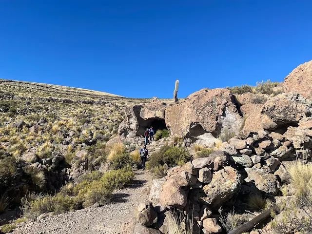
We drove up to the trailhead. The landscape was barren, epic, and empty. Signs for zip lines and hot air balloons stood like lonely sentinels of a pre-pandemic tourism boom.

Barren landscape leading to the mummy cave trailhead: Rocky, desolate terrain near Coqueza
Deserted activity signs near Coqueza village: Signs for zip lines and balloon rides in the empty landscape
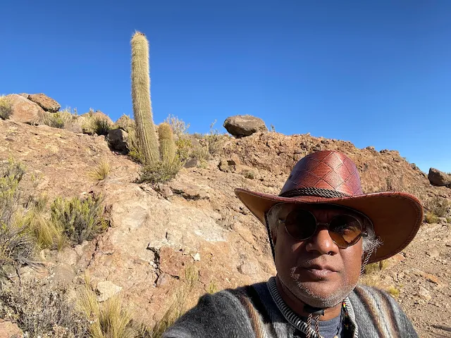
The hike up was short but steep. We passed towering Trichocereus giant cactus, ancient survivors in a land of rock and salt.
Giant Trichocereus cacti on the hike to the mummy cave: Ancient cacti growing in the rocky landscape

Close-up of a giant cactus near the trail: Detailed view of the Trichocereus cactus spines and texture

Rocky path leading up to the cave entrance: Steep trail through volcanic rock formations

View of the salt flats from the ascending trail: Panoramic vista of the Salar from the hillside

Approaching the cave entrance on the hillside: View of the cave opening in the rocky slope

Rock formations near the Cave of the Mummies: Volcanic rock structures surrounding the cave
Entrance to the Cave of the Mummies at Coqueza: The dark opening of the ancient burial cave
View from inside the cave entrance looking out: Perspective from within the cave showing the outside landscape

Interior rock wall of the cave: Textured volcanic rock inside the cave chamber
Las momias de Coqueza: the mummies of Coqueza (The Cave of the Mummies)
Grocery of the Mums of Coqueza
17:30 PM

Informational sign titled 'Grocery of the Mums of Coqueza' at the cave entrance: Educational sign explaining the mummy cave
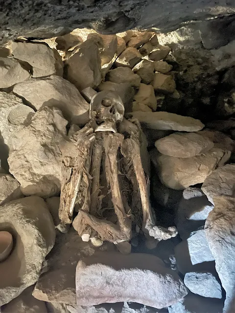
The sign at the entrance, hilariously titled "Grocery of the Mums of Coqueza," explained that these are ancient burials (chullpares) of important figures from the Lordship of the Greater Land of Los Lipez. Our guide, Juan, explained that "grocery of the mums" refers to the Aymara and Inca tradition of sharing meals with mummified ancestors and leaving them food and gifts - a practice that views death not as an end, but as a continuation of community. It's a perspective that's both haunting and beautiful.
Historical & Cultural Deep Dive: The Andean Relationship with Death The mummies of Coqueza are a profound window into Andean cosmology. Ancient civilizations here were practicing mummification at least 2,000 years before the Egyptians got famous for it. For the Aymara, Tiwanaku, and Inca cultures, death was not a separation. The deceased, especially important ancestors, remained active members of the community - mallquis. They were consulted, fed, given drink (including chicha, corn beer), and included in celebrations. Their mummified bodies were kept in above-ground tombs or caves (chullpas) like this one. The Spanish conquest brutally disrupted this, desecrating tombs in search of gold and scattering bones. The fact that this cave remained undisturbed is a minor miracle. Being here isn't just looking at old bodies; it's encountering a fundamentally different, more integrated philosophy of life, death, and time.
We entered the cave. A sliver of light pierced through a grilled hole, and a curious chinchilla peered in at us. The atmosphere was immediately heavy, silent, and profoundly peaceful.

Light filtering into the cave through a grilled opening: Sunlight entering the dark cave interior
Inside rock-cut chambers were the mummified remains of six individuals, curled in the fetal position, wrapped in straw, leaves, and textiles. They had been here, untouched, for over 500 years. Their hair, clothing, and peaceful poses were preserved. There was no smell of decay, just the musty scent of ancient stone and dry earth.

One of the mummified individuals in a fetal position inside a rock chamber: Ancient mummy preserved in a natural cave tomb
It wasn't scary or morbid. It was calm, almost meditative. You felt a connection to deep time, to the cycle of everything. It was sad, tranquil, and strangely hopeful, all at once.

Another mummy in a side chamber of the cave: Additional mummified remains in a separate rock niche
Close-up view of a mummy's preserved hair and wrappings: Detailed look at the ancient textiles and hair preservation

Mummy surrounded by ceramic offerings inside the chamber: Ancient pottery left as offerings with the mummified remains
One chamber held a woman and two children. Seeing the little ones was heart-wrenching. What story ended here, 500 years ago?

Chamber containing the mummies of a woman and two children: Family group burial in the cave
Surrounding the mummies were earthen jars, plates, and bowls. On the floor in front of them, people had left modern offerings: wine, food, coins, and even cigarettes. In this cave, the past isn't locked away; it's invited for a smoke and a drink.

Offerings of food, wine, and money left for the mummified ancestors: Modern offerings placed in the ancient burial cave
Sunset over Salar de Uyuni
18:12
We wished peace to the ancient souls in the cave, said goodbye to the brooding Tunupa, and headed back across the Salar towards Uyuni. Our guide, Nelson, found another patch of shallow water for photos. I attempted some hilarious "extreme perspective" shots, making my wife stand on my hat and my son on my shoulder. The results were less "artistic masterpiece" and more "family with a poor grasp of physics." But sunset? Sunset on the Salar was pure, unfiltered magic. The sky exploded in colors that reflected perfectly on the watery mirror, turning the world into a kaleidoscope of fire and gold.

Panoramic view of the Salar de Uyuni at sunset: Wide vista of the salt flat during golden hour

Sunset colors reflecting on the shallow water of the salt flats: Vibrant sky colors mirrored in the water on the Salar

Silhouette against the sunset on Salar de Uyuni: Human figure against the dramatic sunset sky

Golden hour light on the expansive salt flat: Warm sunset light bathing the Salar's surface

Deep orange sky as the sun sets over the Salar: Intense orange sunset colors over the salt flat

Last light of day on the salt crust patterns: Final sunlight illuminating the polygonal salt formations

Twilight over the Salar de Uyuni: Blue hour after sunset on the salt flats
We wrapped up the day with a delicious Bolivian dinner in Uyuni, picked up supplies for our upcoming off-road odyssey, and returned to our salty palace, ready to collapse. The next few days, we were promised, would be unforgettable. They had no idea.
Huge Natural Crystalline Patterns on Salt Crust
The salt flat isn't just flat. It's covered in massive, naturally-forming polygonal patterns, like a giant honeycomb or cracked mud, but made of salt. These formations can be big enough to park a couple of 4x4s inside. They're created by the repeated cycles of flooding and evaporation, a slow-motion geologic art project.

Large natural polygonal salt formations on the Salar: Geometric salt crust patterns created by evaporation

Close-up of the intricate crystalline salt patterns: Detailed view of the salt crystallization patterns
December 29, 2022
8:30 AM
A country in turmoil
Protests Turn Violent in Bolivia Amid a Political Crisis
Ah, travel. Just when you think you've got it figured out, a country decides to have a political meltdown. We were supposed to be picked up at 8:30 AM, but our guide Nelson called: there was a gasoline shortage because protesters in Santa Cruz were burning cars and clashing with police after the arrest of a governor. You know, normal Tuesday stuff. Having just escaped similar chaos in Peru, we briefly considered bailing to Chile. But the part of Bolivia we were in felt peacefully disconnected from it all. We decided to roll the dice. Spoiler: best decision ever.
9:30 AM
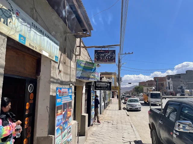
The folks at Expediciones Mammut worked miracles, found gas, and sent their Japanese colleague Masayuki-san in a Toyota Tundra to get us. He didn't even bother with roads, just charged diagonally across the terrain and hopped onto the highway like it was a mild suggestion. We were taken to their office in Uyuni to sort out logistics, which gave us time to explore the town center.

Driving across open terrain near Uyuni: Toyota Tundra driving off-road to reach us during the fuel crisis
Historical Context: Bolivia's Political Landscape Bolivia's history is a complex tapestry of indigenous civilizations, brutal Spanish colonization, a struggle for independence, and persistent political instability. The tensions often center on the distribution of wealth from natural resources (like gas and lithium), regional autonomy (the lowland department of Santa Cruz vs. the highland government in La Paz), and the rights of the indigenous majority. The 2019 political crisis, the 2020 elections, and the 2022 protests we encountered are all chapters in this ongoing story. Traveling here requires an understanding that you're in a living, breathing nation working through deep-seated challenges, not just a picturesque backdrop. The resilience and warmth of the Bolivian people in the face of this uncertainty is perhaps the most impressive sight of all.

Luz at the Expediciones Mammut office in Uyuni: Staff member helping to arrange our tour during the political crisis

Interior of the Expediciones Mammut office: Tour company office with maps and travel information
Tour maps and information at the Mammut office: Wall maps showing tour routes across the Salar and Altiplano
Additional office space and seating area: Waiting area in the tour company office

Storage and equipment area in the office: Gear storage for tours and expeditions

View of the office entrance and waiting area: Front area of the Expediciones Mammut office

Exterior of the Expediciones Mammut office building: Building facade of the tour company in Uyuni
We wandered down the main street and found a bustling marketplace next to a military regiment. It was a riot of colors, smells, and sounds - vendors selling everything from Bluetooth speakers to fresh fish. I bought peanuts because when in doubt, snack.

Busy street scene in Uyuni near the marketplace: Vibrant market area in the town center

Inside the bustling marketplace of Uyuni: Interior view of the market with various stalls

Stalls selling vegetables and fruits at the Uyuni market: Fresh produce vendors in the local market
Soon, the call came. Logistics were sorted. We jumped into Nelson's Nissan Patrol and set off for our first official day of off-roading.
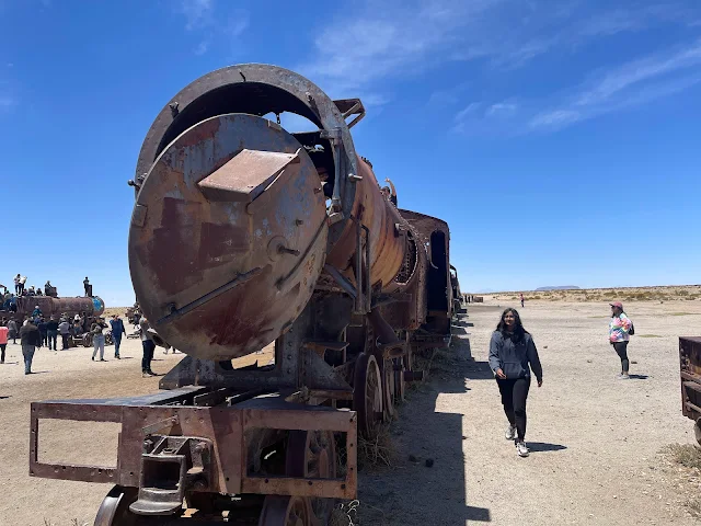
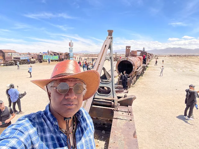
Bolivia's Train Cemetery: The Great Train Graveyard at Uyuni
11:21 AM
Historical Deep Dive: Rails to Rust The Train Cemetery is a monument to boom, bust, and geopolitical drama. In the late 19th century, Bolivia had big dreams of being a mineral export powerhouse. British engineers built railroads to connect the mines of the Altiplano to the Pacific port of Antofagasta. President Aniceto Arce inaugurated the line to Uyuni in 1890 with great fanfare. But then came the War of the Pacific (1879-1884), where Bolivia and Peru lost to Chile. Bolivia lost its coastline and Antofagasta. Suddenly, the railroad was a line to nowhere. The trains, mostly British-built steam locomotives, were abandoned where they stood. The salt air accelerated their decay into the surreal, rusting sculptures you see today. It's a poignant place: a testament to ambition, the cruel turns of history, and the relentless power of nature to reclaim human endeavors.
This place is seriously weird. It's a sprawling junkyard of rusting steam locomotives and rail cars from the late 1800s, slowly being consumed by the salt and wind. It's like a post-apocalyptic playground or a heavy metal album cover come to life. The story is sad: Bolivia built this railroad for mineral exports, then lost its coastline to Chile in the War of the Pacific, rendering the trains useless. Now they're a wildly popular tourist attraction. Irony, thy name is rust.

Train Cemetery - The Great Train Graveyard, Uyuni, Bolivia: Rusting steam locomotive abandoned in the salt desert

Train Cemetery - The Great Train Graveyard, Uyuni, Bolivia: Another angle of the decaying train remains

Train Cemetery - The Great Train Graveyard, Uyuni, Bolivia: Close-up of rusted train wheels and undercarriage

Train Cemetery - The Great Train Graveyard, Uyuni, Bolivia: Panoramic view of the Train Cemetery under blue skies
Train Cemetery - The Great Train Graveyard, Uyuni, Bolivia: Rows of abandoned train cars stretching into the distance

Train Cemetery - The Great Train Graveyard, Uyuni, Bolivia: Detail of a rusted train car with missing panels
Train Cemetery - The Great Train Graveyard, Uyuni, Bolivia: Tourists exploring the Train Cemetery

Train Cemetery - The Great Train Graveyard, Uyuni, Bolivia: Wide shot of the vast train graveyard landscape

Train Cemetery - The Great Train Graveyard, Uyuni, Bolivia: Decaying locomotive engine amidst the salt flat

Train Cemetery - The Great Train Graveyard, Uyuni, Bolivia: Rusted train car interior with graffiti
Return to Salar de Uyuni
From the graveyard of the past, we returned to the blinding white present of the Salar. This was it: the start of our three-day off-road adventure across the roof of the Andes.

Nissan Patrol - 4x4 offroad tour of Salar de Uyuni and Bolivian Andes Altiplano: Our tour vehicle ready for adventure
Ojos de Agua - Eyes of Water
12:43 PM
Geological Phenomenon: The Salar's Cold Springs The Ojos de Agua are fascinating geothermal... well, cryothermal features. Mineral-rich water, flowing in underground channels beneath the massive salt crust, finds weak spots to escape. The pressure release causes it to bubble up to the surface like a cold spring. They look like little volcanic mud pots but are just chilly. The strong metallic smell on your hands after touching the water is a direct sniff of the Salar's rich interior cocktail of lithium, magnesium, and other dissolved minerals. It's a reminder that this vast, solid-looking plain is dynamic, with hidden aquatic life beneath its feet-thick skin.
In the middle of this vast, solid-looking desert, there are random bubbling pools of water. They're called Ojos de Agua - Eyes of Water - and they're formed by mineral-rich water escaping from beneath the salt crust. They bubble away like tiny, cold Jacuzzis built by geology. We dipped our hands in, and they came out smelling strongly of metal, like we'd been fondling old pennies. The Salar was literally letting us smell its minerals. How considerate.

Ojos de Agua - Eyes of Water, Salar de Uyuni: Bubbling mineral pool known as an 'Ojo de Agua' on the salt flat

Ojos de Agua - Eyes of Water, Salar de Uyuni: Close-up of the bubbling water escaping the salt crust

Ojos de Agua - Eyes of Water, Salar de Uyuni: Multiple bubbling pools dotting the salt flat

Ojos de Agua - Eyes of Water, Salar de Uyuni: Panoramic view of the Ojos de Agua area

Ojos de Agua - Eyes of Water, Salar de Uyuni: Standing next to one of the bubbling mineral pools
Monumento al Dakar: Dakar Monument
12:56 PM

The Dakar Monument on the salt flats: Salt sculpture commemorating the Dakar Rally stage
In 2015, the infamous Dakar Rally routed its eighth stage right across the Salar de Uyuni to Iquique, Chile. The drivers flagged off here on Jan. 11, 2015, probably wondering why they were racing across a giant salt shaker at 12,000 feet. To commemorate this feat of vehicular madness, there's a monument made of salt. Because of course there is.

Dakar Monument: Monumento al Dakar, Salar de Uyuni, Bolivia, 29-DEC-2022: Close-up of the Dakar Monument salt sculpture
Behind the monument is the old, abandoned Hotel de Sal Playa Blanca. Inside, two salt pillars are plastered with stickers from high-performance automotive brands, left by rally teams and fans. It's like a shrine to speed, built out of the slowest-forming material on Earth.

Dakar Memorial, Salar de Uyuni, Bolivia: Salt pillars covered in automotive stickers inside the old hotel

Dakar Memorial, Salar de Uyuni, Bolivia: Close-up of stickers on the salt pillar

Dakar Memorial, Salar de Uyuni, Bolivia: Another view of the sticker-covered salt structures
Plaza de las Banderas: Flag Square
12:59 PM
Near the Dakar monument is a raised salt platform called the Plaza de las Banderas - Flag Square. Dozens of national flags fly from poles, often several to a pole. It's a tradition for visitors to place their country's flag here. We saw Old Glory flying proudly (at least twice), and it was incredibly moving to see the blue and yellow of Ukraine sharing a pole with Venezuela and Panama. In the middle of the Bolivian desert, a symbol of defiance and courage fluttered in the thin, high-altitude wind.

The Flag Square (Plaza de las Banderas) on the salt flats: Collection of national flags on the Salar

Plaza de las Banderas: Flag Square at Salar de Uyuni: Flags of many nations flying at the Flag Square

Plaza de las Banderas: Flag Square at Salar de Uyuni: Ukrainian flag flying alongside others at the Flag Square

Plaza de las Banderas: Flag Square at Salar de Uyuni: Another view showing multiple national flags
Hotel de Sal Playa Blanca, Salar de Uyuni
The original old abandoned Hotel Palacio de Sal
13:07

Historic photo of the original Hotel Palacio de Sal: Early salt hotel that pioneered salt-block construction
This is the OG salt hotel, built in the mid-1990s. It had 12 double rooms and a shared bathroom with no shower. The influx of tourists overwhelmed its primitive sewage system, causing an environmental mess. It was shut down in 2002. Now called Hotel de Sal Playa Blanca, it's used as a lunch stop. We ate here, surrounded by the impressive, slightly crumbling, salt sculptures of a bygone tourism era. A newer hotel with the same name exists elsewhere, because nothing can be simple.

Hotel de Sal Playa Blanca, Salar de Uyuni: The Old Hotel Palacio de Sal: Exterior of the abandoned hotel

Hotel de Sal Playa Blanca, Salar de Uyuni: The Old Hotel Palacio de Sal: Interior salt sculpture in the old hotel
Hotel de Sal Playa Blanca, Salar de Uyuni: The Old Hotel Palacio de Sal: Salt block walls and architectural details inside the hotel
Stuck on the Salar de Uyuni Salt Flats
14:20
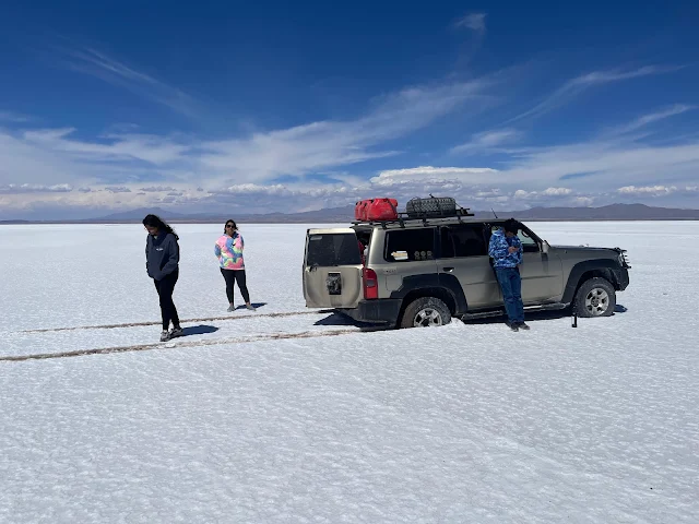
And now, the main event. The Salar, for all its beauty, is a sneaky, treacherous beast. The salt crust can be deceptively thin. Our trusty Nissan Patrol found one of those weak spots. With a sickening crunch, it broke through into the soft, wet, sludgy mud beneath. We were stuck. Properly, hilariously, epically stuck.

Stuck in the Salar de Uyuni Salt Flats, Bolivia: The Nissan Patrol stuck in the soft mud beneath the salt crust

Stuck in the Salar de Uyuni Salt Flats, Bolivia: View of the stuck vehicle from a distance
Nelson tried valiantly to free it. No dice. He climbed on the roof, got a bar of signal, and called the office. We relaxed on the salt, turning our vehicular crisis into a bizarre picnic.
Stuck in the Salar de Uyuni Salt Flats, Bolivia: Waiting for rescue while sitting on the salt crust

Stuck in the Salar de Uyuni Salt Flats, Bolivia: Another view of the stuck vehicle and surrounding salt flat

Stuck in the Salar de Uyuni Salt Flats, Bolivia: Wide shot showing the vehicle's position on the salt flat
14:49
Help arrived! Masayuki-san and Luz in the Toyota Tundra. The Tundra promptly also broke through the crust and got stuck. We now had two vehicles immobilized. They had tools - wooden poles, blocks, jacks - and attempted a heroic rescue. The Patrol got out briefly, then immediately sank again. It was like watching a nature documentary where the prey almost escapes.

Stuck in the Salar de Uyuni Salt Flats, Bolivia: Attempting to free the stuck vehicle with recovery equipment
15:20
A third vehicle, a Toyota Land Cruiser, appeared on the horizon like a heroic mirage. It drove toward us... and also crashed through the crust, wheels deep in slush. Three vehicles. Stuck. It was a comedy of errors written by the Salar itself.

Stuck in the Salar de Uyuni Salt Flats, Bolivia: Third vehicle stuck while attempting rescue

Stuck in the Salar de Uyuni Salt Flats, Bolivia: Panoramic view of the three stuck vehicles

Stuck in the Salar de Uyuni Salt Flats, Bolivia: Close-up of the recovery attempt with multiple vehicles
Luz spotted a distant motorcycle andwith me in tow waving like a maniac, flagged down the biker. After a quick chat, she hopped on and they sped off toward Uyuni to get more help. We were living in an adventure movie.
17:10
A solid patch of salt crust was identified some distance away. Our luggage, gas cans, and essentials were hauled over and placed on a tarp. Our bags looked so lonely and small in the infinite white.

Luggage on the Salt Flats: Stuck in the Salar de Uyuni Salt Flats, Bolivia: Our luggage placed on a tarp on the salt flat
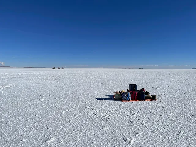
Luggage on the Salt Flats: Stuck in the Salar de Uyuni Salt Flats, Bolivia: Another view of our isolated luggage on the Salar
Finally, a tow truck arrived on the horizon. The cavalry! It began the delicate operation of extracting three very embarrassed 4x4s.

Luggage on the Salt Flats: Stuck in the Salar de Uyuni Salt Flats, Bolivia: Tow truck arriving for the recovery operation

Tow Truck on Salt Flats to Rescue Vehicles Stuck in the Salar de Uyuni Salt Flats, Bolivia: Tow truck preparing to extract the stuck vehicles
Tow Truck on Salt Flats to Rescue Vehicles Stuck in the Salar de Uyuni Salt Flats, Bolivia: Recovery operation in progress
Not long after, our savior arrived: a fourth Toyota Land Cruiser. It reached us without sinking. We piled in with our salvaged luggage, breathed a collective sigh of relief, and were back on our way. The Mammut team later confirmed everyone and every vehicle was fine. What was supposed to be a simple drive turned into an epic, unscheduled, and utterly memorable Salar adventure.

Stuck in the Salar de Uyuni Salt Flats, Bolivia: Final rescue vehicle arriving to transport us

Stuck in the Salar de Uyuni Salt Flats, Bolivia: View of the recovery operation from a distance

Luggage on the Salt Flats: Stuck in the Salar de Uyuni Salt Flats, Bolivia: Loading our luggage into the rescue vehicle
Funny Pictures at Salar de Uyuni: Extreme Perspective Photos
The Salar is world-famous for forced-perspective photos that play with the featureless horizon. I'd tried some clumsy ones, but Nelson, a master of the art, took these gems. Behold: my wife standing on my hat, my son towering over me, and general family silliness on the world's largest blank canvas.

Funny Pictures at Salar de Uyuni, Bolivia: Extreme Perspective Photography: Forced perspective shot making a person appear giant

Funny Pictures at Salar de Uyuni, Bolivia: Extreme Perspective Photography: Another creative perspective shot on the salt flat

Funny Pictures at Salar de Uyuni, Bolivia: Extreme Perspective Photography: Vertical perspective shot with dramatic scale effects

Funny Pictures at Salar de Uyuni, Bolivia: Extreme Perspective Photography: Family posing with perspective tricks on the Salar
Isla Incahuasi: The "House of the Incas" Island
18:20
Panorama of Salar de Uyuni from top of Incahuasi Island
Ecological & Historical Oasis: Incahuasi Island Rising from the center of the Salar, Incahuasi is a hilly, rocky island formed by the top of an ancient volcano. It's a crucial ecological island in a literal sea of salt. The most striking residents are the forests of giant Trichocereus bridgesii cactus, some over 700 years old and reaching 33 feet. They grow agonizingly slowly, about 1 cm per year in this harsh environment. The island also has fossilized coral and algae, proving that this was once a lake or sea floor. For the Incas, it was a vital rest stop (tambo) on the trade routes across the Altiplano, offering shelter, a vantage point, and possibly freshwater springs. It's a place where geology, ecology, and human history intersect on a grand scale.
Incahuasi Island is a volcanic pimple in the middle of the Salar. A trail leads to its 12,539-foot summit, offering a 360-degree view that will make your jaw drop and your lungs complain. The island was a pit stop for Inca traders - a place to rest their llamas and probably complain about the lack of decent snacks. The presence of corals and seashells here is a mind-bender, screaming that all this was once underwater.

Incahuasi Island, Salar de Uyuni, Bolivia: View of the island rising from the salt flat
The island is also home to a forest of giant, 700-year-old cacti, standing like silent, spiky sentinels. They're the Trichocereus bridgesii, or Bolivian torch, and they are magnificent.

Incahuasi Island, Salar de Uyuni, Bolivia: Giant cacti forest on the island

Incahuasi Island, Salar de Uyuni, Bolivia: Close-up of ancient giant cacti on the island

Incahuasi Island, Salar de Uyuni, Bolivia: Hiking trail through the cactus forest on the island
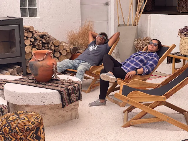
Hotel de Sal Cruz Andina
20:00
We spent the night at the Hotel de Sal Cruz Andina, located on Tambo Loma island just off the Salar's south shore. This hotel is built in the shape of the ancient Andean Chakana (Inca Cross), a symbol representing the three worlds (underworld, this world, upper world) and the Southern Cross constellation. It was a beautiful, quiet place to rest, with walls made of salt and local volcanic stone that stored the day's heat for the cold night.

Hotel de Sal Cruz Andina, Tambo Loma, Colcha K, Potosí, Bolivia: Exterior of the hotel shaped like an Inca cross

Hotel de Sal Cruz Andina, Tambo Loma, Colcha K, Potosí, Bolivia: Interior courtyard of the hotel

Salar de Uyuni and Tambo Loma Island - Andes Altiplano Desert - Hotel de Sal Cruz Andina, Tambo Loma, Colcha K, Potosí, Bolivia: View of the Salar from the hotel location

Chakana shaped Hotel in the Andes Altiplano: Hotel de Sal Cruz Andina, Tambo Loma, Colcha K, Potosí, Bolivia: Aerial view showing the Inca cross design of the hotel

Hotel de Sal Cruz Andina, Tambo Loma, Colcha K, Potosí, Bolivia: Interior hallway with salt-block construction

Hotel de Sal Cruz Andina, Tambo Loma, Colcha K, Potosí, Bolivia: Guest room with salt-block walls and traditional decor

Hotel de Sal Cruz Andina, Tambo Loma, Colcha K, Potosí, Bolivia: Another view of the hotel interior showing salt architecture

Hotel de Sal Cruz Andina, Tambo Loma, Colcha K, Potosí, Bolivia: Dining area with salt-block walls and panoramic windows

Hotel de Sal Cruz Andina, Tambo Loma, Colcha K, Potosí, Bolivia: Lounge area with comfortable seating and salt-block architecture

Hotel de Sal Cruz Andina, Tambo Loma, Colcha K, Potosí, Bolivia: View from the hotel showing the surrounding landscape

Hotel de Sal Cruz Andina, Tambo Loma, Colcha K, Potosí, Bolivia: Another interior view showing the hotel's unique architecture
Hotel De Sal Luna Salada, Uyuni, Bolivia: The Hotel Made of Salt - Lounge area with expansive windows overlooking the Salar
Hotel De Sal Cruz Andina, Tambo Loma, Colcha K, Potosí, Bolivia: View of the hotel's exterior showing its cross-shaped design
December 30, 2022
We packed up, ate breakfast, and hit the road, leaving the Salar behind. Our mission now: to drive across the sacred, barren, breathtaking Andes altiplano towards Chile.
Julaca, Bolivia (20.9112° S, 67.5649° W, alt. 12,500 feet)
10:48 AM

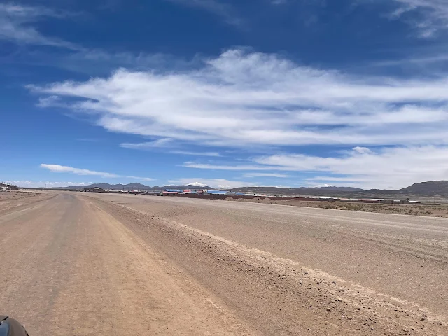
Julaca, Bolivia: Panoramic view of the tiny altiplano village
Our first stop was the tiny, windswept hamlet of Julaca. It consisted of a few adobe and salt-brick buildings on the roadside, rail tracks stretching toward Chile, and a bizarre metal-wire-mesh sculpture of an Alien from the movie franchise. Because why not?

Rail Track for Railway Trains to Chile at Julaca, Bolivia: Railroad tracks leading toward Chile across the altiplano

Julaca, Bolivia: View of the village with traditional buildings

Julaca, Bolivia: Another view of the remote altiplano settlement

Julaca, Bolivia: Traditional adobe and salt-brick structures in the village
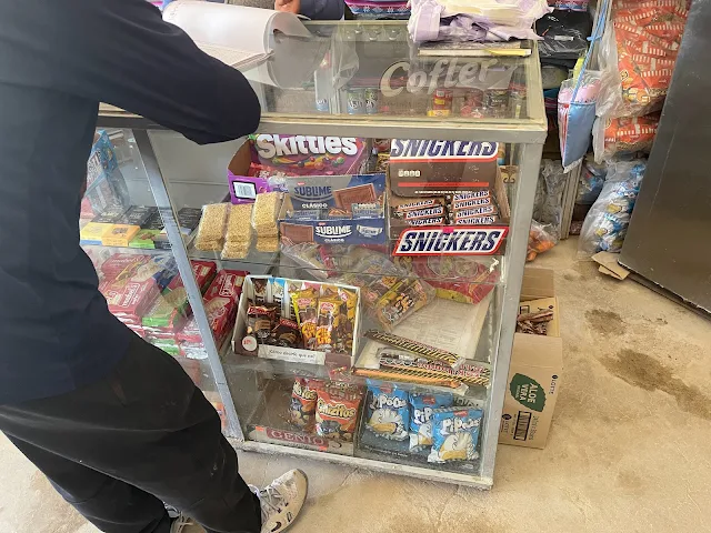
The "Julaca Salt Shop" was a tiny, surreal minimarket in a salt-brick building, stocked with a weird mix of local goods and random Americana: Snickers, Lays, Skittles, Pringles, Corona. With no other customers, I bought a couple of blue energy drinks from the lonely shopkeeper. It felt like supporting the most remote convenience store on Earth.
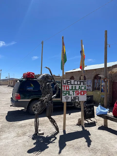
Alien Sculpture at Julaca, Bolivia: Wire-mesh sculpture of the Alien movie creature in the remote village

Alien Sculpture at Julaca, Bolivia: Another view of the surreal Alien sculpture against the altiplano landscape

Grocery / Minimarket Store at Julaca, Bolivia: Small salt-brick shop in the remote village

Grocery / Minimarket Store at Julaca, Bolivia: Interior of the small village shop
Grocery / Minimarket Store at Julaca, Bolivia: Shelves stocked with goods in the remote shop

Grocery / Minimarket Store at Julaca, Bolivia: Shopkeeper in the small village store

Grocery / Minimarket Store at Julaca, Bolivia: Another view of the shop interior showing various products
Estancia Chakha: Wildlife Valley and Flat Tire
12:03 PM

Wildlife Valley on Andes Altiplano at Estancia Chakha, Bolivia: Panoramic view of the green valley with grazing animals
We turned south on a dirt track toward the hamlet of Alota. Just before Estancia Chakha, we passed a stunning green valley teeming with wildlife: herds of alpaca, llama, and guanaco grazing peacefully. It was a lush oasis in the rocky altiplano. And then, as if to remind us this was a real adventure, we got a flat tire. Nelson swapped it with the spare in minutes, a true professional.

Wildlife Valley on Andes Altiplano at Estancia Chakha, Bolivia: Herds of alpacas and llamas grazing in the valley

Wildlife Valley on Andes Altiplano at Estancia Chakha, Bolivia: Close-up of alpacas in the green valley

Flat Tire on Andes Altiplano at Estancia Chakha, Bolivia: Changing a flat tire on the remote altiplano road

Flat Tire on Andes Altiplano at Estancia Chakha, Bolivia: Close-up of the tire change in progress
Villa Alota
12:27 PM
We reached the small village of Villa Alota and stopped for lunch at the Hospedaje Fatima, a simple roadside diner. It was here we had one of the most fascinating encounters of the trip.
Villa Alota, Potosi, Bolivia: View of the small altiplano village

Villa Alota, Potosi, Bolivia: Traditional buildings in the village

Restaurant Hospedaje Fatima, Route 701, Villa Alota, Potosi, Bolivia: Simple roadside diner where we had lunch

Restaurant Hospedaje Fatima, Route 701, Villa Alota, Potosi, Bolivia: Interior of the local restaurant

Restaurant Hospedaje Fatima, Route 701, Villa Alota, Potosi, Bolivia: Dining area of the local eatery
Meeting Adam Palowski - the biker who rides across the world
Parked outside was a motorcycle loaded to the gills with gear, covered in stickers and flags, with EU plates from Poland. This was the bike of Adam Palowski, a man from Poland who is riding his motorcycle across the world. He's been through Africa, Asia, Europe, North America, and was now in the middle of South America. We met him, swapped stories, and took a photo together. In the middle of the Bolivian altiplano, at 12,500 feet, we shared a moment with a modern-day nomad, a reminder of the endless ways to explore this incredible planet.

Adam Palowski's Motorcycle in Villa Alota, Bolivia: Heavily loaded adventure motorcycle with global stickers

Adam Palowski's Motorcycle in Villa Alota, Bolivia: Close-up of the motorcycle's loaded gear and stickers

Adam Palowski's Motorcycle in Villa Alota, Bolivia: Another view of the adventure motorcycle parked outside the restaurant

Adam Palowski and Supratim Sanyal in Villa Alota, Andes Altiplano, Bolivia (South America): Meeting a Polish world traveler in the remote Bolivian altiplano
We chatted a bit and exchanged contact information, promising to look each other up in Poland, Georgia or the United States. Adam is easily among the most remarkable people I have met in my life, a shining example of what travel does to people. Warm, laid back, smiling and brave. He let me sit on his bike. Adam can be found on facebook where he dumps his diary. He went the other way across the Salar to Peru, and had some pretty scary experiences in the chaotic political violence in Peru.
This chance encounter with a fellow traveler in the vastness of the Bolivian highlands is a classic example of the 'camaraderie of the road.' The Altiplano has been a crossing point for millennia, from pre-Columbian llama caravans to Spanish conquistadors and modern adventurers on motorbikes, all drawn by its stark beauty and challenging paths.

Adam Palowski's adventure motorcycle in Villa Alota, Bolivia, showcasing a BMW GS model equipped for long-distance travel across the rugged Altiplano terrain at approximately 12,000 feet elevation
This image sequence captures different perspectives of Adam Palowski's adventure motorcycle setup in Villa Alota. The first image provides a broader view of the bike in its highland environment, while the table-wrapped image offers a closer examination of specific equipment and details, illustrating how travelers prepare their vehicles for the extreme conditions of the Bolivian Altiplano.
 |
| Detailed view of Adam Palowski's adventure motorcycle in Villa Alota, Bolivia, showing specialized gear and luggage systems for transcontinental travel (table-wrapped image for detailed examination) |
Lunch break over, we got out of Villa Alota back on Route 701 driving west towards Avaroa to greet Volcán Ollagüe.
Route 701 cuts across the southwestern Potosí Department, a region historically defined by silver mining that bankrolled the Spanish Empire. The road itself is a modern scratch on an ancient landscape, following paths first worn by indigenous Aymara and Quechua peoples traveling between settlements and salt flats.

Westbound Bolivia Route 701 from Villa Alota towards Avaroa with Volcán Ollagüe visible in the distance, showcasing the remote gravel roads that connect highland settlements across the Altiplano at approximately 13,000 feet elevation
Volcán Ollagüe
14:10 PM

Panoramic view of Volcán Ollagüe (Volcano Ollague) on the Bolivia-Chile border, showing the massive 19,252-foot andesite stratovolcano with its characteristic fumarolic activity emitting steam and gases over 300 feet into the air
We get off gravel track Route 701 to a dirt track going south towards Laguna Colorada. There is a great viewpoint (map) at 14,421 feet on this dirt track from which the massive 19,252 foot andesite stratovolcano Volcán Ollagüe can be seen looming behind at the boundary of Bolivia and Chile.
Volcán Ollagüe is part of the Central Volcanic Zone of the Andes, a line of fire created by the subduction of the Nazca Plate under the South American Plate. Its name likely derives from the Aymara words 'ulla' (penis) and 'ghawi' (mountain), though its exact meaning is debated. For local communities, such volcanoes are often considered Apus (mountain spirits), deities that govern weather and fertility and demand respect.
Volcano Ollagüe continues to emit steam and volcanic gases over 300 feet into the air. The "Fumarolic activity" indicates it can wake up to cause trouble any time.
The constant plume of gas is a sign of a restless magma chamber below. The volcano's last confirmed eruption was over 10,000 years ago, but the persistent fumaroles suggest it is merely dormant, not extinct. In local folklore, such steaming vents are sometimes seen as the breath of the mountain spirit or portals to the underworld.

Mirador (Viewpoint) of Volcán Ollagüe (Volcano Ollague), Bolivia, showing the visitor observation area at 14,421 feet elevation with interpretive signage and panoramic views of the volcanic landscape
These consecutive images of Volcán Ollagüe provide complementary perspectives on this significant Andean volcano. The first wide-angle view shows the full scale of the mountain in its geographical context, while the second image focuses on the visitor experience at the designated viewpoint, illustrating how travelers engage with and interpret this dramatic volcanic landscape.

Detailed view from the Volcán Ollagüe viewpoint in Bolivia, highlighting the rugged volcanic terrain and atmospheric conditions typical of the high-altitude Altiplano environment
Laguna Chulluncani
14:27

Panoramic view of Laguna Chulluncani, Potosi, Bolivia, at 16,404 feet elevation in the Andes mountains, showing the salt lake with flamingos and the snow-covered 17,848-foot volcanic summit of Cerro Caquella in the Cordillera Occidental range
At an altitude of 16,404 feet in the Andes mountains, Laguna Chulluncani (map) is the first lake after the great Titicaca that we behold on the legendary Altiplano.
Lake Chulluncani is a salt lake with Flamingos on and around it. The 17,848 foot snow-covered volcanic summit of Cerro Caquella in the Bolivian Andes and Cordillera Occidental ranges looms over it.
The Altiplano is a high plateau formed by the collision of tectonic plates, dotted with endorheic basins (closed drainage basins) that collect mineral-rich runoff from the surrounding mountains. Laguna Chulluncani is one such basin. Its waters support brine shrimp and algae, which in turn attract flamingos. For ancient peoples crossing the Altiplano, these lakes were vital landmarks and sources of salt and other minerals.

Close-up view of Laguna Chulluncani, Potosi, Bolivia, showing the mineral-rich waters and the distinctive coloration created by algae and microorganisms that sustain the flamingo population in this high-altitude ecosystem
This sequence of images from Laguna Chulluncani documents the multi-scale nature of high-altitude lake ecosystems in the Bolivian Altiplano. The panoramic view establishes the geographical context with Cerro Caquella towering above, while the subsequent images progressively zoom in to reveal the lake's specific characteristics, mineral content, and the delicate ecological relationships that define this extreme environment.

Laguna Chulluncani shoreline detail showing mineral deposits and the interface between water and land in this high-altitude salt lake ecosystem of the Bolivian Altiplano

Laguna Chulluncani with Cerro Caquella reflected in the mineral-rich waters, illustrating the dramatic interplay between volcanic peaks and high-altitude lakes that characterizes the Cordillera Occidental landscape

Laguna Chulluncani atmospheric conditions showing cloud formations and light patterns unique to the high-altitude Altiplano environment, where weather systems interact with volcanic topography

Final perspective of Laguna Chulluncani emphasizing the vast scale and isolation of this high-altitude lake system in the Potosí Department of southwestern Bolivia
Laguna Hedionda (Stinking Lake): Suri (Andean Ostrich) and more Guanaco
14:39
The mineral-rich salt lake Laguna Hedionda (map) on the Bolivian Altiplano sits at an altitude of 13,520 feet. Snow-covered peaks of mountains Michincha, Cerro de Caquella, Cerro de Pajonal, Cerro de Tatio, Pabellón and Tocorpuri of Cordillera Occidental range of central Andes overlook it. Pink and white flamingos walk on it. Llamas and alpacas graze on its shore.
Laguna Hedionda literally translates to "Smelly Lake" or "Stinking Lake". The smell is of volcanic gases and sulfur, similar to geothermal areas like Hveravellir (Iceland) or Yellowstone.
The sulfuric scent is a clear sign of ongoing hydrothermal activity beneath the lake bed, where volcanic heat interacts with groundwater and minerals. Historically, such 'stinking' lakes were often avoided by indigenous herders for their animals, but they were known as sources of medicinal minerals and salts.

By Diego Delso, CC BY-SA 4.0, Link
Laguna Hedionda (Stinking Lake) in Bolivia, a mineral-rich salt lake known for its sulfuric smell and vibrant flamingo population
As we cross Laguna Hedionda on our way to Laguna Cachi (map), we see two Suri birds (Andean Ostrich) and more Guanaco.
The Suri is an endangered species categorized to be in "critical danger" in Peru and only a few hundred left in Bolivia.
Guanaco are related to camels and evolved for survival in the high deserts of the Altiplano.
The Suri, or Darwin's Rhea, is a flightless bird that has roamed the Altiplano for millions of years. Its drastic decline is due to habitat loss, hunting for its feathers and meat, and egg collection. In Andean cosmology, the Suri sometimes appears in myths as a clever trickster figure. Guanacos are the wild ancestors of the domesticated llama. They were crucial to pre-Columbian societies for wool, meat, and as pack animals. Their ability to survive at high altitudes with little water is a marvel of evolution, with specialized blood cells that carry oxygen efficiently in thin air.

Suri (Andean Ostrich) at Laguna Hedionda, Altiplano, Andes Mountains, Bolivia - this endangered flightless bird, also known as Darwin's Rhea, foraging in its high-altitude habitat where only a few hundred individuals remain in Bolivia
This photographic sequence documents the rare Suri (Andean Ostrich) in its natural habitat at Laguna Hedionda. The images progress from establishing shots showing the bird in its environmental context to closer views that reveal distinctive physical characteristics, collectively illustrating the behavior and appearance of this critically endangered species in the Altiplano ecosystem.

Side profile view of a Suri (Andean Ostrich) at Laguna Hedionda showing the bird's distinctive plumage, long neck, and adaptation to high-altitude conditions in the Bolivian Altiplano

Close-up of Suri (Andean Ostrich) head and neck showing detailed feather structure and facial features of this rare high-altitude bird species at Laguna Hedionda, Bolivia

Suri (Andean Ostrich) in motion at Laguna Hedionda illustrating the bird's locomotion and behavior patterns in the mineral-rich environment of this high-altitude salt lake
The wildlife documentation continues with images of Guanaco, showing how these wild camelid relatives have adapted to the extreme conditions of the Altiplano. While the previous images focused on the endangered Suri, these photographs highlight another key species in the high-altitude ecosystem, demonstrating the biodiversity that persists in these challenging environments despite increasing pressures.

Guanaco at Laguna Hedionda, Altiplano, Andes Mountains, Bolivia - this wild camelid relative of the llama demonstrates adaptations for high-altitude survival including specialized blood cells for oxygen efficiency in thin air

Profile view of Guanaco showing the animal's characteristic posture and fur coloration that provides camouflage and thermal regulation in the extreme temperature variations of the Altiplano
Laguna Cachi
15:11
Laguna Cachi, altitude 14,744 feet (map). Mineral rich salt lake with barren desert and high snow-covered mountains around. Flamingos love it. The volcanic mountains are sites for mining with shafts leading into them. Ores extracted include for Sodium, Cobalt, Halite, Lithium, Boron-Borates, Molybdenum, Tungsten and Arsenic.
This region sits on the "Lithium Triangle," holding over half the world's lithium reserves. The mineral wealth has driven both local economies and international conflicts for centuries. The stark beauty of the flamingos against the industrial backdrop is a striking contrast between fragile ecology and resource extraction.

Panoramic view of Laguna Cachi on the Andes Altiplano, Bolivia, showing the mineral-rich salt lake at 14,744 feet elevation with surrounding volcanic mountains that contain significant lithium, cobalt, and other strategic mineral deposits
This extensive photographic series documents Laguna Cachi from multiple perspectives and scales. The panoramic views establish the lake's geographical context within the mineral-rich Lithium Triangle, while closer images reveal specific ecological features, industrial elements, and the interplay between natural beauty and resource extraction that characterizes this region of the Bolivian Altiplano.

Wide-angle view of Laguna Cachi emphasizing the vast scale of this high-altitude salt lake and its position within the barren desert landscape of the Bolivian Altiplano

Laguna Cachi with flamingos in the foreground, illustrating how these birds thrive in the mineral-rich waters despite the extreme altitude and harsh environmental conditions

Detail view of Laguna Cachi shoreline showing mineral deposits and coloration patterns created by different algae and microorganisms in the saline waters

Laguna Cachi with volcanic mountains in the background, highlighting the geological relationship between the lake basin and surrounding volcanic peaks that contribute minerals to the water

Aerial perspective of Laguna Cachi showing the lake's full extent and its relationship to surrounding desert terrain and distant mountain ranges
Laguna Kara
15:54

Transition view between Laguna Cachi and Laguna Kara on the Bolivian Altiplano, showing the continuity of high-altitude lake systems in this desert landscape at approximately 14,800 feet elevation
Leguna Kara (map) sits at an altitude of 14,846 feet in the desert highlands of Bolivian Altiplano nestling under snow-covered peaks of Cordillera Occidental range of central Andes. Flamingos walk on it. The landscape around it gets even more rugged and desert-like than the lakes on our way here. Desierto de Siloli lies ahead.
The Cordillera Occidental is a volcanic range marking the border between Bolivia and Chile. Its peaks, often over 19,000 feet, were formed by the subduction of the Pacific oceanic plate. The snowmelt from these peaks is the primary source of water for the altiplano's lakes, though much of it is lost to evaporation in the arid climate, leaving behind concentrated salts and minerals.

Laguna Kara at 14,846 feet elevation in the Bolivian Altiplano, showing flamingos feeding in the mineral-rich waters with the snow-covered peaks of the Cordillera Occidental range forming a dramatic backdrop
This sequence continues the documentation of high-altitude lakes with images of Laguna Kara, located even deeper into the desert highlands. The photographs show the progression from transitional landscapes to focused views of this specific lake, illustrating how each water body in the Altiplano chain has unique characteristics while sharing common ecological patterns shaped by extreme altitude and aridity.

Detailed view of Laguna Kara shoreline showing mineral crystallization patterns and the interface between water and desert terrain characteristic of these high-altitude saline lakes

Laguna Kara with distant volcanic peaks illustrating the hydrological relationship between mountain snowmelt and lake formation in the closed basin system of the Altiplano

Final perspective of Laguna Kara showing the increasing aridity and ruggedness of the landscape as the journey approaches the hyper-arid Desierto de Siloli
Desierto de Siloli
16:38
Legend has it the high desert of Desierto Siloli (map) is where the earth meets the sky. (Ref: dangerousroads)
At an altitude of 15,604 feet, the Siloli Desert in the Bolivian Altiplano is lined on two sides by colorful volcanic mountains of Cordillera Occidental range of the Andes. On top of the thin air making breathing challenging, gale force winds whipping through this driest of deserts makes it hard to remain standing although our children somehow climbed up some rocks.
Siloli Desert is part of the great Atacama Desert which holds the distinction of being the most arid desert in the world. Entrance to the Eduardo Avaroa Andean Fauna National Reserve park is next to it.
The Siloli Desert's extreme aridity is due to a double rain shadow effect. Moisture from the Amazon is blocked by the Cordillera Oriental to the east, and Pacific moisture is blocked by the Chilean Coast Range to the west. The result is a hyper-arid landscape where some weather stations have never recorded rain. The colorful mountains are stained by iron oxide (red), sulfur (yellow), and other mineral deposits from ancient volcanic activity.
Desierto de Siloli (Siloli Desert) on Andes Altiplano, Bolivia - this hyper-arid landscape at 15,604 feet elevation shows colorful volcanic mountains stained by iron oxide and sulfur deposits, with some areas receiving no measurable precipitation for decades
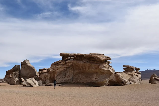
There are spectacular rock formations sculpted by sandstone and salt laden forceful winds, the most famous of which is the Árbol de Piedra - the "Stone Tree" sticking out of the desert. It is a 16½ foot natural monolith of mostly quartz with more iron at top which makes the top more resilient.
The Árbol de Piedra is a textbook example of a ventilact, a rock shaped by wind-blown sand. Over millennia, abrasive particles have sandblasted the softer material at its base, leaving the harder, iron-rich cap as a "crown." Similar formations are found in deserts worldwide, but the altitude and stark setting make this one particularly iconic.
 |
| The iconic Árbol de Piedra (Stone Tree) rock formation in Desierto de Siloli, Bolivia - this 16.5-foot natural monolith of quartz with iron-rich cap is a classic example of a ventilact shaped by wind erosion over millennia (table-wrapped image showing this wind-sculpted natural monument at 15,604 feet) |
The 18,432 foot Cerro Inacaliri o del Cajón (Volcano Inacaliri) towers above the colorful range of high mountains at the northwest of Siloli. There is a crater lake on a large 1,300 foot diameter crater at the top of Inacaliri which can be hiked to.

Desierto de Siloli (Siloli Desert) on Andes Altiplano, Bolivia, showing the extreme wind erosion patterns and colorful mineral deposits that characterize this hyper-arid region within the greater Atacama Desert system
This extensive photographic documentation of Desierto de Siloli captures the desert's most distinctive features from multiple perspectives. The images progress from establishing shots showing the vast scale of the hyper-arid landscape to focused views of specific geological formations, wind patterns, and atmospheric conditions that define this extreme environment at 15,604 feet elevation.

Desierto de Siloli landscape showing wind-sculpted rock formations and the characteristic sparse vegetation that has adapted to survive in one of Earth's driest environments

Desierto de Siloli with Cerro Inacaliri (Volcano Inacaliri) visible in the distance, showing the relationship between volcanic peaks and the desert basin they surround

Desierto de Siloli atmospheric conditions showing cloud formations and light patterns unique to high-altitude desert environments where extreme aridity creates distinctive optical effects

Desierto de Siloli geological features showing layered sedimentary deposits and erosion patterns that reveal the area's geological history spanning millions of years

Desierto de Siloli panoramic view emphasizing the vast emptiness and scale of this hyper-arid landscape where the earth truly appears to meet the sky

Desierto de Siloli with evidence of wind action on surface materials, showing how persistent gale-force winds shape every aspect of this extreme desert environment

Final perspective of Desierto de Siloli showing the transition zone toward the Eduardo Avaroa Andean Fauna National Reserve, illustrating how this hyper-arid desert connects to protected alpine ecosystems
Reserva Nacional de Fauna Andina Eduardo Avaroa: Eduardo Avaroa Andean Fauna National Reserve
17:11

Map on Sign Board at Entrance of Eduardo Avaroa National Park, Bolivia - this informational display shows the park's extensive 1.7 million-acre protected area encompassing volcanoes, geysers, hot springs, and critical flamingo habitats in the Bolivian Altiplano
We stop at the control point at the entrance to the Eduardo Avaroa National Park (map) to purchase tickets. This entrance is next to the northwest corner of Laguna Colorada.
The park is named after Eduardo Avaroa, a Bolivian engineer and hero of the War of the Pacific (1879-1884) against Chile. He famously declared "I will not retreat, you cowardly invaders!" before being executed. The park protects over 1.7 million acres of unique altiplano ecosystems, including volcanoes, geysers, hot springs, and lakes that are critical habitat for flamingos and other wildlife.
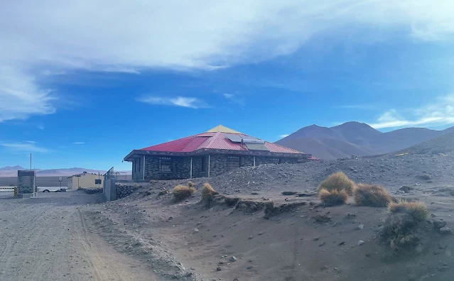
Eduardo Avaroa National Park Entrance - North Gate, Bolivia - the park entrance facility near Laguna Colorada where visitors purchase tickets valid for four days to access this protected area in the southwestern Potosí Department
The passes are valid for four days and cost 150 Bolivianos each. Chilean Pesos and US Dollars are also accepted at the ticket office, though we paid in Bolivianos.
For people like us heading to Chile over the Hito Cajon international mountain crossing, it is very important to hold on to the tickets even after exiting the park. Cancelled ("Anulado", annulled) tickets are part of required documents to exit Bolivia.

Eduardo Avaroa National Park Tickets from the North Gate in Bolivia near Laguna Colorada - these 150 Boliviano passes are valid for four days and must be retained for border crossing documentation when exiting Bolivia via Hito Cajón
Laguna Colorada (Red Lagoon)
17:25
A legend says the Red Lagoon (map) is made of God's blood, but the dazzling colors of the incredibly panoramic lake are due to plankton, algae and minerals.
By any measure, Laguna Colorada sitting at an altitude of 14,035 feet inside geologically active Eduardo Avaroa National Reserve on Andes altiplano is stunning. The shallow 3 foot deep salt lake with white borax islands nestles in a caldera - a large depression formed when a volcano erupts and collapses. Covering almost 15,000 acres, the colors of its water are a glorious range of deep blue, bright white and deep red.
The red color comes from pigments in certain types of algae (Dunaliella salina) and sediments rich in iron. The white "islands" are deposits of borax (sodium borate), a mineral used in detergents and cosmetics. The lake's position in a volcanic caldera means the ground is still warm in places, influencing the algae growth. For the local indigenous people, such vividly colored lakes are often considered sacred, gateways to other worlds or the blood of earth deities.

Laguna Colorada (Red Lagoon), Bolivia - this stunning salt lake at 14,035 feet elevation covers almost 15,000 acres within a volcanic caldera, with red coloration from Dunaliella salina algae and white borax islands creating a visually spectacular landscape
This photographic sequence documents Laguna Colorada from multiple vantage points, showing how light, weather conditions, and viewing angles transform the appearance of this remarkable lake. The images progress from establishing shots that capture the lake's full scale and distinctive coloration to closer views that reveal specific features like borax islands, flamingo populations, and the intricate patterns created by mineral deposits and microorganisms.

Laguna Colorada with borax islands visible, showing the white mineral deposits that contrast dramatically with the red algal waters in this shallow three-foot-deep salt lake

Laguna Colorada shoreline detail showing mineral crystallization patterns and the interface between colored waters and the surrounding volcanic landscape of the caldera basin
Of the six species of flamingos in the world, three are found abundantly on the Red Lake: Andean, Chilean and the thought-to-be-extinct James' Flamingo.
The James's Flamingo was believed extinct until its rediscovery in 1956 in this very region. The lake's brine shrimp and diatoms are a perfect food source. The flamingos' unique beaks filter the mud to extract this nourishment. Their presence in such a harsh, mineral-rich environment is a testament to nature's adaptability.

Flamingos at Laguna Colorada, Bolivia - three of the world's six flamingo species (Andean, Chilean, and James's Flamingo) feed in the mineral-rich waters, with James's Flamingo having been rediscovered here in 1956 after being thought extinct

Flamingo behavior at Laguna Colorada showing feeding patterns and social interactions among these high-altitude adapted birds in their unique mineral-rich habitat
Latitudes Hostal, Huyajara
17:47
 |
| Courtyard of Latitudes Hostal near Huyajara, Bolivia - this off-grid accommodation operates completely on solar power with generator backup, providing basic comfort in the remote Altiplano at approximately 14,000 feet elevation (table-wrapped image showing hostel infrastructure) |
We stayed the night at Latitudes Hostal located just over 3 miles south of southwestern corner of Laguna Colorada, close to the village of Huyajara (map). The hostel is not marked on Google maps at the time of writing and I sent a update request, but the Laguna Colorada Simple Mountain Lodge (GPS coordinates -22.26354751826685, -67.81586925150025) exists on Google maps as right next to it. Or maybe the Simple Mountain Lodge, whose photos look like an under-construction version of Latitudes Hostal, was the same hostel before the pandemic wiped out tourism. I don't know.
Huyajara is a tiny, remote settlement whose existence is tied to the park and the few hardy tourists who venture here. Life here is dictated by the extreme environment - bitterly cold nights, intense solar radiation during the day, and a constant struggle for water and energy.
 |
| Reception desk, Latitudes Hostal - the hospitality center in this remote off-grid accommodation serving travelers exploring the Eduardo Avaroa National Park region (table-wrapped image showing hostel interior) |
Located in the barren mountain desert of the Andes altiplano, Latitudes Hostal operates completely off-grid. Electricity is from battery-backed solar panels during the day and they run a generator in the evenings till 9:30 PM after which the batteries provide some power. We had two rooms with attached bathrooms. There is hot water for showers on request assumedly from an oil or propane water heater. Internet is available for a small fee over satellite, and WiFi continues to work from the solar-charged battery setup after the generator shuts off. There is no heat. The ceilings of the rooms are translucent, letting through a remarkable amount of light from the moon and stars in the most clear air on the planet that Atacama is famous for.
All in all, Latitudes Hostal is surprisingly cosy and comfortable given its location and infrastructure!

Generator for Electricity at Latitudes Hostal, Huyajara - this diesel generator provides evening power until 9:30 PM in this completely off-grid accommodation near Laguna Colorada at 14,000 feet elevation
This photographic documentation of Latitudes Hostal illustrates the infrastructure and living conditions available to travelers in one of the world's most remote regions. The images show how human habitation adapts to extreme environments through hybrid energy systems, satellite communications, and architectural solutions that balance comfort with sustainability in a location defined by its isolation and challenging climate.

Solar Panels for power and Satellite dish for internet at Latitudes Hostal - the hybrid energy and communication systems that enable this remote hostel to operate off-grid while providing basic connectivity to guests
Rooms surround a central dining area reachable across a hallway. The kitchen is on the right of the hallway before it opens up to the dining area.

Hallway to the left of the kitchen, Latitudes Hostal - the interior circulation space connecting guest rooms to common areas in this remote high-altitude accommodation
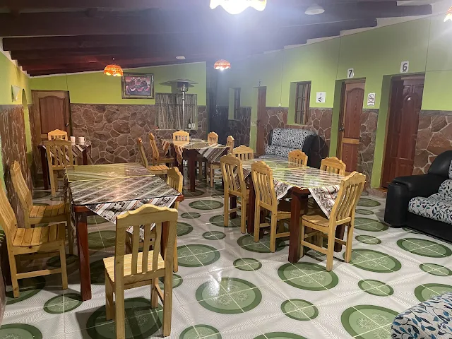
Dining area of Latitudes Hostal showing the central communal space with surrounding guest rooms in this remote high-altitude accommodation
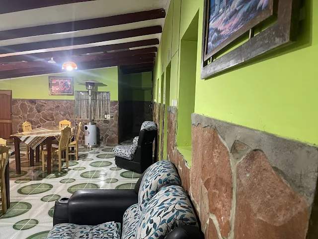
Interior view of Latitudes Hostal dining area showcasing the simple but functional design adapted to extreme high-altitude conditions in the Bolivian Altiplano

Numbered rooms around Dining area, Latitudes Hostal - the central communal space where guests gather for meals in this remote hostel, showing the simple but functional design adapted to extreme high-altitude conditions
December 31, 2022
05:38
We wake up very early when it is still dark, have breakfast and hit Camino Hito Cajon - Laguna Colorada road by first light of dawn. Back inside Eduardo Avaroa National Park, our first destination for the day is the geothermal area of Sol de Mañana which coincidentally translates to "Sun of the Morning".

Sunrise between Laguna Colorada and Sol de Mañana on the Bolivian Andes Altiplano, capturing the first light of dawn illuminating the high-altitude desert landscape at approximately 14,000 feet elevation
Geotermas Sol de Mañana
05:54 AM
At an altitude of 16,092 feet in the rugged desert of the Bolivian Andes Altiplano lies the 2,500 acres of Sol de Mañana Geothermal Area (map) with furiously boiling mineral rich mud in scary cracks on the ground, intense jets of vapor and geysers shooting up hot water sometimes to over 160 feet.
This is a high-altitude geothermal field, where magma close to the surface superheats groundwater. The boiling mud pots are caused by steam and gases forcing their way up through clay-rich soil. The sulfurous smell and hissing vents have led to associations with the underworld in many cultures; here, they might be seen as the breath of Pachamama (Earth Mother) or as entrances to mythical realms.

Geotermas Sol de Mañana panoramic view showing the expansive 2,500-acre geothermal area at 16,092 feet elevation with boiling mud pots and steam vents in the Bolivian Andes Altiplano

Close-up view of Geotermas Sol de Mañana showing intense geothermal activity with boiling mineral-rich mud and steam vents at 16,092 feet elevation in the Bolivian Andes

Geotermas Sol de Mañana geothermal field showing colorful mineral deposits and steam vents created by volcanic activity beneath the surface at 16,092 feet elevation

Geotermas Sol de Mañana boiling mud pots showing the intense hydrothermal activity with temperatures reaching over 160°F at this high-altitude geothermal area

Geotermas Sol de Mañana steam vents showing intense geothermal activity with jets of vapor and gases escaping from deep within the earth's crust

Geotermas Sol de Mañana mineral-rich mud pools showing distinctive coloration from sulfur and other volcanic minerals at this high-altitude geothermal site

Geotermas Sol de Mañana geothermal features showing the interaction between extreme altitude conditions and volcanic activity in the Bolivian Andes

Geotermas Sol de Mañana overview showing the vast expanse of geothermal activity with multiple steam vents and boiling mud pools across the 2,500-acre site
The Laguna Colorada Geothermal Plant under construction at an altitude of 16,305 feet is the world's highest such facility. The 5mW plant will generate enough electricity for over 2,500 people. The plant is a pilot project inside the Reserva de Fauna Andina Eduardo Avaroa in the Campo Sol de Mañana area. Bolivia's Ministry of Economy and Public Finance announced the signing of the contract in March of 2019.
Harnessing geothermal energy in such an extreme environment is a major engineering feat. It represents a shift for Bolivia, traditionally reliant on fossil fuels, toward using its volcanic geology for sustainable power. The challenge is to do so without damaging the fragile ecosystem and scenic values of the national park.

Laguna Colorada Geothermal Plant under construction at Campo Sol de Mañana, Bolivia - this 5mW facility at 16,305 feet elevation will be the world's highest geothermal power plant, providing electricity for over 2,500 people
Termas de Polques: Hot Springs on Laguna Chalviri at Salar de Chalviri
06:33 AM

Termas de Polques Hot Springs at Laguna Chalviri, Salar de Chalviri, Bolivia - natural thermal pools at 16,306 feet elevation with water temperatures around 70°F, offering therapeutic relaxation in a spectacular high-altitude setting
The salt flats of Salar de Chalviri (map) at an altitude of 16,306 feet sit not too far southeast of Sol de Mañana. On the western side of Salar de Chalviri, there is a mineral salt lake called Laguna Chalviri. The Aguas termales de Polques - the Polques Hot Springs - is at the western tip of Laguna Chalviri.
These hot springs are a gift of the same geothermal activity that creates the geysers. The water is heated deep underground, rises through fractures, and mixes with cooler surface water to create a comfortable bathing temperature. The minerals dissolved in the water - lithium, sulfur, calcium - are thought to have therapeutic properties. For weary travelers and locals alike, they have been a place of relaxation and healing for generations.

Termas de Polques Hot Springs panoramic view showing the thermal pools with Laguna Chalviri and surrounding volcanic mountains creating a dramatic backdrop at 16,306 feet elevation
Termas de Polques has a reputation for being rejuvenating and therapeutic with water temperatures hovering around a comfortable 70 degrees fahrenheit. The lake with flamingos and the salt flat with surrounding volcanoes provide a spectacular natural backdrop. There are restaurants, cafes and nice parking facilities at the site which looks more touristy than the places we visited so far.

Termas de Polques Hot Springs facilities showing the developed tourist infrastructure including changing rooms and access points to the thermal pools

Termas de Polques Hot Springs interior view showing the natural stone construction of the thermal pools with mineral-rich waters

Termas de Polques Hot Springs showing visitors enjoying the therapeutic waters with views of Laguna Chalviri and surrounding mountains

Termas de Polques Hot Springs detailed view showing the mineral deposits around the pool edges and the clear thermal waters

Termas de Polques Hot Springs panoramic view showing the relationship between the thermal pools, Laguna Chalviri, and the surrounding volcanic landscape

Termas de Polques Hot Springs showing the natural stone construction and mineral-rich waters that have made this site a popular destination for therapeutic bathing

Termas de Polques Hot Springs with visitors relaxing in the mineral-rich thermal waters known for their therapeutic properties

Termas de Polques Hot Springs final perspective showing the complete thermal pool complex with Laguna Chalviri visible in the background
Desierto Salvador Dalí (Valle de Dalí)
07:56 AM

Salvador Dalí's famous 1931 Surrealist Painting "The Persistence of Memory" (fair use)
South of Termas de Polques, the vast expanse of Salvador Dalí Desert at an altitude of 15,289 feet is inside the Eduardo Avaroa Andean Fauna National Reserve.

Salvador Dalí Desert panoramic view showing the surreal, dreamlike landscape named after the artist because its colorful, bizarre rock formations resemble his paintings, located at 15,289 feet in the Eduardo Avaroa Andean Fauna National Reserve
The Desierto Salvador Dalí in Bolivia, located on the Andes Altiplano, is a surreal, dreamlike landscape named after the famous artist Salvador Dalí because its colorful, bizarre rock formations resemble his paintings.
Geologically, it is part of the Eduardo Avaroa Andean Fauna National Reserve, formed by volcanic activity, erosion, and mineral deposits, creating vibrant reds, yellows, and whites.

Salvador Dalí Desert rock formations showing vibrant mineral coloration from iron oxide (reds), sulfur (yellows), and other volcanic compounds deposited during ancient eruptions and sculpted by wind erosion over millennia

Salvador Dalí Desert geological features showing wind-sculpted formations and mineral stratification that create the surreal appearance reminiscent of Dalí's melting clocks and dreamscapes
Historically, the region was shaped by ancient volcanic eruptions and glacial movements.
During the last ice age, glaciers carved and scoured these valleys. When they retreated, they left behind loose sediment that was then sculpted over thousands of years by relentless wind and occasional flash floods. The mineral colors come from oxidized iron (reds and oranges), sulfur (yellows), and other volcanic compounds.

Salvador Dalí Desert landscape showing the vast 27,000-acre expanse of mountain desert with distant volcanic peaks, illustrating the extreme aridity and geological diversity of this high-altitude region
Culturally, it is tied to the indigenous Aymara and Quechua peoples, who have lived in the Andes for millenia, respecting the land as sacred.
Local folklore tells of spirits and deities inhabiting the mountains and deserts, with legends of hidden treasures and mystical beings guarding the harsh terrain.
Stories speak of the Anchanchu or Supay, trickster spirits of the underworld who inhabit caves and strange rock formations. Travelers might leave small offerings like coca leaves to ensure safe passage. The surreal landscape is seen as a physical manifestation of the spiritual world.

Salvador Dalí Desert with unique wildlife including flamingos, vicuñas, and viscachas that have adapted to survive in this otherworldly environment, adding ecological dimension to the surreal landscape

Salvador Dalí Desert atmospheric conditions showing the interplay of light and shadow that enhances the surreal quality of the landscape, particularly during sunrise and sunset when colors intensify
The area is also home to unique wildlife, like flamingos, vicuñas, and viscachas, adding to its otherworldly charm.

Salvador Dalí Desert panoramic view emphasizing the vast scale and dreamlike quality that led to the area being named after the surrealist artist, despite Dalí never having visited Bolivia
The desert really has nothing to do with the legendary artist who lived in Spain and California having never set foot in Bolivia.
It is named after Salvador Dali because of the extremely dry rugged 27,000 acres of mountain desert vistas that apparently remind people of paintings by the genius of Surrealism.
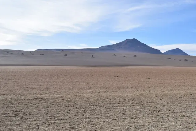
Salvador Dalí Desert geological details showing intricate erosion patterns and mineral banding that create natural artworks rivaling the imagination of the surrealist master

Salvador Dalí Desert vertical composition emphasizing the dramatic contrast between colorful mineral deposits and the stark blue sky characteristic of high-altitude desert environments
Laguna Blanca (White Lagoon) and Laguna Verde (Green Lagoon)
08:36 AM
As we get close to Hito Cajon mountain pass at Bolivia's southwestern border with Chile, the Bolivian highlands reveal 14,272 foot Laguna Blanca (White Lagoon) and Laguna Verde (Green Lagoon) next to each other with volcanoes Juriques (18,714 feet) and Licancabur (19,409 feet) behind them (map).
Laguna Blanca is a white salt lake with no outflow. Laguna Verde is emerald green because of arsenic which makes it poisonous. Flamingos avoid it.
The stark difference between the two neighboring lakes shows how small variations in mineral content can create entirely different worlds. Laguna Blanca gets its white color from massive precipitates of borax and other salts. Laguna Verde's green is from copper and arsenic compounds dissolved in the water, leached from the surrounding volcanic rocks. The arsenic levels are toxic to most life, creating a beautiful but dead lake.

Laguna Blanca (White Lagoon) and Laguna Verde (Green Lagoon) panoramic view showing the contrasting white and green lakes at 14,272 feet elevation with volcanoes Juriques and Licancabur towering behind them on the Bolivia-Chile border
Volcán Licancabur: NASA Mars Mission on Earth
Looming behind Laguna Verde, Volcán Licancabur is considered by NASA to be "the best Earth-based analog for conditions on Mars billions of years ago." So compelling are the similarities with ancient Mars that a team of scientists led by Nathalie Cabrol of NASA Ames Research Center arrived at Licancabur volcano "to explore what life is able to exist in such an extreme environment - as well as to test diving and other high-tech equipment like bodysuits that one day might be used to monitor the physiology (breathing rates, heartbeat, etc) of Mars explorers," according to NASA.
Licancabur is a nearly perfect stratovolcone, sacred to the Atacameño people, who called it "Licancabur" meaning "mountain of the people" in the Kunza language. Its summit crater contains one of the highest lakes in the world, a tiny body of water that survives despite UV radiation and freezing temperatures - conditions similar to ancient Martian lakes. Studying microbes there helps scientists understand the limits of life.

Laguna Verde (Green Lagoon) close-up view showing the emerald green arsenic-rich waters with Volcán Licancabur in the background - this lake is toxic to most life due to its high arsenic content

Laguna Blanca (White Lagoon) showing the white borax and salt deposits that give this lake its distinctive coloration at 14,272 feet elevation

Laguna Blanca and Laguna Verde side-by-side comparison showing the dramatic color contrast between the white borax lake and the green arsenic-rich lake at the Bolivia-Chile border

Volcán Licancabur towering behind Laguna Verde - this 19,409-foot stratovolcano is considered by NASA as the best Earth-based analog for conditions on ancient Mars
Hito Cajón (Portezuelo del Cajón) Mountain Pass
Bolivia - Chile International Border Crossing
Bolivian Customs / Immigration
09:09 AM

Bolivia-Chile International Land Border Crossing at Hito Cajón mountain pass panoramic view showing the 14,700-foot high border crossing facilities with Volcán Juriques in the background
The 14,700 foot Hito Cajon mountain pass (map) is among the highest international land border crossings in the world, and the highest land border crossing in our travels so far. It is located at the base of Volcán Juriques.
This border was finalized after the War of the Pacific (1879-1884), a conflict that left Bolivia landlocked. The "hito" is a border marker. Crossing here is not just a geographical shift but a passage through a deep historical wound for Bolivia, which lost its Pacific coastline to Chile.
There are three controls (bureaucratic check points) that we have to go through to exit Bolivia.
- The Bolivia - Chile border here is also the border of Bolivia's Eduardo Avaroa Andean Fauna National Reserve. The first control is the exit gate of the National Park where we get exit stamps on our tickets and are repeatedly reminded to retain the tickets.
- The second control before Hito Cajone is a building where we fill out immigration / customs exit forms and stand in a queue. The officer there checks our canceled Park tickets, verifies our exit forms for correct passport numbers and lets us go.
- Migración Bolivia: Bolivian Immigration Control at land border at Hito Cajone pass.
Arriving at Hito Cajón from the Bolivian side, there is some sort of a covered booth with traffic lanes with an adjacent largish building, all with red roofs, under construction before the trailer that currently serves as the immigration office.

Approaching Hito Cajón border crossing from the Bolivian side showing the construction of new border facilities with the Andes mountains in the background

Hito Cajón border crossing facilities showing the temporary trailer serving as Bolivian immigration office at this high-altitude border post
The current Oficina Migración is a tiny derelict looking building with a satellite dish and pole antennas sticking out from the sides.

Bolivian immigration office at Hito Cajón showing the small temporary structure with satellite communication equipment at 14,700 feet elevation

Inside view of Bolivian immigration processing at Hito Cajón showing travelers completing exit formalities at this remote high-altitude border crossing

Bolivian immigration officer processing exit documents at Hito Cajón border crossing, the final Bolivian bureaucratic control before entering Chile
The Bolivian immigration officer inside was professional and friendly. After checking our passports and visas, he stamped our passports and that was it. We had heard rumors of an unofficial 15 Boliviano fees payable in cash to get the exit stamps, but there was no such thing asked for.
This is where the Bolivian part of our 4x4 expedition ended. Transfer to Chile is on white minibuses waiting right across the Bolivian Immigration office.

Transfer minibuses waiting at Hito Cajón border crossing to transport travelers from Bolivian immigration to Chilean immigration facilities
We said goodbye to our driver and guide who had driven us across an epic landscape for three days. Our luggage was already transferred to a white minibus. Off we went officially into Chile across the lonely "República de Chile" sign right behind the Bolivian office.

"República de Chile" border sign marking the official entry point into Chile from Bolivia at Hito Cajón mountain pass
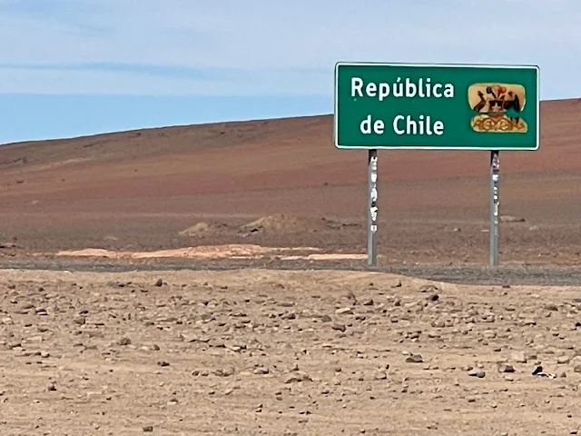
Crossing from Bolivia into Chile at Hito Cajón showing the paved Chilean road that contrasts with the rough Bolivian tracks experienced during the preceding days
After at least four days of rough offroading, we celebrated being back on an excellent paved road. And we were on our way to the Chile Immigration and Customs office and then San Pedro de Atacama!
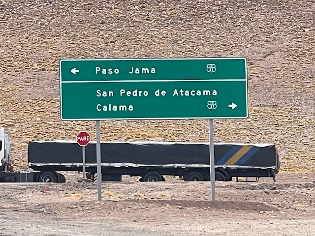
Chilean paved highway after crossing Hito Cajón border, showcasing the improved infrastructure on the Chilean side compared to the rough Bolivian tracks
Chile Customs / Immigration

Photo credit: Unidad de Pasos Fronterizos, Gobierno de Chile
Complejo Fronterizo Hito Cajón - the modern Chilean border control complex at 14,925 feet elevation that began operation in August 2017
On the Chilean side of the Hito Cajon land border, a new Border Control Complex "Complejo Fronterizo Hito Cajón" at an altitude of 14,925 feet is in operation since August of 2017. It is just over 4 miles south on Chile Route 27 (Ruta CH-27), connected by southbound Ruta B-243 from the Bolivian control.
Our white minibus pulls into the building through a roll-up door. All luggage is unloaded. There are examination tables for luggage next to the stopped bus for Chile Customs officers to check. Everyone in the minibus queue up their luggage on the tables and headed to the Immigration counters at the right corner inside the building.
Given our experience entering Bolivia at Santa Cruz Viru Viru airport, we stood in the Chile immigration queue with a bit of apprehension. It turned out Chile immigration is a breeze just like entering a EU or Schengen or any other country with visa-free entry for Americans. The officer at the counter stamped our passports. "Welcome to Chile", he smiled.
We went back out where Customs officers were checking luggage. A perfunctory check was performed on what we had, and we walked out of the door on the other side of the building pulling our luggage to wait for our minibus to be cleared and pick us up.

Exiting Complejo Fronterizo Hito Cajón after completing Chilean immigration and customs procedures, ready to continue the journey to San Pedro de Atacama
The Wild Donkeys of Atacama Desert
11:53 AM
The Spanish marauders had brought donkeys with them to carry loads when they reached the Atacama desert. But the donkeys failed in the rugged terrain and thin air of high altitudes. So the Spaniards simply let go of their donkeys in the wild and switched to llamas.
The liberated Spanish donkeys did not die off. Their descendents still roam the high deserts happily munching on whatever is available.
Fortuitously the first animals we saw in Chile from our minibus were wild donkeys!
These donkeys, known as "burros" in Spanish, are a living legacy of the colonial era. They are a feral population, having adapted to the extreme desert over centuries. They compete for scarce resources with native wildlife like vicuñas, but they have also become a part of the local ecological and cultural landscape, often seen as charming, hardy survivors.

Wild Donkeys of Atacama Desert, Chile - descendants of Spanish colonial donkeys that have adapted to survive in the harsh high-altitude desert environment for centuries

Close-up view of Wild Donkeys in the Atacama Desert showing their adaptation to the extreme arid conditions of the Chilean high desert
San Pedro de Atacama, Chile
12:30 PM
San Pedro de Atacama is a tourist town of around 2,000 permanent residents at an altitude of 8,000 feet. It is approximately 40 minutes west of Chile's Hito Cajon immigration complex on Ruta 27 (map).
San Pedro sits in the lap of Volcán Licancabur persisting with vistas of Atacama desert, salt flats, volcanoes, geysers, hot springs and lakes from across the political border. The Los Flamencos National Reserve to its east is essentially a southern expansion of Bolivia's Eduardo Avaroa Andean Fauna National Reserve. The nearby Valle de la Luna (Valley of the Moon) is popular for its unusual rock formations, a huge sand dune and pink-streaked mountains.
The ancient town is continuously inhabited since prehistoric times. It is a candidate for UNESCO world heritage site status. "Subsequential groups left circular tombs, adobe houses with conical roofs, a ceremonial center of the Atacama people (under the influence of the Tiwanaku empire), defensive and industrial works by the Inca and the colonial local church", say UNESCO. The R. P. Gustavo Le Paige Archaeological Museum showcases ancient cultures of the Atacama. More recently, San Pedro was a major town on the Inca empire's 19,000 mile Qhapaq Ñan road network that connected Argentina, Bolivia, Chile, Colombia, Ecuador and Peru.
San Pedro has special importance for modern astronomical science. The Atacama desert is the driest place in the world with no precipitation for decades in some places. The high-altitude pollution-free dry and calm air results in the clearest night skies seen from Earth. A host of telescopes and observatories have been looking at the heavens from around San Pedro, including ALMA (Atacama Large Millimeter/submillimeter Array) observatory that is part of the Event Horizon Telescope which recently took the first photographs of the supermassive black hole in the center of our galaxy. ALMA is currently the largest astronomical project in existence.
Other than telescopes, San Pedro's Museo del Meteorito three blocks from city center features a fascinating collection of meteorites combined with the story of life on Earth, our solar system and the cosmos.
The Bolivia to Chile Transfer Minibus makes two stops in San Pedro. The first stop is at the Terminal de Buses (map) where some folks got off to connect with other buses. We disembarked at the second stop at Plaza TourisTour at intersection of Ignacio Carrera Pinto and Caracoles (map). From there it was a six-minute walk up Caracoles and left into Tocopilla to our Hotel La Cochera.

San Pedro de Atacama street scene showing the distinctive adobe architecture and arid mountain backdrop of this ancient town at 8,000 feet elevation

San Pedro de Atacama main street showing tourist shops, restaurants, and the distinctive desert architecture of this popular base for exploring the Atacama region
Traditional adobe architecture in San Pedro de Atacama showing building techniques adapted to the extreme desert climate of northern Chile

San Pedro de Atacama evening scene showing the peaceful atmosphere of this ancient town with distant volcanic peaks visible in the background

Hotel La Cochera entrance in San Pedro de Atacama, a traditional accommodation showcasing local architectural styles and materials
I had many great conversations with Carlos who was managing La Cochera at the time. Of the many interesting stories I heard from Carlos, he has hitch-hiked his way across the legendary Carretera Austral, Chile's trans-Patagonia Route 7. We have a deal with him: when we return to Chile drive the Austral, Carlos is coming with us!

San Pedro de Atacama courtyard showing traditional architectural elements including adobe walls, wooden beams, and desert-adapted vegetation
After checking in, we headed out to find some lunch, ending up in a pretty restaurant named Casa de Piedra Atacameña. We were led across the fiery grills and up the stairs to the 2nd floor with a straw roof (rain is not an issue here) and distinct Atacameño ambience. The food was delicious!
The Atacameño culture, also known as Lickan Antay, is one of the oldest continuous cultures in the Americas, with a history stretching back over 11,000 years. Their traditional cuisine uses local ingredients like quinoa, llama meat, corn, and potatoes, often cooked in earthen ovens. Eating here was a taste of this deep cultural heritage.

Restaurant Casa de Piedra Atacameña entrance in San Pedro de Atacama, showcasing traditional Atacameño architecture and design elements

Interior of Restaurant Casa de Piedra Atacameña showing traditional decor and the open kitchen with fiery grills preparing authentic Atacameño cuisine

Traditional Atacameño meal at Restaurant Casa de Piedra Atacameña featuring local ingredients like quinoa, llama meat, and native vegetables
Dining area of Restaurant Casa de Piedra Atacameña with traditional straw roof and rustic decor creating an authentic Atacameño atmosphere
We then strolled around a bit at random, picking up some essentials, a traditional llama wool scarf and simple souvenirs. Interestingly a local money exchanger agreed to exchange our remaining Boliviano to Chilean Pesos, probably at a pretty bad exchange rate but we were happy to swap out the little unused Boliviano we had.
Llama and alpaca wool has been used in the Andes for thousands of years. The scarves are not just souvenirs; they represent a traditional craft. The intricate patterns and colors often have specific meanings, denoting community, marital status, or spiritual beliefs.

San Pedro de Atacama craft market showing traditional llama wool textiles and souvenirs available for visitors to this ancient desert town

San Pedro de Atacama street scene showing the blend of traditional adobe architecture and modern tourist infrastructure in this ancient desert town

San Pedro de Atacama commercial street showing shops, restaurants, and tour operators catering to visitors exploring the Atacama Desert region
There is something about sowing machines in shops on the altiplano. A classic singer machine was displayed in a minimarket, perhaps for sale.
Singer sewing machines are iconic even in remote corners of the world. They represent self-sufficiency and the ability to repair and create clothing - a vital skill in isolated communities where ready-made goods are expensive or unavailable. Seeing one here is a reminder of the practical, everyday life that continues amidst the tourist facade.

Classic Singer sewing machine displayed in a San Pedro de Atacama store, representing self-sufficiency and traditional craftsmanship in this remote desert community
We headed back to our hotel at dusk to get some dinner and be ready for the famous Atacama astronomical tour.

San Pedro de Atacama at dusk showing the transition to evening as the town prepares for its famous astronomical tours under some of the world's clearest night skies
Astronomical Tour at San Pedro de Atacama
21:37 PM
We had no prior reservation for an astronomical tour. It was a challenge to find one operating on the night of New Year's Eve with only a few hours left before nightfall. With great effort and a lot of convincing ("We are coming from Washington, DC to tour with you, so please please ..."), Tour Astronómico por Sol Andino (Astronomical Tour by Sol Andino) agreed to take us. We walked to the pick-up point of Sol Andino Expediciones office at Caracoles 362 at 9 PM. The tour guide and assistant met the four of us there along with just one other couple, and we walked together to Plaza TourisTour (where we had gotten off the Bolivia-Chile Transfer minibus earlier in the day) to board their van.
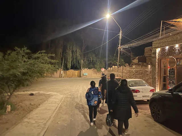
Astronomical tour meeting point in San Pedro de Atacama showing the gathering of visitors for nighttime stargazing under the world's clearest skies
We were driven a some distance out of town into near-total darkness. Our guide then walked us to a compound from where we looked up to see the clearest night sky I have ever seen!
We met Laika the Dog on our way. Apparently this Laika of San Pedro de Atacama hangs around every night to welcome stargazers like us. Laika is, of course, named after the legendary Soviet space dog - a stray mongrel from the streets of Moscow who became the first animal to orbit planet Earth and sadly gave her life in pursuit of the science of astronomy.

Laika the Dog at San Pedro de Atacama astronomical tour - this friendly local dog named after the famous Soviet space dog welcomes stargazers to nighttime astronomy sessions
Our guide then pulled out a laser pointer and we listened to him awestruck as he pointed out clusters, superclusters, nebulae, planets and constellations. It was like we were in a real-life planetarium show.
The clarity is due to multiple factors: high altitude, low humidity, lack of light pollution, and stable air above the desert. Ancient Andean cultures were also expert astronomers, building alignments into their architecture and using the stars to guide agriculture and ceremonies. The Milky Way, known as "Mayu" (river) in Quechua, was seen as a celestial river mirroring those on Earth.

Astronomical tour guide using laser pointer to identify celestial objects in the exceptionally clear night sky above San Pedro de Atacama

Observing the night sky during an astronomical tour in San Pedro de Atacama, known for having some of the world's clearest astronomical viewing conditions

Adrita observing celestial objects during the San Pedro de Atacama astronomical tour under pristine dark skies

Arnab observing distant celestial objects during the San Pedro de Atacama astronomical tour

Ipshita observing the night sky through a telescope during the San Pedro de Atacama astronomical tour

Supratim using astronomical equipment during the San Pedro de Atacama tour to observe celestial objects under pristine dark sky conditions
We then went to another dark compound with just a dull red lamp for a little light when needed. There were three telescopes in the compound, including a particularly big one.
It was a mesmerizing couple of hours as our guide and his assistant then pointed the telescopes to different objects and we put our eye on the eyepieces of wonder. Distant gaseous nebulae and galactic clusters to the rings of Saturn revealed themselves with a clarity only possible from the Atacama.
Telescope setup at San Pedro de Atacama astronomical tour showing professional equipment used to observe celestial objects under pristine dark sky conditions

Astronomical tour assistant adjusting telescope equipment during nighttime observation session in San Pedro de Atacama

Large telescope used during San Pedro de Atacama astronomical tour for observing distant galaxies, nebulae, and planetary details

Visitors using telescopes during San Pedro de Atacama astronomical tour to observe celestial objects with exceptional clarity due to the region's optimal atmospheric conditions
Laika the (Chilean) Dog loves to sit below telescopes!

Laika the Dog resting beneath telescopes during San Pedro de Atacama astronomical tour, becoming a familiar companion to nighttime stargazers

Astronomical tour guide explaining celestial phenomena to visitors using visual aids and laser pointers under the clear Atacama night sky

Group observation during San Pedro de Atacama astronomical tour as visitors take turns using telescopes to view distant celestial objects

Final telescope observation during San Pedro de Atacama astronomical tour showcasing the professional equipment available for public stargazing sessions
We ended the outstanding tour with complimentary snacks and wine in a room behind the telescopes and headed back to the hotel.

Complimentary snacks and wine served after the San Pedro de Atacama astronomical tour, providing refreshments while discussing celestial observations

Tour participants enjoying post-observation refreshments after the San Pedro de Atacama astronomical tour, sharing experiences of the night's celestial sightings
January 1, 2023
San Pedro de Atacama Main Plaza
08:42 AM
After an excellent breakfast at La Cochera, we walked down a few blocks to the town center Plaza de San Pedro de Atacama. It is a pretty square with Spanish architecture. Imposing administrative buildings, including Carabineros de Chile Police Commissioner, an arts, crafts and handicrafts market, the Municipal Office building, the Parish House and Sernatur (Chile's department of tourism) office, line Gustavo Le Paige street across Iglesia San Pedro church. A gorgeous decorated Christmas tree was on display at the center of the Plaza.
The plaza is the heart of the community, a mix of colonial history and modern tourism. The Christmas tree, a northern hemisphere tradition, stands somewhat surreal in the dry summer heat of January in the Southern Hemisphere, a symbol of the global culture that now intersects with this ancient town.

Main Square of San Pedro de Atacama showing the central plaza with decorated Christmas tree and surrounding colonial-style buildings in the heart of this ancient desert town

Town center of San Pedro de Atacama showing the blend of historic adobe architecture and modern tourist infrastructure in this UNESCO World Heritage candidate site
The historic 17th century adobe (built of mud and cactus wood) Iglesia San Pedro de Atacama (Church of San Pedro de Atacama) is the second oldest in Chile. It was built using traditional Andes altiplano construction techniques. Painted white in and out, the walls, roof, and main door are built of algarrobo wood and cardón (cactus wood) bound together by llama leather. It has an arched stone lintel and beamed ceiling, with the roof made of large rafters of algarrobo wood overlaid with slices of cactus logs. (Ref: Wikipedia)
This church is a fusion of Catholic faith and indigenous technology. The use of local materials like cactus wood (cardón) and llama leather bindings shows how Spanish missionaries adapted to the environment, incorporating native knowledge to create a durable structure in a land with no traditional European building materials.

Church of San Pedro de Atacama - the 17th century adobe church built with traditional materials including cactus wood and llama leather bindings, making it the second oldest church in Chile

Front view of Iglesia San Pedro de Atacama showing the distinctive whitewashed adobe construction and traditional architectural details of this historic desert church

Side view of Iglesia San Pedro de Atacama showing the traditional construction techniques using local materials adapted to the extreme desert environment

Architectural details of Iglesia San Pedro de Atacama showing the traditional construction methods using cactus wood beams and adobe walls
Church of San Pedro de Atacama is known for its elegant simplicity. Carved and painted altarpieces inside feature statues of St. Mary and St. Joseph with fluorescent lighting.

CC BY-SA 3.0, Link
Interior view of Iglesia San Pedro de Atacama showing the simple yet elegant design with carved altarpieces and traditional religious artwork
The Feria Artesanal San Pedro de Atacama (San Pedro de Atacama Craft Fair) across the church was empty when we were there, possibly due to pandemic-induced evaporation of tourism. This place is usually a bustling bazaar of indigenous Andean art and craft where visitors spend a great time shopping artefacts of llama wool, stone carvings, cactus, leather and more.

Feria Artesanal San Pedro de Atacama - the traditional craft market usually filled with indigenous artwork and textiles, shown here empty due to reduced tourism during the pandemic period
More Andean adobe construction is seen in the Casa Parroquial San Pedro de Atacama (Parish House), Municipalidad San Pedro de Atacama (San Pedro de Atacama Municipality) and Carabineros de Chile - Prefectura El Loa - 2a Comisaría San Pedro de Atacama (Chile Police - El Loa Prefecture - 2nd Commissioner) buildings.

Casa Parroquial San Pedro de Atacama - the Parish House showing traditional adobe construction methods characteristic of the region's architecture

Entrance to Casa Parroquial San Pedro de Atacama showing traditional wooden door and adobe construction details

Architectural details of Casa Parroquial San Pedro de Atacama showcasing traditional construction techniques adapted to the desert environment
The Municipalidad San Pedro de Atacama Municipality office, established November 25, 1980, serves the public between 8:30 AM and 1:30 PM on working days according to the posted signs.

Municipalidad San Pedro de Atacama - the town municipality building showing traditional architecture and administrative functions of this desert community
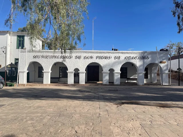
Municipalidad San Pedro de Atacama entrance showing the hours of operation and administrative details for this local government office

Municipalidad San Pedro de Atacama courtyard showing traditional architectural elements and the peaceful atmosphere of this desert town administration center

Architectural details of Municipalidad San Pedro de Atacama showcasing traditional construction methods using local materials adapted to the desert climate

Carabineros de Chile police station in San Pedro de Atacama showing traditional adobe construction with official signage for the El Loa Prefecture 2nd Commissioner Office

Entrance to Carabineros de Chile police station in San Pedro de Atacama showing the blend of traditional architecture and modern law enforcement functions
There was a contraption hanging from the electric meter on the boundary wall of the church. It appears to be some sort of a cell phone charging station for public use.
This improvised charging station is a great example of practical innovation in a remote area. It provides a vital service for locals and tourists alike who may need to power devices, blending modern needs with the historic setting.

Improvised cell phone charging station on the boundary wall of Iglesia San Pedro de Atacama, demonstrating practical innovation in this remote desert community
The streets around the central plaza were deserted. And every Chilean street dog we saw was huge and insanely beautiful!
Street dogs are a common sight across Chile. They are often well-fed and friendly, part of the community. Many are mixed breeds that have adapted to the climate. Their presence adds to the laid-back, organic feel of towns like San Pedro.

Deserted streets around the central plaza of San Pedro de Atacama showing the quiet morning atmosphere of this ancient desert town

San Pedro de Atacama street dog resting in the morning sun, representative of the friendly street dogs commonly found throughout Chilean towns

Another street dog in San Pedro de Atacama showcasing the healthy, well-adapted dogs commonly seen in Chilean communities

Street scene in San Pedro de Atacama showing the blend of traditional architecture and quiet morning atmosphere in this desert town
Final view of San Pedro de Atacama city center showing the peaceful morning atmosphere before departure from this ancient desert town
We returned to the hotel, packed up, checked out and headed to Calama.
Calama, Chile - Driving the Ruta del Desierto
13:30 PM
Driving Chile Route 23: Ruta del Desierto (Desert Route) On Atacama
San Pedro de Atacama to Calama
https://youtu.be/qe6RzhbTquI
Chile's Carreteras CH-23 Ruta del Desierto (Desert Road) connects Calama to San Pedro de Atacama and continues east to the 13,386 foot Paso de Sico (Sico Pass mountain border crossing) into Argentina's Ruta Nacional 51. Our drive on westbound Ruta 23 from San Pedro to Calama was one of the most breathtaking road trips we have experienced.
The road descends from the altiplano into the Atacama Basin, passing through landscapes shaped by wind, water (long ago), and tectonic forces. You can see alluvial fans spreading from mountain canyons, salt crusts, and distant mining operations. Calama is a mining city, home to Chuquicamata, one of the world's largest open-pit copper mines. The road is a lifeline for this industry.

Chile Ruta 23 (Desert Route) winding through the Atacama Desert landscape between San Pedro de Atacama and Calama, showcasing the dramatic desert scenery of northern Chile

Desert landscape along Chile Ruta 23 showing the extreme aridity and geological formations characteristic of the Atacama Desert region

Mountainous desert terrain along Chile Ruta 23 showcasing the dramatic geology and extreme aridity of the Atacama Desert region

Distant views along Chile Ruta 23 showing the vast scale of the Atacama Desert landscape with mountain ranges visible on the horizon

Final stretch of Chile Ruta 23 approaching Calama, showing the transition from remote desert to mining town landscape in northern Chile
We checked in to Hotel Agua del Desierto, Calama for the night.
Restaurant inside Hotel Agua del Desierto in Calama, Chile, providing comfortable accommodation in this mining town before early morning flights
The first of our long series of flights back home (Calama - Santiago on SKY, Santiago - Panama City, Panama - Washington Dulles on Copa) was very early the next morning.
Acknowledgements
We owe the Bolivia part of our trip to a couple of outstanding people and their businesses. I am not affiliated with these businesses and this is independent opinion.
![]()
Pukina Travel logo - the La Paz-based tour company that helped organize the Bolivian portion of this Andean adventure
My friend Juan Carlos Cardenas is the boss of Pukina Travel based in La Paz: pukinatravel.com

Mammut Expeditions logo - the Uyuni-based tour operator that provided expert guidance through the Bolivian Altiplano
Juan's friends Luz and Nelson are now my friends too. They run Mammut Expeditions from Uyuni.
The End
0 comments