
 |
| Hassan II Mosque and Casablanca shoreline across Atlantic ocean from Cabano Beach |
After the lanes of Fes el-Bali, we trade the medina for ONCF train 132 to Casablanca. The route runs through Rabat to Morocco’s Atlantic commercial capital, where a port, twentieth-century planning, oceanfront neighborhoods and Hassan II Mosque have spent decades refusing to fit into one tidy description.
This July 2023 stop belongs to our Pan-Africa journey. We arrive by train, tour by petit taxi and leave for Mohammed V International Airport by grand taxi. The transport is public, the timetable is optimistic and nobody has to find a parking space.
Fes to Casablanca — Post Summary
We take an evening ONCF train from Fes through Rabat to Casablanca, then spend a full day crossing the city by taxi. The route links Casa-Voyageurs, Casa-Port, the commercial harbor, Rick’s Café, Hassan II Mosque, El Hank, the Corniche, Anfa, Habous and the central civic squares before a grand taxi carries us south to Mohammed V International Airport.
| What's Covered | |
| 🗺️ | Route at a Glance — Fes, Rabat, Casablanca and the airport in travel order |
| 🚆 | Fes to Casablanca by Train — ONCF train 132, Rabat and Casa-Voyageurs |
| 🏙️ | Casablanca: Port City and Modern Metropolis — Anfa, migration, planning and wartime history |
| 🚕 | Petit and Grand Taxis in Casablanca — City taxi rules and Mohammad’s full-day circuit |
| ⚓ | Casa-Port and the Port of Casablanca — Rail terminus, cargo terminals and the waterfront |
| 🎬 | Rick’s Café and the Casablanca Film — Hollywood mythology given a real address |
| 🕌 | Hassan II Mosque — Oceanfront engineering and Moroccan craft traditions |
| 🌊 | El Hank and Casablanca’s Atlantic Shore — Lighthouse, rocky coast and mosque views |
| 🌴 | Anfa and the Corniche — Pools, cafés, hotels and residential streets |
| ⛳ | Royal Golf Anfa and the Hippodrome — Golf, horse racing and the former airfield district |
| 🛍️ | Habous Quarter — A planned new medina of arcades, mosques and craft shops |
| 🏛️ | Mohammed V Square — Administrative architecture, theater and central post office |
| ⛲ | United Nations Square and the Zevaco Dome — Old market ground and modern public architecture |
| ✈️ | Casablanca to Mohammed V International Airport — A3 motorway, Chaouia plain and Royal Air Maroc |
Map of Casablanca city tour (Link to full map)
We travel from Fes to Casablanca by ONCF train, then cross the city by petit taxi and continue by grand taxi to Mohammed V International Airport near Nouaceur. The route runs through Rabat and links Casa-Voyageurs, the port, Hassan II Mosque, El Hank, the Corniche, Anfa, Habous and the central squares. This is the final leg of our July 2023 Morocco route.
Method: ONCF train, petit taxi and grand taxi
Distance / Time: 4 hr 50 min by train on our trip, one full city-tour day and about 30 km to the airport
Themes: Atlantic port city · Moroccan craft · twentieth-century planning · film mythology
Route at a Glance
- Gare de Fes and ONCF train 132
- Rabat and the Bou Regreg crossing
- Gare de Casa-Voyageurs
- Casablanca city orientation — port, central districts and Atlantic side
- Petit and grand taxi circuit through Casablanca
- Casa-Port and the Port of Casablanca
- Rick’s Café
- Hassan II Mosque
- El Hank and the Atlantic shore
- Ain Diab and the Corniche
- Anfa and the former airfield district
- Royal Golf Anfa and the hippodrome
- Habous Quarter
- Mohammed V Square
- United Nations Square and Place Al Yassir
- Mohammed V International Airport
Fes to Casablanca by Train
After our time inside Fes el-Bali, we board ONCF train 132 at Gare de Fes at 5:40 PM. The train runs west through Rabat to Gare de Casa-Voyageurs, turning a medieval-medina day into an evening of platforms, luggage and the reliable railway truth that arrival times are aspirations with uniforms.
 |
| Gare de Fes (Fez Railway Station) |
At 9:06 PM, the train passes Rabat and the Mohammed VI Tower rising across the Bou Regreg in Salé. In July 2023, the 250-meter tower had not yet opened to the public; it opened in April 2026. The train offered a useful preview and no possibility of asking the driver to pause for a better angle.
 |
| Mohammed VI Tower in Salé, seen from the train near Rabat |
The railway also crosses the Bou Regreg, the river separating Rabat from Salé before it reaches the Atlantic. A road bridge is visible from the carriage, but the moving train is better at supplying views than nameplates.
 |
| Bridge across the Bou Regreg River near Rabat |
Our train reaches Gare de Casa-Voyageurs at 10:30 PM, roughly an hour late. The station is a major Casablanca interchange for long-distance, regional and airport services, which makes it practical at an hour when poetry has gone to bed.
Casa-Voyageurs was rebuilt as a modern interchange, but its job remains old-fashioned: put travelers, luggage, trains and taxis in one place and hope they agree on timing. The forecourt is the first hint that Casablanca values movement over ceremony.
The station opens directly toward hotels and city transport. ONCF made the trip from Fes straightforward; identifying the correct exit required the older navigation system known as looking around.

|

|

|
| Gare de Casa-Voyageurs — three views of Casablanca’s railway interchange and station facade after our late arrival from Fes. | ||
Our Morocco journey had begun at the ONCF station at Mohammed V Airport, where we took trains toward Marrakech. Returning to Casablanca closes that rail loop, though the luggage shows no interest in symbolism.
It is late, so we collect food at the station and check into Hôtel Ibis Casa-Voyageurs across the road. Casablanca’s city tour can wait until morning; the paper route map cannot object.
 |
| Tour map of Casablanca listing attractions |
Casablanca: Port City and Modern Metropolis
Casablanca, often shortened to Casa and called Dar al-Bayda in Arabic, is Morocco’s largest city and principal commercial center. The Atlantic port drove its rapid growth, while twentieth-century planners, architects and migrants produced a city whose districts rarely agree on a single style. That disagreement is one of its better features.
Districts on Our Route
Casablanca is divided into many prefectures, districts and neighborhoods rather than eight tidy tourist quarters. Our route links the rail and port districts with El Hank, Ain Diab, Anfa, the central administrative squares and Habous before returning to Casa-Voyageurs.
From Anfa to Casablanca
Casablanca grew from Anfa, a medieval Atlantic port whose earlier origins remain debated. Portuguese forces destroyed Anfa in 1468, then established Casa Branca on the coast during the following century. The 1755 earthquake helped end that settlement, because even empires eventually meet geology.
Sultan Mohammed ben Abdallah rebuilt the town in the late eighteenth century and used the Arabic name Dar al-Bayda, “the White House.” European trade later popularized the Spanish form Casablanca.
During the nineteenth and early twentieth centuries, agricultural exports from the Chaouia plain, port construction and migration transformed Casablanca into a major industrial city. French Protectorate planning added broad avenues and modern districts beside older Moroccan urban forms.
From January 14 to 24, 1943, Franklin D. Roosevelt and Winston Churchill met in Casablanca for the Allied conference that announced the policy of demanding unconditional Axis surrender. The meeting took place in wartime Anfa, several months after Hollywood released a film that had already borrowed the city’s name.
A City Built from Several Casablancas
Casablanca’s culture reflects repeated migration from across Morocco, long-standing Jewish and European communities, port commerce and the city’s own working-class neighborhoods. Moroccan Arabic, French and Amazigh languages share streets with cafés, football loyalties, music and food from many regions.
The city’s major monuments belong to different periods: Hassan II Mosque represents a late-twentieth-century royal project, Habous reworks older Moroccan forms through colonial planning, and the central squares display Art Deco and neo-Moroccan civic architecture.
Cinema gave Casablanca a second identity long before our taxi reached the waterfront. The dedicated Rick’s Café stop later gives that borrowed mythology a real street address.
Food follows the city’s mixed population: seafood from the Atlantic, grilled meats, tagines, couscous, pastilla and café culture all appear along the route. A commercial capital needs lunch, even when the itinerary behaves as if it does not.
By 9 AM, breakfast has done its duty and we are ready for a full circuit of Casablanca.
 |
| View of Gare de Casa-Voyageurs Train Station from Hotel Ibis Casa Voyageurs |
Railway hotels occupy a practical niche for late arrivals and early departures. Their romance lies mainly in not dragging luggage across an unfamiliar city at midnight, which is enough romance for most suitcases.
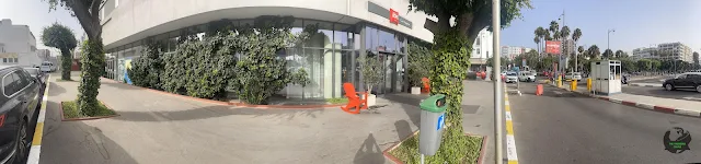 |
| Entrance door of Hotel Ibis Casa Voyageurs |
Outside Casa-Voyageurs, the taxi stand moves us from rail travel into Casablanca traffic, both of which have firm opinions about schedules.
 |
| Casa Voyageurs Railway Station Taxi Stand across Hotel Ibis Casa Voyageurs |
Petit and Grand Taxis in Casablanca
Moroccan cities distinguish between petit taxis, which operate inside city limits, and grand taxis, which can handle longer routes. Casablanca’s petit taxis are red, a useful detail when a station forecourt contains more vehicles than patience.
A large taxi stand faces Gare de Casa-Voyageurs. We hire Mohammad’s red petit taxi for a city circuit, and his local knowledge turns a simple ride into a full day across the port, coast, Anfa, Habous and the central squares. The route map records the result; the meter had a more immediate interest in it.
Casa-Port and the Port of Casablanca
We head toward the port along Rue Sidi Belyout, passing the adjoining Hôtel Ibis Casablanca City Center and Novotel Casablanca City Center.
 |
| Hotel Ibis Casablanca City Center & Novotel Casablanca City Center |
Next comes Gare de Casa-Port, Casablanca’s downtown terminus near the port and old medina. Regional trains connect it north toward Rabat and Kenitra, while Casa-Voyageurs carries a wider share of long-distance traffic.
 |
| Gare de Casa Port, Casablanca Train Station |
Port of Casablanca
The Port of Casablanca is one of Morocco’s principal commercial ports. Its terminals handle containers, conventional cargo, minerals and roll-on/roll-off traffic, with the official operator reporting annual throughput above ten million tonnes.
 |
| Port De Casablanca Porte 1: Port of Casablanca Terminal A |
The Préfecture de Casablanca building houses district administration and police functions beside the port. Its formal façade belongs to the civic architecture that grew with Casablanca’s commercial waterfront.
 |
| Préfecture de Casablanca - District du Port |
Rick’s Café and the Casablanca Film
The modern Rick’s Café opened in 2004 as a recreation of Rick’s Café Américain from Casablanca, the 1942 Michael Curtiz film starring Humphrey Bogart and Ingrid Bergman. The movie was filmed in Hollywood, so this is an adaptation of a fictional place in a real city. The circle is complete enough to sell dinner under a name built on celluloid. Watch the film scene here.
 |
| Rick's Café Casablanca |
The film never contains the exact line “Play it again, Sam,” though the misquotation became more famous than most of the script. Casablanca has spent decades hosting a sentence Hollywood did not actually write.
Hassan II Mosque
King Hassan II commissioned the oceanfront mosque, which opened in 1993 after work by thousands of Moroccan craftspeople. Stone, cedar, carved plaster, painted wood and zellij turn the huge complex into a national survey of traditional building arts rather than a structure decorated afterward as an afterthought.
The mosque’s minaret rises 200 meters and dominates this stretch of the coast. A laser near its summit points toward Mecca at night, giving the landmark a direction as well as a skyline. The Guinness record page tracks a category that changes whenever another mosque reaches higher.
The mosque stands partly over the Atlantic on a vast platform, reflecting a Quranic image of God’s throne upon the water. The location also created a less poetic engineering problem: salt, spray and waves had to be managed beneath a building intended to last.
The prayer hall has a retractable roof that can open the interior to the sky while the Atlantic remains just beyond the walls. It is a modern mechanism serving a building rooted in older Moroccan craft.
Public subscription helped finance the mosque. The linked project history records the scale of national participation, while later accounts differ over how the campaign was experienced and described.

|

|

|

|

|

|
||
| Hassan II Mosque — exterior views of the oceanfront mosque complex, including the 200-meter minaret and Atlantic-facing esplanade. | |||
The Musée de la Mosquée Hassan II explains the materials, craft methods and engineering used across the complex. Its displays make the finished ornament less mysterious and the labor behind it considerably harder to ignore.
 |
| Musée de la Mosquée Hassan II |
The complex also includes the Academy of Traditional Arts, inaugurated in 2012. Students study crafts such as wood carving, zellij, plasterwork, calligraphy and metalwork, keeping skills alive through training rather than nostalgia.
Zellij is assembled from individually cut glazed pieces placed face down before being fixed into panels. The finished geometry appears effortless, which is the customary reward for work that required neither ease nor mercy.

|

|
| Academy of Traditional Arts — two views of the craft-training complex beside Hassan II Mosque. | |
Visitor parking sits on the waterfront edge of the Hassan II Mosque complex, outside the broad pedestrian esplanade. The arrangement keeps ordinary traffic away from the prayer hall, which is useful because Casablanca traffic has no natural sense of reverence.
The parking area marks the edge of the ceremonial mosque precinct. Beyond it, Casablanca returns to ordinary traffic, cemetery walls and the practical business of finding the next turn.
The second parking view shows how the complex separates vehicle circulation from the vast pedestrian esplanade. Friday prayers and major religious occasions can draw large crowds, so access planning is part of the mosque’s operation rather than an afterthought. From here, our route turns west toward El Hank.

|

|

|
| Leaving Hassan II Mosque — visitor parking at the mosque complex and the turn toward Boulevard de la Corniche. | ||
El Hank and Casablanca’s Atlantic Shore
El Hank forms a low peninsula west of Hassan II Mosque, giving us a broad view back across the water. The El Hank lighthouse has marked this coast since the early twentieth century, which is useful on a shoreline where Atlantic weather can erase architectural subtlety.
The shoreline near El Hank is labeled Cabano Beach on some local maps. Rock shelves and dark boulders meet the Atlantic below the road, with Hassan II Mosque visible along the coast to the northeast.
El Hank’s rocky shore contains wave-cut ledges and tide pools exposed by the Atlantic. Waves do the geological editing here, with no concern for pedestrian access.
The shore is unexpectedly quiet during our July visit despite the clear weather. Empty parking spaces leave the Atlantic view to a small audience, which the Atlantic handles without complaint.

|

|

|

|
| El Hank and Cabano Beach — Hassan II Mosque across the Atlantic shoreline and the rocky coast at El Hank. | |||
Anfa and the Corniche
We follow Boulevard de la Corniche past Complexe La Cascade, with the Atlantic on our right and Casablanca’s leisure frontage beginning to replace the working port.
The Corniche developed as Casablanca’s leisure frontage, with cafés, pools and restaurants facing the ocean. This is the public-facing strip where the commercial city comes to walk and look west.
Restaurants along the Corniche draw on Casablanca’s Atlantic position, with grilled fish, seafood and long café meals forming part of the coastal routine. The ocean supplies the view; Moroccan dining habits ensure nobody has to admire it on an empty stomach.
Ain Diab became associated with sea bathing and nightlife during Casablanca’s twentieth-century growth. Private pools offered predictable water beside a coast whose surf and rocky ledges do not always cooperate with vacation vocabulary.
At the Corniche junction, Driss Slaoui Boulevard and Habib Sinaceur Avenue meet the coastal road beside West.91 Café Brasserie and the Mercedes-Benz showroom.
The popular public beach of Plage Lalla Meryem is on our right as we pass McDonald's Corniche and Anfaplace Mall.

|

|

|

|

|

|
||
| The eastern Corniche — Complexe La Cascade, Boulevard de la Corniche, the main Corniche junctions and the Lalla Meryem beachfront stretch. | |||
The boulevard follows the shore instead of forcing a straight grid onto it. Long ocean views alternate with bends, junctions and businesses advertising the same sunset from slightly different chairs.
The road alternates between public ocean views and private terraces or clubs. The Atlantic is free; a dry towel and preferred table remain commercial products.
In the afternoon heat, the promenade is quieter than the traffic. The road keeps moving while pedestrians can wait for cooler hours.
At the Megarama traffic circle, Boulevard de la Corniche passes the Pestana Casablanca hotel, offices and coworking buildings. The minaret of Al-Saoud Mosque rises ahead as the road continues west.
West of this stretch, the Corniche begins sliding from dense beachfront commerce toward Anfa’s lower-rise villas and larger compounds. The road does not announce the boundary; the buildings do.

|

|

|

|

|
|
| Along Boulevard de la Corniche — oceanfront road views from the beachfront commercial strip toward the Megarama area and Anfa. | ||
Anfa’s villas say little about Morocco’s broader national income statistics, because a wealthy neighborhood and a countrywide category measure different things. We pass the walled compound of Palais des Al-Saoud.
 |
| Palais des Al-Saoud |
The name Anfa keeps the older Atlantic city visible inside the modern district, but our route here is very twentieth-century: villas, coastal roads and the former airfield ahead.
 |
| Boulevard de la Corniche: Megarama Traffic Circle |
West of the Megarama traffic circle, we pass Restaurant Le Fèj, Mooja Tabac Store, Hotel Casablanca Le Lido, La Paillote and Tahiti Beach Club. Several terraces are quiet in the daytime heat; the Corniche keeps its busiest social hours for later.
The Megarama junction adds a multiplex to a shore already crowded with cafés, clubs and hotels. The Corniche seems content to give entertainment several addresses at once.
Small stores beside large hotels show that the Corniche serves residents as well as visitors. A beach district still needs water, snacks and ordinary commerce, subjects rarely granted starring roles in travel posters.

|

|

|
| Corniche businesses west of Megarama — Restaurant Le Fèj, Mooja Tabac, Hotel Casablanca Le Lido, La Paillote and Tahiti Beach Club. | ||
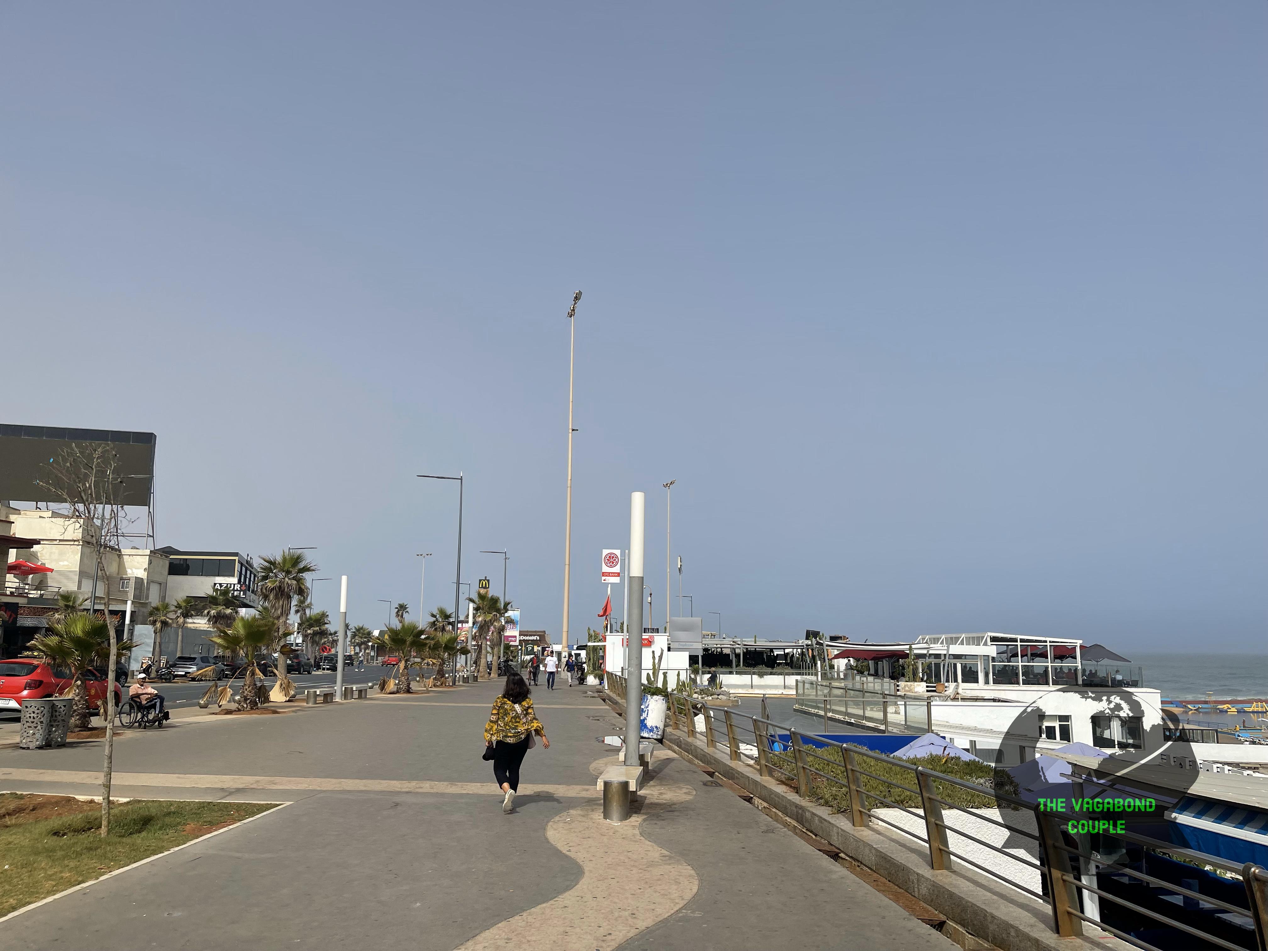
Mohammad parks at a petit-taxi stand across from Piscine Tropicana and sends us west on foot toward McDonald’s Ain Diab. The short walk brings open Atlantic views, fresh air and a promenade with enough room to remember that cities can contain horizons.
Petit taxis are city vehicles rather than tour buses, yet Mohammad turned his red Dacia into a rolling introduction to Casablanca. Local taxi knowledge is a form of urban scholarship with a meter attached.
Seaside pools such as Tropicana borrowed the Atlantic as scenery while excluding its strongest waves. The compromise was practical, popular and commercially sound, three qualities oceans seldom provide together.
Tropicana makes the basic bargain obvious: ocean on one side, controlled pool water on the other. The Atlantic supplies drama; the pool supplies a more negotiable depth.
Looking back along the coast, Hassan II Mosque anchors a skyline otherwise dominated by low leisure buildings. One minaret performs the work of several ordinary landmarks and does so without requesting road signs.

|

|

|
|

|
|
| Ain Diab and Piscine Tropicana — Mohammad and his Dacia Sandero at the petit-taxi stand, the pool beside the Atlantic and the Corniche looking back toward Hassan II Mosque. | ||
Boulevard de la Corniche bends south past Hôtel Bellerive and becomes Avenue Côte d’Émeraude at Rond-Point Suisse, beside the Swiss Hotel.
The Lido name reflects a twentieth-century habit of borrowing European seaside vocabulary for pools and resort districts far from Venice. Casablanca adopted the word and supplied its own Atlantic surf.
From Rond-point Suisse, we take Boulevard de l’Océan Atlantique and Boulevard de l’Océan Pacifique into Anfa’s low-density residential streets. Casablanca has named the route after two oceans while providing only one of them.
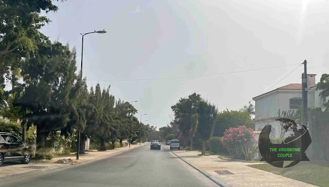
Rte d’Anfa Supérieur leads past detached villas, walled gardens and planted setbacks before reaching the circular Aire d’Anfa. The street pattern announces privacy long before the gates do.
Upper Anfa replaces the Corniche’s commercial frontage with walls, hedges and detached villas. There are fewer storefronts, signs and reasons for a taxi to stop.

|

|

|

|

|
|
| From Ain Diab into Upper Anfa — Hôtel Bellerive, Hotel Suisse, the ocean-named boulevards and the first villa-lined streets of Anfa Supérieur. | ||
The planted setbacks leave more sky between buildings than in central Casablanca. Traffic looks briefly underemployed.
The former Casablanca-Anfa airfield once made this district an aviation gateway. Commercial flights later moved to Mohammed V Airport, leaving road names, open tracts and urban redevelopment to carry the memory.
The road keeps curving through walled compounds toward Aire d’Anfa. Here the 1943 conference becomes a physical neighborhood rather than another date in a history book.
Aire d’Anfa’s circular street geometry breaks from Casablanca’s rectilinear central grid. The roundabout also sits close to the former airfield district, where aviation space has been absorbed into roads and redevelopment.
From Aire d’Anfa, we continue by Rue Cor d’Anfa, Avenue Abou El Hassan Mrini and Rue Lice d’Anfa toward Royal Golf Anfa.

|

|

|

|
|
|
| Upper Anfa — Rue d’Anfa Supérieur, Aire d’Anfa and Avenue Abou El Hassan Mrini through the former airfield district toward Royal Golf Anfa. | ||
Royal Golf Anfa and the Hippodrome
The Royal Golf Anfa course shares this green precinct with the Casablanca-Anfa hippodrome. The club lists a nine-hole layout played as an 18-hole, 5,537-meter, par-70 round, while the racecourse preserves another large open space inside the city.
Golf and horse racing put two very different sporting geometries side by side: fairways on one side, a racecourse on the other. Neither requires a high-rise to make its point.
The hippodrome belongs to formal racing rather than Morocco’s ceremonial tbourida, but both depend on long traditions of breeding and horsemanship. The horse has never required urban planners to explain its importance.

|

|

|
| Royal Golf Anfa and Hippodrome Casa-Anfa — fairways and racecourse sharing one large sporting precinct. | ||
The nearby Cameo Cinema has also offered outdoor screenings. Anfa can therefore move from racecourse to screen without asking the neighborhood to choose one form of leisure.
Rue Lice d’Anfa reaches the Shell Kennedy–Franklin Roosevelt traffic circle, where roads named for two American presidents meet Avenue Habib Sinaceur. Casablanca has compressed international diplomacy into a roundabout.
 |
| Kennedy-Franklin Roosevelt-Habib Sinaceur-Lice d Anfa traffic circle |
We turn southeast on Franklin Roosevelt Boulevard, continue along Boulevard Moulay Rachid and join Boulevard Al Massira Al Khadra. The route carries us away from Anfa’s open grounds and back into denser commercial Casablanca.
Al Massira Al Khadra Boulevard carries us through a newer commercial district. The Casablanca Twin Center became a major skyline marker after opening in the late 1990s, and the same complex houses the Kenzi Tower Hotel.
By here the coastal villas are gone. Offices, hotels and apartment towers crowd the boulevard, turning the tour into an urban cross-section rather than a coastal drive.
At Rue Normandie, the Onomo hotel occupies one of those busy corners. International branding arrives at street level; the traffic remains locally administered.
Ricardo Bofill designed the Twin Center with Moroccan architect Elie Mouyal. The paired towers rise from a shared commercial base, turning one busy junction into a vertical district of offices, shops and hotel rooms.
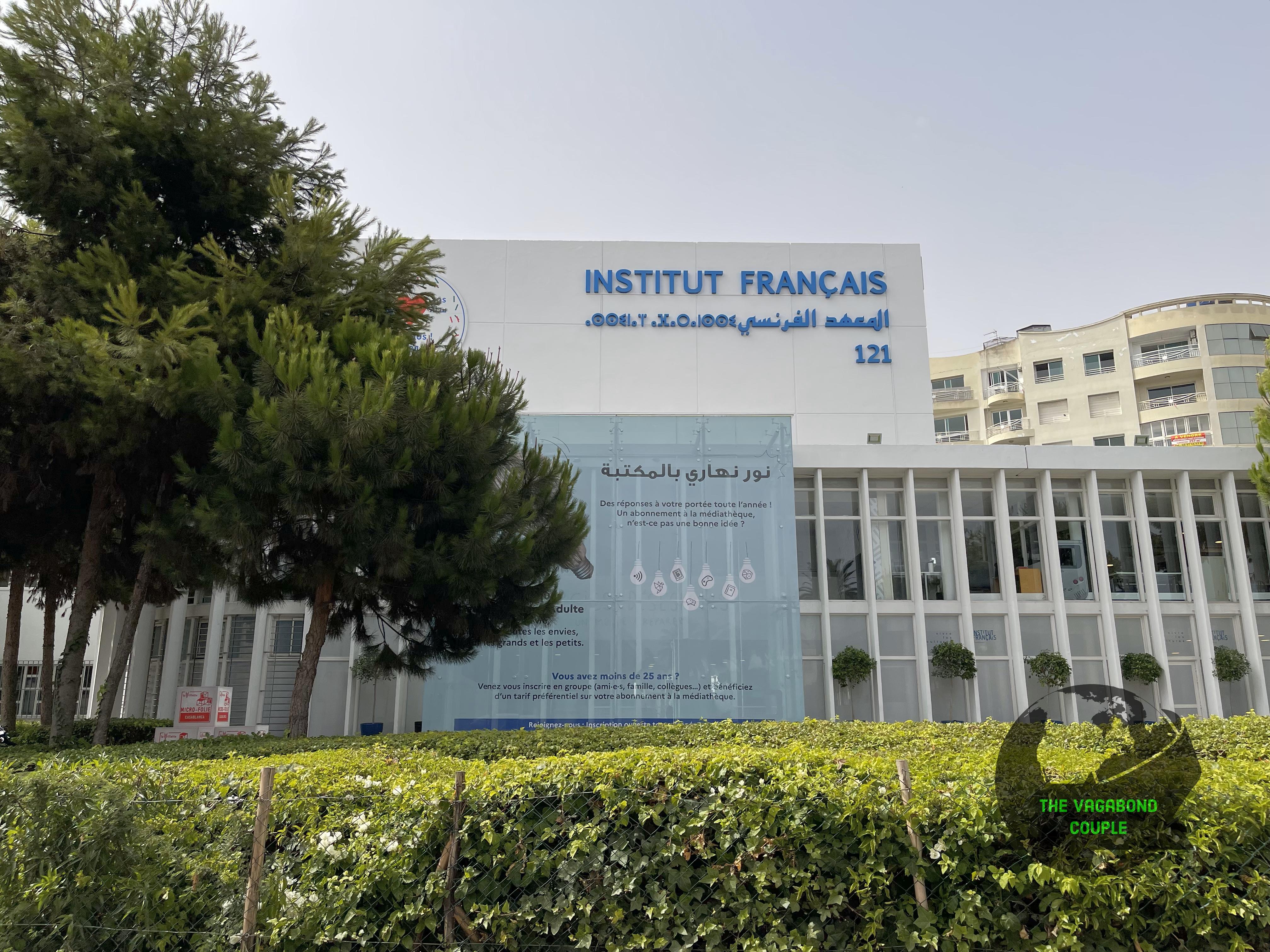
Boulevard Al Massira Al Khadra continues as Boulevard Mohamed Zerktouni. We pass the Institut français de Casablanca as the route turns toward Habous.
Casablanca’s broad boulevards were planned to connect the port, center and expanding suburbs. Boulevard Mohamed Zerktouni still performs that job under rather more traffic than its early planners had the courtesy to predict.

|

|

|

|

|
|

|
|
| Back into commercial Casablanca — Boulevard Al Massira Al Khadra, Onomo City Center, the Casablanca Twin Towers, Kenzi Tower Hotel, Institut français and Boulevard Mohamed Zerktouni. | |||
We leave Boulevard Mohamed Zerktouni for Rue Mohamed Al Fidouzi near the Ibn Rochd University Hospital Center, one of Morocco’s major teaching-hospital complexes.
 |
| Ibn Rochd University Hospital Center (CHUIR / CHU Ibn Rochd) |
Rue Mohamed Al Fidouzi leads southeast toward Habous near the Muhammadi Mosque and Royal Palace. The broad commercial boulevards drop behind us as the streets tighten and arches begin to appear.
 |
| Rue de Provence, Habous, Casablanca |
Habous Quarter
Habous was planned and built mainly between 1917 and 1926 as a “new medina” for Casablanca’s growing Moroccan population. Its designers combined shaded streets, arcades, mosques, shops and courtyards with modern services and colonial planning. The result is neither an untouched old town nor a stage set; it is an early neo-Moroccan urban experiment that still functions as a commercial district.
The Tribunal Administratif de Casablanca stands at the traffic circle in a formal civic building. Its scale and symmetry suit the administrative district rather well.
Muhammadi Mosque and its gardens occupy the south side of the traffic circle, adding a religious and planted center to this planned administrative quarter.

|

|

|
| Entering Habous — Allée impériale, the Tribunal Administratif and Muhammadi Mosque with its gardens. | ||
Mohammad leaves us near Arabesque Bazaar on Rue Ibn Khaldoun and waits while we walk through the quarter.
We walk down Rue Ibn Khaldoun through the shops and arcades around Rue Sidi Oqba and Rue du Palais du Sultan, north of Moulay Youssef Mosque.
Rue Ibn Khaldoun is named for the fourteenth-century North African historian whose Muqaddimah examined labor, taxation and the rise and decline of states. A market street is an unusually suitable memorial.
Ibn Khaldun used asabiyyah for the social bonds that help communities gain and hold power. Habous merchants might prefer the shorter retail version: neighbors, reputation and repeat customers matter.
The third view returns theory to practice. Goods move through arcades, customers compare prices and the planned quarter supports the daily exchange that keeps it alive.

|

|

|

|
| Rue Ibn Khaldoun in Habous — shopfronts, arcades and the market street through the planned new medina. | |||
Moulay Youssef Mosque dates from the early development of Habous. Its square minaret follows a long Moroccan architectural tradition, a form we had already seen at the Koutoubia in Marrakech, while serving a district planned in the twentieth century.
Sidi Oqba Street uses short blocks and repeated arches to create shade and break the route into smaller visual rooms. The proportions echo older Moroccan streets while leaving room for twentieth-century sanitation and access.
The next stretch shows doors, shopfronts and arches sharing one narrow alignment. Habous manages a lot of frontage with very little wasted street.
Toward the palace road, Habous becomes more formal. Royal, legal, religious and commercial functions were placed within one coordinated district, a remarkably ambitious task for any planner and an impossible one for most family group chats.

|

|

|

|
| Rue Sidi Oqba and the palace-side streets — Moulay Youssef Mosque, shaded arches and the turn toward Rue du Palais du Sultan. | |||
We circle back to Rue Ibn Khaldoun and pick up a couple of souvenirs from a crafts store.
Habous craft shops often cluster related trades, echoing the organization of older souks. Leather, cloth, metal and wood develop their own concentrations instead of appearing at random.
The next shop shows the overlap between daily objects and souvenirs. A brass tray does not stop being Moroccan because somebody plans to carry it through airport security.

|

|

|
| Habous crafts — Rue Ibn Khaldoun and two craft shops where we stopped for souvenirs. | ||
We return to Mohammad’s Dacia Sandero and leave Habous by Avenue 2 Mars. The Church of Notre Dame of Lourdes stands near the route. It is a church, not Casablanca’s cathedral, despite the larger title that sometimes follows it around.
 |
| Church of Notre Dame, Casablanca at left viewed from northbound Av. 2 Mars |
Avenue Mers Sultan leads toward Arab League Park, a central green space planned under Henri Prost and Albert Laprade during the early Protectorate period. The palms and long paths supplied Casablanca with an urban promenade before the automobile claimed most of the surrounding streets.
East of Arab League Park, we cross Rond-Point Mers Sultan, where Mers Sultan Avenue meets Rue Mostafa El Maani, Rue Allal Al Fassi, Boulevard Rahal El Meskini and Rue Hadj Omar Riffi.
Mers Sultan returns us to dense central Casablanca within a few turns. Apartment blocks, offices and traffic replace Habous’s planned intimacy with impressive efficiency.
The Chambre Française de Commerce et d’Industrie du Maroc (CFCIM) stands on Avenue Mers Sultan. Its institutional façade fits Casablanca’s commercial center rather more clearly than another slogan could manage. The taxi then carries us toward Hassan II Avenue and Mohammed V Square.

|

|

|

|
| Mers Sultan corridor — Avenue Mers Sultan, Rond-Point Mers Sultan and the CFCIM building before the taxi turns toward Hassan II Avenue. | |||
Mohammed V Square
At Hassan II Avenue, we turn northeast toward Mohammed V Square, entering Casablanca’s main administrative district.
Mohammed V Square developed as Casablanca’s main administrative plaza during the French Protectorate. The courthouse, prefecture and post office combine European planning with Moroccan decorative forms, while the pigeons maintain full control of the pavement and acknowledge no architectural authority.
The Grand Théâtre de Casablanca stands across Avenue Hassan II, designed by Christian de Portzamparc with Moroccan architect Rachid Andaloussi. Its sweeping white forms make the building difficult to mistake for an office block, which is a useful quality in a theater.
We continue north on Av. Hassan II to the intersection with Boulevard de Paris.
The Barid Al-Maghrib central post office anchors the boulevard edge of the square. Completed during the early Protectorate period, it is one of the civic buildings that made Casablanca a laboratory for modern planning wrapped in Moroccan motifs.

|

|

|

|

|
|
| Mohammed V Square — Hassan II Avenue, Palais de Justice, Grand Théâtre de Casablanca, Boulevard de Paris and the Barid Al-Maghrib central post office. | ||
We leave Mohammed V Square toward United Nations Square, turning west onto Boulevard de Paris and then north on Rue Abderrahmane Serghini.
At Rue Abou Soufiane, Casa Délice occupies a corner commercial building with balconies and street-level frontage. The corner puts restaurant space, apartments and street life into one compact slice of central Casablanca.
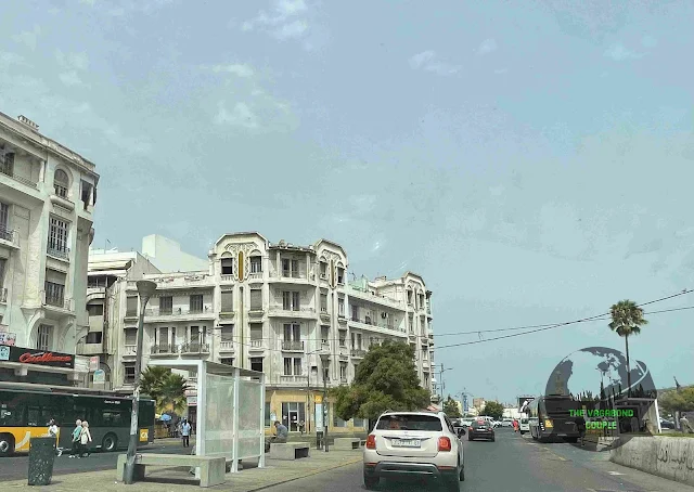
Rue Abderrahmane Serghini reaches the southern edge of United Nations Square through older central commercial blocks. Banque Populaire occupies one of them, because architectural history still has accounts to balance.
From Rue Abderrahmane Serghini, we turn west toward Boulevard Moulay Hassan I and then follow the northern edge of United Nations Square.

|

|

|
|
| Between Mohammed V Square and United Nations Square — Boulevard de Paris, Casa Délice, Banque Populaire and Boulevard Moulay Hassan I. | |||
United Nations Square and the Zevaco Dome
United Nations Square occupies the meeting point between the old medina and the planned twentieth-century city. Before Place de France and its later name, the area was associated with Souq Kbir, the large market outside the medina walls.
Jean-François Zevaco designed the domed Kora Ardia structure in the 1970s. Its renovation reopened the landmark in 2021, preserving one of Casablanca’s more playful pieces of late-modern public architecture.
 |
| Coupole Zevaco / United Nations Square |
We continue by Hassan I Boulevard, Avenue des FAR and Rue Qortobi to Place Al Yassir in Belvédère. Boulevard Mohammed V, Boulevard Émile Zola, Rue Qortobi and Rue du Lieutenant Mohamed Mahroud meet at this busy tramway junction.
 |
| Place Al Yassir |
We cross Place Al Yassir and return to Hôtel Ibis Casa-Voyageurs. Mohammad’s petit taxi cannot take us to the airport because it is licensed for city service, so we thank him after a full day in which he served as driver, guide and determined ambassador for Casablanca.
Casablanca to Mohammed V International Airport
We check out of Hôtel Ibis Casa-Voyageurs and hire a grand taxi for Mohammed V International Airport near Nouaceur, about 30 kilometers south of central Casablanca. The drive uses the A3 corridor and crosses the cable-stayed Sidi Maârouf bridge.
The airport road crosses the Chaouia plain, the agricultural hinterland that fed Casablanca’s port growth. Grain and livestock once moved toward the city by slower routes; the expressway now carries travelers across the same country with less dust and more lane markings.
Casablanca’s outward expansion follows transport corridors toward Nouaceur. Housing and business parks appear beyond the dense city, replacing the clean edge a map might suggest.
Road signs replace city monuments as Mohammed V International Airport becomes the destination. The airport lies outside Casablanca proper near Nouaceur, despite carrying most of the city’s international passengers.
The motorway reduces the outer city to exits and directional signs. Geography becomes a set of lanes with arrows, which is efficient and slightly insulting to scenery.
Toll roads brought divided carriageways and controlled access to long-distance travel in Morocco. They also created the small ritual of finding the ticket just after everyone agreed it was safely stored.
Freight traffic shares the corridor with us: trucks, containers and airport-bound cargo keep Casablanca’s commercial role visible after the skyline fades.
Wheat and barley from the Chaouia plain also show up at the other end of the system: bread and couscous. The port economy had dinner attached to it, which is a more edible way to understand a hinterland.

|

|

|

|

|

|

|

|
| Leaving Casablanca on the A3 — the expressway, Chaouia plain, airport-bound lanes, toll motorway and freight traffic on the run south toward Nouaceur. | |||
Near Nouaceur, logistics gives way to a more specialized aerospace cluster tied to the airport. The approach is economically busy long before the terminal appears.
Interchanges near Sidi Maârouf peel traffic toward southern Casablanca while our lane keeps aiming for Nouaceur. At motorway speed, the city stops being neighborhoods and becomes choices made several hundred meters too early.
As the city thins, construction gives way to broader fields and logistics compounds. Casablanca releases the traveler slowly, as if checking that no final errand has been forgotten.
Airport traffic mixes cars, buses, taxis and hotel shuttles. Every driver follows the same signs while maintaining an independent theory about the fastest lane.
Service areas support regional traffic and airport runs. Coffee remains part of the transport system, although civil engineers continue to omit it from motorway diagrams.
Closer to the terminal, aircraft replace minarets and towers as navigation points. The site traces to a wartime airfield; today Mohammed V Airport is Morocco’s principal international gateway.
The last junctions make lane choices suddenly important. Casablanca has saved one final traffic decision for departure, a gesture of admirable consistency.
The terminal road completes the loop begun at Casa-Voyageurs. Train, taxi, motorway and aircraft form one journey even when each transfer behaves like a separate administrative kingdom.

|

|

|

|

|

|

|

|
| Approaching Mohammed V International Airport — Nouaceur’s airport corridor, Sidi Maârouf bridge and signs, airport traffic, final A3 lanes and the toll plaza. | |||
At the terminal, we board a Royal Air Maroc Boeing 787-8 Dreamliner for the flight home. Casablanca is the airline’s main hub for African, European and transatlantic routes, so the departure board covers rather more geography than our luggage would prefer.
 |
| Royal Air Maroc Boeing 787-8 Dreamliner |
Casablanca closes the Morocco portion of our July 2023 Pan-Africa journey with a useful correction to its own legend. The city is less a film set than a working Atlantic metropolis built from port trade, migration, royal projects and urban experiments that still sit beside one another without pretending to be identical. Two years later, Morocco returned to our road story when our 2025 overland journey crossed from Algeciras to Tanger Med and Tangier. That return came much later in the same Silk Road expedition whose blog story begins in Turkmenistan.
Before that 2025 chapter, our next published story jumps to a separate journey in December 2023: a Christmas-week homecoming in Kolkata, including Mother House, Kumartuli, Victoria Memorial and Tangra. Morocco and Bengal are not consecutive road stops. The blog calendar has simply changed continents without filing the usual paperwork.
