
 |
| Gateway Arch and St. Louis riverfront behind the Tom Sawyer passenger deck |
Part 1 brought us and Shehzadi, our overlanding Toyota Tundra, from Hyattsville through Dublin, Ohio, to St. Louis. Part 2 begins where that drive ended: beside the Mississippi River, with a sunset cruise and the Gateway Arch leaning over the water like a 630-foot punctuation mark.
After the cruise, we returned the next morning for the Arch tram, then pointed Shehzadi west on I-70 through Columbia, Boonville and Kansas City to Topeka. We parked in Topeka with the Pan-American loop merely clearing its throat.
Trans-America Overland Part 2 — Post Summary
Part 2 begins with a sunset cruise on the Mississippi River and a tram ride inside the Gateway Arch. We then point Shehzadi west along I-70 through Columbia, Boonville and Kansas City before ending the day in Topeka, Kansas, before ending the day in Topeka, Kansas.
| What's Covered | |
| 🚢 | Mississippi River Sunset Cruise — Tom Sawyer, St. Louis riverfront and the Gateway Arch |
| 🌉 | Bridges Across the Mississippi — Stan Musial Veterans Memorial Bridge and MacArthur Bridge |
| 🏛️ | Gateway Arch Tram — museum entrance, capsule ride and observation-deck views |
| 🛣️ | St. Louis to Kansas City on I-70 — Columbia, Boonville and the historic east-west road corridor |
| 🍔 | Topeka — HuHot, Spangles and an odometer check |
The evening cruise and next-morning Arch visit gave us two views of St. Louis: one from the Mississippi River and one from 630 feet above it. Then we drove Shehzadi west on I-70 across Missouri and into Kansas, ending the day in Topeka. Rivers, steel, interstate concrete and dinner on a circular grill made a surprisingly coherent day. Road trips are generous that way.
Route: St. Louis, Missouri, to Topeka, Kansas
Vehicle: Shehzadi, our Toyota Tundra
Main road: I-70 through Columbia, Boonville and Kansas City
Main experiences: Mississippi River cruise, Gateway Arch tram, HuHot and Spangles
Overnight stop: Topeka, Kansas
Route at a Glance
- Board the Tom Sawyer for an evening cruise on the Mississippi River.
- Pass beneath St. Louis's river bridges, including the Stan Span and MacArthur Bridge.
- Return to Gateway Arch National Park for the tram ride and observation deck.
- Drive west on I-70 through Columbia, Boonville and Kansas City.
- Stop overnight in Topeka for HuHot, Spangles and an odometer check.
Mississippi River Sunset Cruise in St. Louis
We boarded the Tom Sawyer at the St. Louis levee as the light dropped over the Mississippi River. The cruise passed the city riverfront, Laclede's Landing and the Gateway Arch, while East St. Louis occupied the opposite bank. The river supplied the motion. The Arch handled the advertising.
 |
| Passengers boarding the Tom Sawyer at the St. Louis riverfront |
Passenger riverboats were brought to the St. Louis riverfront in 1964 so visitors could watch the Arch rise. The Tom Sawyer itself was built in 1966 and came to St. Louis later, so the boat did not spend 1964 observing construction from a suspiciously unfinished future.
 |
| The Gateway Arch and St. Louis riverfront in low evening light from the Mississippi River |
Eero Saarinen's stainless-steel Arch reaches 630 feet in both height and width. Workers completed it on October 28, 1965. From the river, its scale was easier to understand than from a photograph, although the camera continued trying with the confidence common to small electronics.
Bridges Across the Mississippi River
The cruise also turned St. Louis's bridge history into a moving exhibit. North of downtown, the cable-stayed Stan Musial Veterans Memorial Bridge carries I-70 across the Mississippi. It opened in 2014, stretches about 2,800 feet and rises roughly 400 feet at its towers. Its shorter local name, the Stan Span, is kinder to road signs and human lungs.
 |
| The Stan Musial Veterans Memorial Bridge, known locally as the Stan Span, from our river cruise |
Farther south, a freight train crossed the MacArthur Bridge. Its road deck opened in 1917, and the bridge later took General Douglas MacArthur's name. By our 2024 visit, highway traffic had left long ago, and the crossing served rail traffic. The steel trusses looked built for work rather than compliments, which was probably the point.
 |
| A freight train crossing the MacArthur Bridge between St. Louis and East St. Louis |
The Arch remained the fixed point as the boat turned along the riverfront.
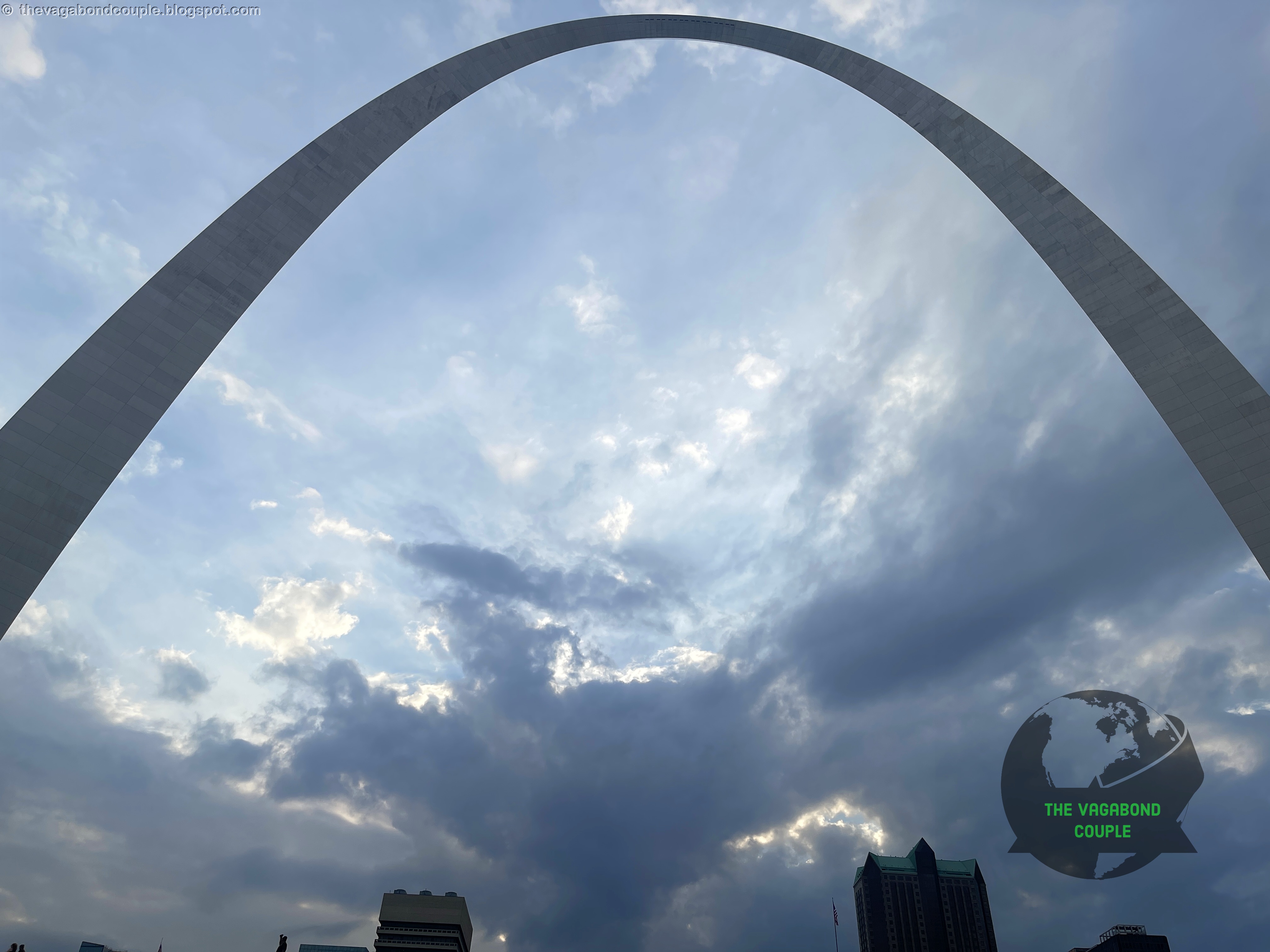 |
| The Gateway Arch from the Mississippi River beneath broken clouds |
We would meet the Mississippi again after looping through the American West and Southwest, first at Baton Rouge and then at New Orleans. At St. Louis, the river felt like a starting line. It had no obligation to make the route simple, and it took that responsibility seriously.
 |
| The Gateway Arch rising above the St. Louis riverfront grounds |
Tram Ride to the Top of the Gateway Arch
The next morning, we returned to Gateway Arch National Park. The 91-acre site includes the Arch, the Old Courthouse and the riverfront grounds. A $380 million redesign completed in 2018 added a new museum entrance and a park connection over the highway, repairing a particularly American problem: building a national monument, then making pedestrians negotiate traffic to reach it.
 |
| Gateway Arch National Park entrance sign in St. Louis |
The museum presents the westward expansion that the Arch was built to commemorate. The National Park Service also recognizes the history's opposing meanings. The same movement can represent courage and opportunity for some people, and conquest, displacement and broken treaties for others. Stainless steel is cleaner than history.
We entered the tram system for the four-minute ride to the top. Each tram has eight capsules with five seats apiece. The pods rotate in small steps as they climb the curved leg, combining an elevator with the useful social lesson that five adults can share a compact space when escape is unavailable.
 |
| Numbered doors for the tram capsules inside the Gateway Arch |
With five seats inside each capsule, spare room is treated as an optional feature. Once the doors close, the tram begins its tilted climb.
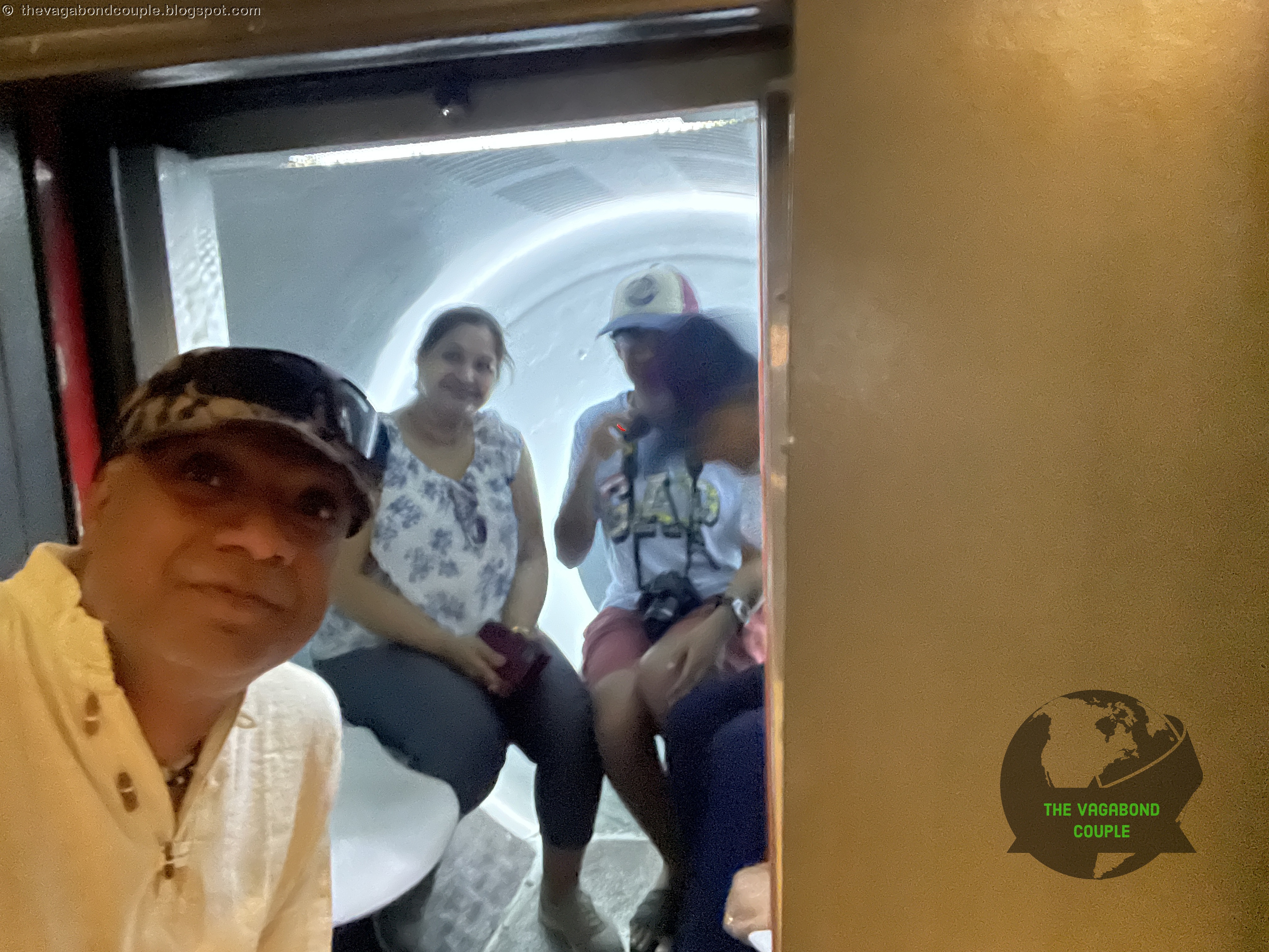 |
| Passengers seated inside one of the Gateway Arch's five-seat tram capsules |
At the observation deck, narrow windows faced both sides of the river. Downtown St. Louis and the Old Courthouse filled the western view.
 |
| Downtown St. Louis and the Old Courthouse from the Gateway Arch observation deck |
To the east, barges moved along the Mississippi below the Illinois riverbank. On a clear day, the view can extend about 30 miles. The windows are small because the Arch has engineering priorities and very little interest in panoramic glass walls.
 |
| Mississippi River barges and the Illinois riverbank from the Gateway Arch observation deck |
The observation room follows the curve at the top, so the floor and windows refuse to behave like those in an ordinary building.
 |
| Visitors at the narrow windows of the Gateway Arch observation deck |
Each leg is formed from stacked, double-walled steel sections with equilateral-triangle cross sections. The foundations extend about 60 feet into the ground. The result looks simple from a distance, which is architecture's polite way of hiding years of calculation, welding and people saying, “That had better meet in the middle.”
 |
| The city side of the Gateway Arch, with the museum and tram entrance below |
St. Louis to Kansas City on I-70
After the Arch, we returned to Shehzadi and joined westbound I-70. Columbia and the University of Missouri passed along the route, followed by Boonville near the Missouri River. We did not detour to Arrow Rock, which sits away from the interstate, and Kansas City received only a drive-through. Its jazz and barbecue would have to survive without our immediate supervision.
The modern highway follows a much older east-west travel corridor. By 1926, the numbered-road system had tied St. Louis, Kansas City and Topeka together along U.S. 40 and related routes. Missouri's I-70 arrived through the 1950s and 1960s, replacing crossroads and town centers with ramps, service exits and the firm belief that every destination should be announced at 70 miles per hour.
For us, this was the first long western push of the expedition. St. Louis's riverfront fell behind, Missouri opened ahead, and Shehzadi settled into the road with none of the dramatic commentary provided by her occupants.
Topeka: HuHot, Spangles and an Odometer Check
We crossed into Kansas and stopped in Topeka for the night. Dinner came from HuHot, where diners choose ingredients and sauces before cooks work around a circular flat grill. The method is called Mongolian barbecue, although it was developed in Taiwan in the 1950s and has no direct connection to Mongolia. Geography had left the kitchen.
 |
| Cooks working around the circular grill at HuHot in Topeka |
We also tried burgers at Spangles, a Kansas fast-food chain that began in Wichita in 1978. Its retro diner styling was difficult to miss, which is useful when dinner decisions have been delegated to highway signs.
 |
| A Spangles drive-through menu board in Topeka |
The restaurant building carried the same chrome-and-neon theme as the menu board. We had now eaten at HuHot and Spangles in one stop, which gave Topeka an impressive ratio of circular grills to roadside nostalgia.
 |
| A Spangles restaurant and roadside sign in Topeka |
Topeka also has a place in interstate history. On September 26, 1956, Kansas began paving a nearby section of I-70 under the new Federal-Aid Highway Act, one of the first projects started after the law created the modern Interstate Highway System.
Shehzadi’s odometer read 7,576 miles in Topeka, up from 6,395 when we left home in Hyattsville. We were now 1,181 miles into the expedition, with most of the continent still waiting ahead.
 |
| Shehzadi's odometer at Topeka: 7,576 miles |
This leg tied a monument to westward movement with the road that now carries it. We left the Gateway Arch, followed I-70 across Missouri and reached the Kansas city associated with the Interstate system's first paving work. The symbolism was almost suspiciously tidy, which is more than we usually ask from an interstate.
Next Stop: Colorado Springs
Part 3 carries us west from Topeka across the Kansas plains to Colorado Springs, where Garden of the Gods and the summit road to Pikes Peak replace river bridges with red rock and altitude. The mountains were preparing the invoice.
St. Louis, Missouri: Sunset Cruise on the mighty Mississippi & ride to the top of Gateway Arch
Reference route maps for our 9,000-mile USA and Mexico overland round trip: Map-1 and Map-2.
