
 |
| Alien Cowpoke, Rachel Three metal alien figures guard hay bales beside the Extraterrestrial Highway. Nevada had moved beyond road signs and into agricultural science fiction. |
Part 9 ended at the eastern threshold of Nevada State Route 375 after our drive from Zion through Las Vegas, Hoover Dam and Lake Mead. This episode resumes there, continuing directly from St. George to Nevada's Extra-Terrestrial Highway via Las Vegas, Hoover Dam, and Lake Mead rather than pretending that Shehzadi had teleported back to breakfast.
From Crystal Springs, we crossed the full Extraterrestrial Highway through Rachel and Railroad Valley, joined U.S. 6 at Warm Springs, turned south through Tonopah and Goldfield, and continued to Beatty, Rhyolite and Goldwell. Dinner in Amargosa Valley came before the final descent into Death Valley, where Furnace Creek waited below sea level with the temperature still displaying three digits after midnight.
Extraterrestrial Highway to Death Valley — Post Summary
This continuation of our longest driving day follows Shehzadi from Crystal Springs across Nevada's Extraterrestrial Highway, through Rachel, Railroad Valley, Tonopah, Goldfield, Beatty and Rhyolite, then past Goldwell's desert sculptures and south into Death Valley. Alien storefronts gradually give way to mining history, cars planted in the ground, formal outdoor art and a 118°F midnight arrival at Furnace Creek. ETR: 22 min.
| What's Covered | |
| 🛣️ | Crystal Springs and Nevada State Route 375 — the eastern gateway and 98-mile Extraterrestrial Highway |
| 👽 | Alien Research Center and Rachel — giant alien, roadside signs and Area 51 country |
| ⛽ | Alien Cowpoke and Little A’Le’Inn — fuel, heat-struck card reader and lunch in Rachel |
| 🧂 | Railroad Valley Playa and Warm Springs — dry lakebed science and the western highway terminus |
| ⛏️ | Tonopah to Goldfield — mining-road history and a living county seat |
| 🚗 | Rocket Bob’s Art Cars — found-object vehicles in downtown Goldfield |
| 🚌 | International Car Forest of the Last Church — planted cars, trucks and buses |
| 👻 | Beatty and Rhyolite — functioning service town followed by a true mining ghost town |
| 🎨 | Goldwell Open Air Museum — verified desert sculptures beside Rhyolite |
| 🛸 | Area 51 Alien Center — final Nevada alien stop and dinner |
| 🌅 | Amargosa Valley to California — sunset drive toward Death Valley Junction |
| 🏨 | Furnace Creek — below-sea-level signs and midnight arrival at The Ranch |
Shehzadi turned west from Crystal Springs onto Nevada State Route 375 with Rachel, Warm Springs, Tonopah, Goldfield, Beatty, Rhyolite and Furnace Creek still ahead. The route joined alien folklore to mining history, public art and a late-night descent into one of North America's deepest basins. It was a single driving day, although the odometer and our attention spans had begun negotiating separate labor agreements.
Method: Overland in Shehzadi via NV-375, US-6, US-95, local Rhyolite roads, NV-373, CA-127 and CA-190
Timing: Continuation of the expedition’s longest driving day
Themes: E.T. Highway · mining towns · found-object art · ghost-town ruins · Death Valley
Vehicle: Shehzadi (Toyota Tundra)
Route at a Glance
- Crystal Springs and the Extraterrestrial Highway
- Alien Research Center and Rachel
- Alien Cowpoke and Little A’Le’Inn
- Railroad Valley Playa to Warm Springs
- Tonopah to Goldfield
- Rocket Bob’s Art Cars
- International Car Forest of the Last Church
- Beatty and Rhyolite Ghost Town
- Goldwell Open Air Museum
- Area 51 Alien Center
- Sunset Road to Furnace Creek
- Midnight at The Ranch at Death Valley
Crystal Springs and the Extraterrestrial Highway
At Crystal Springs, the route turned west beneath the Extraterrestrial Highway sign. Nevada designated this 98-mile section of State Route 375 in 1996, drawing a tourist identity from its proximity to the Nevada Test and Training Range and Area 51. Declassified histories later documented the site's role in U-2 and OXCART aircraft testing. The secret aircraft were real; the roadside aliens remain considerably easier to photograph.
 |
 |
||
| Turning onto State Route 375 The eastern sign and the long road beyond it: Nevada's 98-mile Extraterrestrial Highway begins at Crystal Springs and heads west across central Basin and Range country. | |||
Those aircraft programs also help explain some early UFO reports. High-altitude test flights placed unfamiliar machines in portions of the sky where civilian aircraft were not expected. Observers saw something real but lacked the classified context needed to identify it. Secrecy protected the programs and left public speculation to fill the empty space. Decades later, Nevada turned that gap in information into highway branding, gift shops and metal aliens with excellent roadside posture.
The last eastern-gateway stop before the turn had been E.T. Fresh Jerky, on U.S. 93 near Hiko. The saucer props, warning placards and Alien Zone restroom had made the essential point: normal retail signage had left the building.
 |
 |
 |
 |
 |
 |
||
| E.T. Fresh Jerky recap Storefronts, saucer props, warning placards, murals, and one restroom that had clearly passed through atmospheric reentry. | |||
The road crossed broad basins separated by long mountain ranges. Calling the whole drive Mojave Desert would flatten an important transition. Southern Nevada's creosote bush and Joshua trees gradually yield to colder Central Basin and Range vegetation, including sagebrush, as the route climbs and moves north. The pavement stays mostly straight while the ecological boundaries do the complicated work off camera.
Services thin rapidly beyond the U.S. 93 junction. We had fuel, water and food aboard Shehzadi, which mattered more than any theory about lights in the sky. A remote-road rule applied: an ordinary mechanical problem would remain ordinary only until the nearest help became a very large number of miles away.
State Route 375 is paved, but remoteness changes the meaning of an easy road. Long sight lines can hide the distance between fuel, shade and help. Cattle, wildlife and sudden weather still share the corridor, while cellular coverage cannot be treated as a contractual obligation. We kept the tank healthy and the route visible on more than one device. The road's famous question concerns what might be overhead; the practical question is whether the spare tire, water and recovery gear are already aboard.
Alien Research Center and Rachel
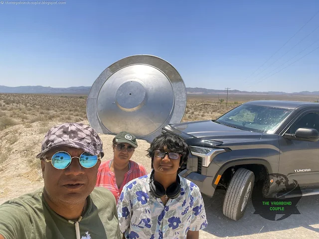
The Alien Research Center appeared beside the highway as a dark, hangar-shaped building guarded by a giant silver alien. Despite the name, its public role is closer to an alien-themed store and road-trip supply stop than a scientific institute. No one handed us a lab coat. This was probably for the best.
 |
 |
 |
 |
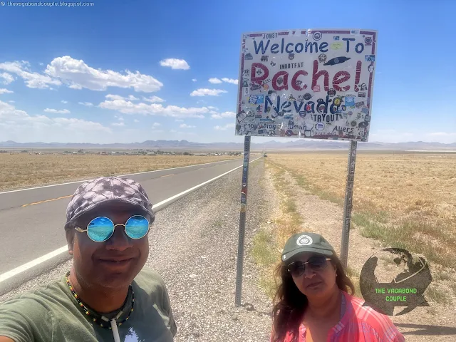
| Alien Research Center and Rachel The giant alien outside the store, followed by Rachel's roadside signs farther west on State Route 375. | |||
Farther west, Rachel sat low against the mountains. The tiny unincorporated community became linked with Area 51 culture because access roads to the restricted military range branch from the surrounding area. That connection produced signs, businesses, television references and a steady flow of visitors who prefer their road trips with at least one unresolved government file.
The two-part Dreamland story in The X-Files used Area 51 mythology as its engine, but Rachel should not be recast as the episode's principal filming set. The real town's contribution is stronger and simpler: it sits on the public highway beside a vast restricted region, close enough to inherit the stories and far enough away to sell lunch.
That public-private boundary explains much of the route's tone. Visitors can drive the state highway, stop at businesses and photograph roadside signs. The military range beyond remains restricted, and a tourism slogan does not turn a security boundary into an invitation. We stayed on public roads and let the souvenir aliens handle diplomacy. The restraint made the trip more interesting, not less: the visible story lay in how a small community adapted to secrecy next door.
Alien Cowpoke and Little A’Le’Inn
At the outskirts of Rachel, the Alien Cowpoke Gas Station and General Store supplied fuel, cattle jokes and metal extraterrestrials posed around hay bales. We filled Shehzadi here. The stop was practical first and theatrical second, although the aliens had secured better positions for the photographs.
 |
 |
 |
 |
 |
 |
 |
|
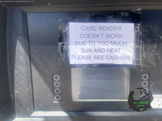
| Alien Cowpoke fuel stop Hay-bale aliens, cattle signs, old vehicles, pumps, and the payment reader defeated by direct July sun. | |||
July heat had introduced a small technical problem. A taped notice explained that the payment reader on the sun-facing side was not working, so we moved to a pump facing the store. Nevada had built a highway around secret aircraft and extraterrestrial mythology, yet direct sunlight still defeated a credit-card terminal. The universe preserves perspective through humble instruments.
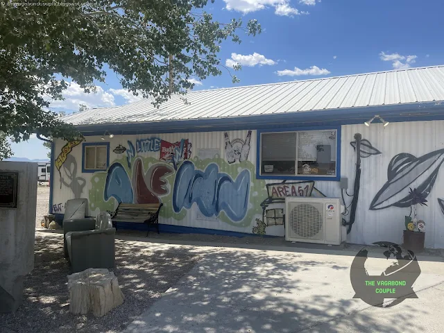
The road then carried us into Rachel proper and the Little A’Le’Inn. We stopped for lunch among alien mannequins, hanging saucers, dollar bills and souvenirs. The meal mattered because the day ahead was long; the decor mattered because eating in an ordinary room would have violated the local zoning spirit.
 |
 |
 |
 |
 |
 |
 |
 |
| Little A'Le'Inn The Rachel roadside inn combines lunch, lodging, a dollar-covered bar, alien mannequins, and enough flying-saucer decoration to satisfy local building code. | |||
The inn serves as Rachel's best-known public gathering point, but the lived account needs no invented menu item or owner biography. We ate, looked around and returned to the road. The walls did most of the storytelling.
Inside, the dollar bills, clippings and alien props showed how a remote service stop can become an archive without behaving like a museum. Travelers leave currency, notes and photographs; the room accumulates decades of road culture one small object at a time. That made lunch more than a fuel calculation for humans. It also showed why the place endures: Rachel has few public stops, and the inn performs several jobs at once while maintaining a remarkably consistent sense of humor.
Updated August 2026: Little A’Le’Inn currently posts Tuesday-through-Saturday operations, with the kitchen closing before the building. It lists no EV charging and advises drivers to stay below 45 mph after dark because open-range cattle can stand on the roadway. Black cattle on black pavement are an advanced stealth system that requires no federal funding.
Railroad Valley Playa to Warm Springs
West of Rachel, the highway entered Railroad Valley. The pale expanse beside the road is better described as a playa—a compacted, clay-rich dry lakebed—than a generic salt flat. The existing map marker for the Salt Flats off the Extra-Terrestrial Highway remains useful for locating the viewpoint, even though the geological label deserves more care.
Railroad Valley Playa also serves as a calibration site for Earth-observing satellites. Its broad, stable surface and dry atmosphere help scientists compare sensor readings over time. A highway promoted through UFO folklore therefore passes a real site used to check instruments in space. The factual version is almost suspiciously well written.
Another existing marker identifies an Off-Grid Solar Water Pump near the playa. The roadside feature remains part of the route record, but the source's detailed claims about its owner, agricultural program and technology were not supported well enough to retain. We saw the installation. We did not conduct an energy audit.
At Warm Springs, Nevada, State Route 375 met U.S. Route 6 and the official Extraterrestrial Highway ended. The sign may stop there; the empty-road feeling does not. U.S. 6 carried us west toward Tonopah through another basin-and-range sequence of long grades, dry valleys and mountains that seemed to move backward only because Shehzadi was doing all the work.
Railroad Valley is internally drained, so water moving toward its lowest ground has no ocean outlet. It evaporates and leaves fine sediment across the playa. That closed-basin process repeats across Nevada and helps explain the state's alternating rhythm of mountain blocks and flat valley floors. From the cab, the geometry looked simple. Geologically, it was the result of crustal extension, faulting, sediment movement and a great deal of time spent without consulting a tourism board.
Tonopah to Goldfield
Tonopah grew after major silver discoveries at the turn of the twentieth century and now forms a practical junction where U.S. 6 meets U.S. 95. We used it as a route hinge rather than claiming a deep underground visit unsupported by the day's photographic record. Mining history sat around us; the schedule kept pointing south.
U.S. 95 then carried us to Goldfield, another boom-era mining town with a very different present. Goldfield is not an abandoned ghost town. It remains the Esmeralda County seat, and its 1907 courthouse still serves the county. The population collapsed after the mining boom, but government, homes and businesses survived. This distinction matters because Nevada already has plenty of genuine ruins without declaring living towns dead for atmosphere.
The highway entered a compact historic center where old mining buildings and improvised art occupy the same streets. Goldfield's present identity is less about preserving one frozen moment than letting several decades argue in public. A county courthouse, an old hotel, decorated vehicles and desert dust share the address without asking for a mediator.
Tonopah and Goldfield also marked a change in the day. The E.T. Highway had traded on secrets and speculation; these towns grew from mineral discoveries, investment, rail connections and the practical machinery of extraction. Their boom years were brief, but their outcomes differed. Tonopah remained a regional center. Goldfield kept county government and a small community. Rhyolite, still ahead, lost almost everything. Driving them in sequence turned “mining town” from one label into three different afterlives.
Mining booms do more than open pits and shafts. They pull in surveyors, merchants, lawyers, laborers, railroads, newspapers and government offices. When ore prices or mine returns fall, those systems contract at different speeds. A courthouse can survive after a mill closes; a road junction can outlast a railroad; an art collection can occupy space once shaped by extraction. Goldfield's decorated cars therefore felt less like a break from history than another use for a town built around materials.
Rocket Bob’s Art Cars
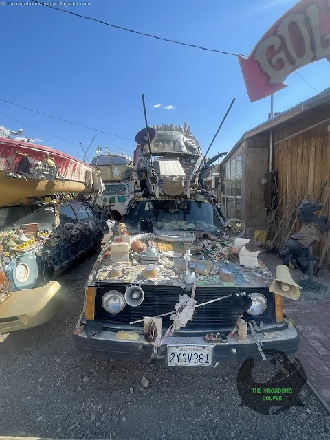
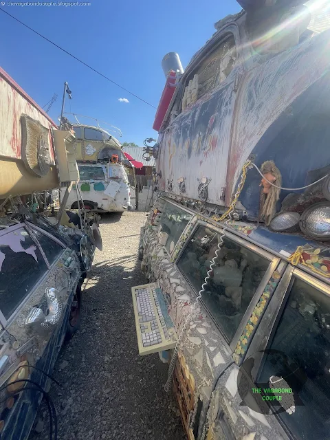
The map link in the source names the Goldfield Art Car Park Gallery. Current Nevada tourism material identifies the downtown collection as Rocket Bob's Art Cars. The vehicles carry shells, household hardware, dolls, kitchenware, fans, signs, keyboards, televisions and other found objects. None of the invented artwork names in the older text survived the fact check. The cars did not need fictional titles; they were already wearing half a garage sale.
 |
 |
 |
 |
 |
 |
 |
 |
| Rocket Bob's Art Cars: first sequence Vehicle bodies covered with paint and found objects turn a Goldfield roadside lot into a compact mechanical cabinet of curiosities. | |||
The first sequence established the method. Vehicle bodies became support structures for things that had outlived their original jobs. Paint covered rust, objects covered paint and the mechanical shape underneath remained visible enough to make the transformation funny. A normal car aims to reduce drag. These appeared to be collecting it.
 |
 |
 |
 |
 |
 |
 |
 |
| Rocket Bob's Art Cars: found-object details Mosaics, metal pieces, household objects, signs, and painted panels accumulate across vehicles that retired from transportation without retiring from public life. | |||
The middle group rewarded close inspection. The attached materials were ordinary in isolation and startling in combination. A fan, a pan or a strip of metal became part of the vehicle's skin. Goldfield's mining boom had once valued ore hidden below ground; this collection placed its material wealth on the outside.
 |
 |
 |
 |
 |
 |
 |
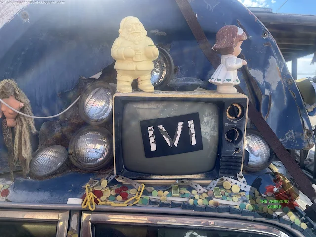 |
| Rocket Bob's Art Cars: later details The collection ends with keyboards, televisions, painted surfaces, and the photographed instruction to support the lunatic fringe. | |||
The final frames included a computer keyboard, a television and the photographed demand to “Support the lunatic fringe!” It was difficult to argue with a sign mounted on an art car in a former mining boomtown. We recorded the instruction and complied by continuing to the larger vehicle installation outside town.
The meaning sits in accumulation. One decorated car can be dismissed as a roadside oddity. Twenty-four views show a method: objects are collected, attached, painted, layered and left exposed to Nevada weather. The sequence preserves differences between the vehicles without forcing formal names onto them. The collection needs no catalog titles; the attached objects already make every car distinct.
International Car Forest of the Last Church
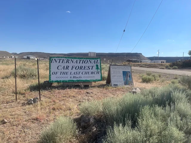
The International Car Forest of the Last Church occupies open ground outside Goldfield. More than forty cars, vans, trucks and buses stand upright, lean at angles, sit partly buried or rest in stacked arrangements. Mark Rippie began the project on his land, and artists Chad Sorg and Zak Sargent helped shape the painted collection seen today.
 |
 |
 |
 |
 |
 |
 |
 |
| Entering the International Car Forest Cars, vans, and buses rise from the ground outside Goldfield while Shehzadi remains sensibly horizontal. | |||
We drove Shehzadi among the installations. That placed an operating truck beside vehicles whose transportation careers had ended and whose second lives required concrete, holes and paint. Shehzadi remained on four tires, perhaps out of professional caution.
The Car Forest uses the silhouettes of vehicles as both sculpture and canvas. Bodies planted nose-first create tall forms visible from across the site; buses provide large mural surfaces; smaller cars cluster like mechanical brush. Weather continues to alter the work after the artists finish, adding fade, rust and dust without asking permission.
 |
 |
 |
 |
 |
 |
 |
|
| Buses, murals, and planted vehicles Graffiti-covered buses, partly buried cars, and painted vehicle shells form the middle of the Car Forest. | |||
The school bus and other large vehicles carried layered graffiti and murals. Some cars were upright, some inverted and some almost consumed by the ground. The arrangement made scale difficult to judge until we stood beside it. A sedan is not especially tall on a highway. Turn it vertical and the same vehicle becomes a public argument with gravity.
 |
 |
 |
 |
| Later Car Forest installations The final group shows stacked, painted, and weathered vehicles before the route returns to U.S. 95. | |||
The site remains free and accessible, but current guidance asks visitors to photograph rather than add paint, tags or damage. That rule protects a collection whose surfaces already look open to intervention. The art may be informal; ownership still exists.
We returned to U.S. 95 with dust on Shehzadi and dozens of retired vehicles behind us. Goldfield had given us two distinct uses for old cars: dense found-object assemblages downtown and large planted forms outside town. Both were cheaper than manufacturing spaceships and easier to register with the county.
The Car Forest's size separates it from the downtown collection. It is an outdoor field rather than a compact lot, and the vehicles act as markers across the ground. Walking or driving between them changes the composition with every angle. A bus blocks one view, an upright car appears behind another, and distant mountains enter the frame. The site therefore works less like a row of objects and more like a route through them—appropriate for travelers arriving in a truck that had no intention of becoming part of the permanent collection.
Beatty and Rhyolite Ghost Town
South on U.S. 95, Beatty provided fuel and services near Death Valley. It is a functioning community, not a ghost town, and the airport should not be described as abandoned without firm evidence. The distinction between Beatty and Rhyolite became clear after we turned toward the latter: one serves travelers now; the other survives mainly through ruins.
Rhyolite began after Shorty Harris and E. L. Cross found gold-bearing quartz in the Bullfrog Hills in 1904. Investment and rail connections drove rapid growth. The Cook Bank, school, depot, water systems, electricity and other civic structures followed the money. The financial panic of 1907 and disappointing mine returns then reversed the process with impressive efficiency.
 |
 |
 |
 |
| Rhyolite's surviving structures The schoolhouse, jail, Cook Bank shell, and railway depot mark the short civic life of Nevada's best-known mining ghost town. | |||
By 1910, Rhyolite's population had fallen to 611. The Montgomery Shoshone mine closed in 1911, and electric service ended in 1916. The ruins now occupy federal and private parcels outside Death Valley National Park. The BLM historic area is day-use only, which is sensible because old masonry and desert darkness are a poor team-building exercise.
The surviving structures tell different parts of the collapse. The Cook Bank remains a tall concrete shell. The depot, built in Mission Revival style, is one of the most intact buildings but is privately owned. The Bottle House used roughly 50,000 bottles, a practical response to scarce conventional building material and abundant saloon inventory.
The buildings also preserve a hierarchy of materials. Concrete and steel kept the bank's outline standing after interiors vanished. The depot's heavier construction preserved rooms and rooflines. Bottle walls survived because thousands of small glass units were set into mortar. Lighter timber structures disappeared more completely, leaving open ground between the landmarks. The result can make Rhyolite seem sparsely planned, when much of the original town has simply left fewer durable traces.
 |
| Rhyolite Historic Site The view south from the railway depot crosses the scattered remains of a boomtown that expanded rapidly after 1904 and declined almost as fast. |
The panorama from near the depot made Rhyolite's scale easier to read. Foundations and walls spread across ground that once held a fast-growing town. The empty spaces between ruins are part of the evidence: they measure how much vanished after the capital, jobs and rail traffic moved elsewhere.
Rhyolite's short life also warns against reading ruins backward. The town did not know in 1907 that it would become a photogenic stop beside Death Valley. Banks, schools, railways and utilities were built for residents who expected continuity. The surviving walls can look romantic now because the danger, noise and investment losses are gone. Standing among them, we saw less a timeless Western ruin than the remains of a modern town whose economic assumptions expired before its concrete did.
Goldwell Open Air Museum
Beside Rhyolite, the Goldwell Open Air Museum changed the register from mining remains to planned sculpture. Albert Szukalski created The Last Supper and Ghost Rider in 1984, and the collection grew through work by other artists. The museum uses the open desert as its gallery space, which avoids climate-control bills while introducing several thousand miles of weather.
 |
 |
 |
 |
| Goldwell Open Air Museum Ghost figures, the visitor center, and the wider collection stand beside Rhyolite's ruins without asking the desert for a conventional gallery wall. | |||
Szukalski made The Last Supper by protecting live models, draping them in plaster-soaked fabric, allowing the forms to harden and then removing the people. The remaining shells preserve the shape of cloth around absent bodies. Their arrangement echoes Leonardo da Vinci's composition without trying to imitate a painted room.
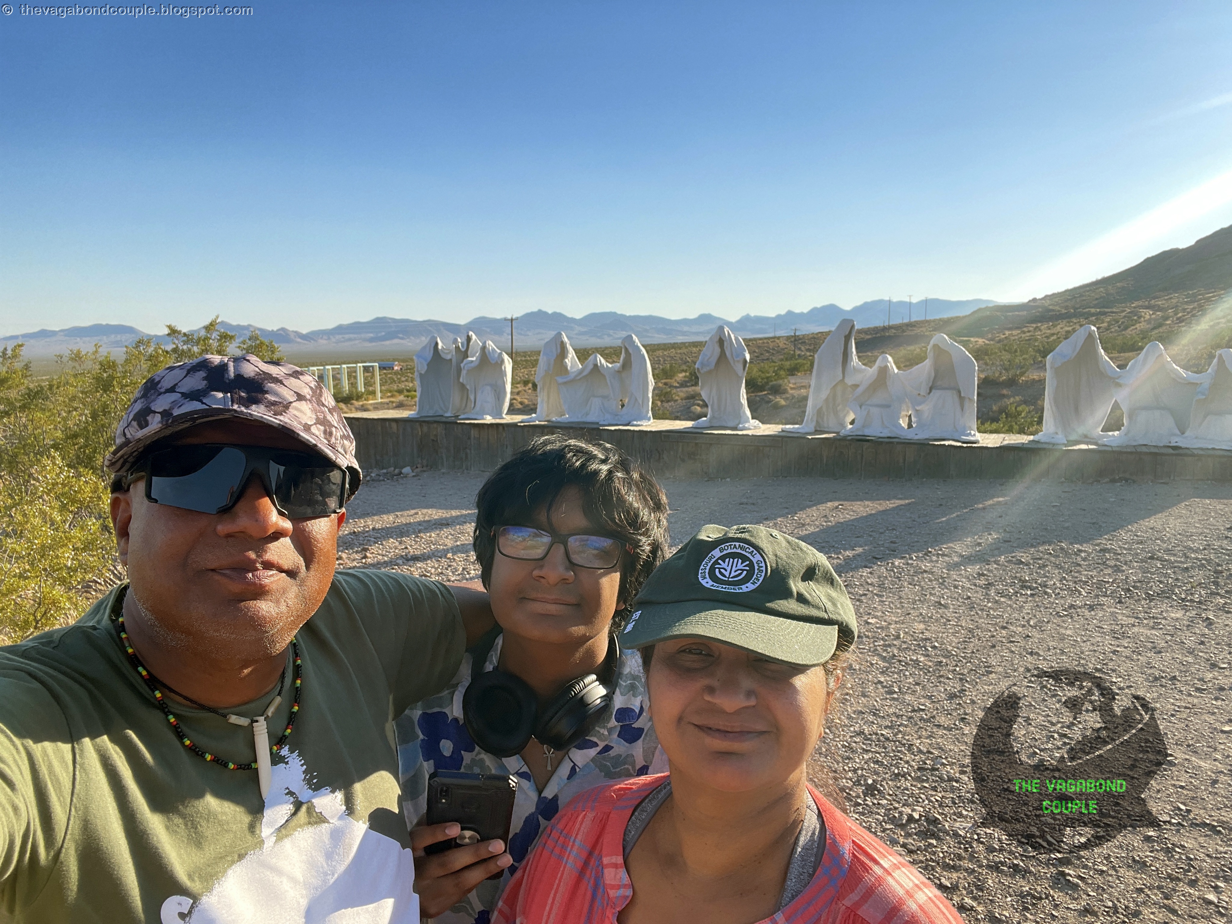 |
| The Last Supper Albert Szukalski's hollow white figures stand in the open desert at Goldwell, a ghostly arrangement created in 1984 beside Rhyolite's ruins. |
The white figures recalled the ghost sculptures we had seen near Vezio Castle (Castello di Vezio) above Lake Como. The materials and setting differ, but both use hollow human forms to make absence visible. At Goldwell, Rhyolite's ruins sit nearby, so the idea requires no explanatory brochure.
 |
 |
||
| The Last Supper details Closer views reveal Szukalski's hollow, fabric-shaped figures and the open space within each body. | |||
Ghost Rider reduced the group to a single hollow figure on a bicycle. The cyclist cannot move, yet the posture carries motion. Nevada had already supplied cars planted vertically and saucers parked beside convenience stores; a stationary ghost on a bicycle felt almost restrained.
 |
 |
||
| Ghost Rider Szukalski's hollow cyclist holds movement and stillness in the same white figure. | |||
Serving Ghost also dates to 1984 and came to Goldwell after a private commission. The original bottles associated with the piece deteriorated, and the low artist's palette is a later interpretation. The older post's self-portrait theory went beyond the evidence, so the sculpture now receives the courtesy of its documented history.
 |
 |
 |
|
| Serving Ghost The figure dates to 1984; the low palette beside it is a later interpretation after the original bottles deteriorated. | |||
Later artists expanded the collection beyond Szukalski's fabric-like shells. Hugo Heyrman's 1992 Lady Desert: The Venus of Nevada builds a pink human figure from cinder blocks, linking classical figure sculpture with pixel-like units. Dre Peeters's 1992 Icara is wood, not metal, and recasts the Icarus story through a female figure.
 |
 |
 |
 |
| Lady Desert and Icara Hugo Heyrman's pink cinder-block figure is followed by Dre Peeters's wooden, female reworking of the Icarus story. | |||
Fred Bervoets's Tribute to Shorty Harris pairs the prospector with a penguin. Goldwell interprets the penguin as a sign of the artist's own displacement in Nevada, not as evidence that Harris had a complicated wardrobe. Amanda Phingbodhipakkiya's 2021 Portone follows with nine light-blue steel frames arranged like a Jacob's ladder. The title means “doorway.”
 |
 |
 |
 |
| Tribute to Shorty Harris and Portone Fred Bervoets's miner-and-penguin pairing gives way to Amanda Phingbodhipakkiya's nine light-blue steel frames. | |||
Diptown, by Irina and Stanislav Schminke, uses rooflines, mailboxes and street elements to suggest a settlement sinking into the ground. The work appeared at Burning Man in 2022, was crowdfunded and joined Goldwell's collection in 2024. Its stated aim is nostalgia for a place and time that never existed, which gives it an unusual advantage over most nostalgia.
Goldwell worked because the art and the neighboring ghost town did not compete. Rhyolite supplied real abandonment; the museum supplied deliberate forms that comment on bodies, memory, movement and vanished settlements. Szukalski's hollow figures carried absence. Lady Desert converted a classical body into blocks. Portone framed the space beyond it. Diptown invented ruins beside actual ruins. The desert around them was active space in every composition, not neutral background.
Outdoor sculpture also changes with distance. A figure that appears isolated from the parking area gains a relationship to the mountains as we move closer. Frames in Portone capture different pieces of sky with each step. The ghost figures reveal their hollow construction only at shorter range. Wide and close views therefore belong together: distance supplies context, while proximity reveals material and construction.
 |
 |
||
| Diptown Partly submerged house forms create nostalgia for a town and time that never existed, a useful skill in a state already selling aliens by the roadside. | |||
The outdoor collection remains open around the clock. Updated August 2026: the visitor center currently posts approximate Monday-through-Saturday daytime hours, but anyone planning around a staffed building should verify before arrival. The sculptures do not keep office hours. The desert occasionally does, usually by turning the lights off.
Area 51 Alien Center
From Rhyolite, the source route followed unpaved desert roads back toward U.S. 95 and the Area 51 Alien Center at the Nevada 373 junction. This was the final alien-themed stop before California and our dinner stop after a long afternoon of mining towns, planted cars and white ghost figures.
 |
 |
 |
 |
 |
 |
 |
 |
| Area 51 Alien Center Exterior murals and mannequins lead indoors to a claw machine, restaurant counter, menu, and our dinner stop at the U.S. 95 junction. | |||
The center combined fuel, retail displays, murals, alien mannequins and a restaurant counter. We ate there without assigning the business an unsupported opening date or ownership history. By this point the alien motif had moved from novelty to route punctuation: every few hours, a green figure confirmed that we had not accidentally returned to an ordinary interstate.
Amargosa Valley lies in the Mojave Desert and within the larger Amargosa River basin. Much of the river runs underground or appears intermittently, yet springs and groundwater support biologically important pockets in an otherwise dry region. The basin's quiet hydrology was less visible than the alien murals, which is how roadside commerce usually wins these contests.
Dinner also reset the practical clock. We were still outside Death Valley, daylight was fading and the final roads would be driven in darkness. Food, fuel and route checks mattered more than adding another attraction. The stop's alien branding made it memorable, but its useful role was ordinary: a staffed place at a major junction before a hot, sparsely settled crossing.
Sunset Road to Furnace Creek
We left the center on Nevada State Route 373 as the sun dropped toward the western ranges. The road crossed Amargosa Valley to the California line, continued as CA-127 and turned toward Death Valley Junction before CA-190 carried us west. The route moved from Nevada's alien economy into a basin where geology needed no costume department.
 |
 |
 |
 |
 |
 |
 |
 |
| Amargosa Valley sunset The light changed across eight frames as Shehzadi left Nevada, crossed Death Valley Junction, and continued onto California State Route 190. | |||
The sunset changed in stages rather than one dramatic switch. Bright light flattened the valley first; orange gathered behind the mountains; the ridgelines became black; then the road entered dusk. Shehzadi's headlights took over before the descent into Death Valley.
The photo gallery keeps those stages together because their value lies in sequence. One sunset frame records color. Eight frames record time passing while the truck moves. Road, mountains and sky shift relative to each other, then visible detail falls away. That progression mattered on this day: the final photographs were also a countdown to a night arrival in a basin famous for heat, elevation and roads that require full attention even when the scenery has gone dark.
Furnace Creek holds the World Meteorological Organization-recognized world air-temperature record of 134°F, recorded in 1913. That record is a weather-station measurement under specific conditions. Our later 118°F display was Shehzadi's outside-temperature reading, useful evidence of what the truck reported but not a replacement for calibrated meteorology.
Watch: The driving sequence from Nevada's Extraterrestrial Highway through the desert-art stops and into Death Valley.
Updated August 2026: Death Valley road conditions can change quickly after heat damage, flooding or maintenance. The official road-status map should be checked before arrival, especially when a route depends on secondary roads. Desert roads dislike assumptions almost as much as they dislike standing water.
Midnight at The Ranch at Death Valley
CA-190 descended through darkness. The Sea Level sign arrived first, followed by the Furnace Creek marker at minus 190 feet. These were route measurements rather than attraction previews; Badwater Basin belongs to the next episode and is deliberately absent from this post's route and schema.
The descent linked the day's geology. Central Nevada had kept lifting us across cold high-desert basins and ranges. The final road dropped into a much lower, hotter basin bounded by steep mountain blocks. Elevation signs made that change legible at night, when the valley floor and surrounding peaks were mostly absent from view. Numbers replaced scenery: zero feet, minus 190 feet, 118°F, 12:15 a.m.
 |
 |
 |
|
| Descent to Furnace Creek Sea Level, minus 190 feet, and The Ranch at Death Valley signs recorded the final descent before the dashboard supplied the temperature and time. | |||
We reached The Ranch at Death Valley after midnight. The dashboard showed 12:15 a.m., 118°F and an odometer reading of 10,191 miles. Shehzadi had left Hyattsville at 6,395 miles, so the odometer recorded 3,796 miles driven since home. The mileage for this single day was far smaller. Even Shehzadi would have filed a complaint about the earlier arithmetic.
The numbers also closed the route more accurately than a dramatic conclusion could. We had begun the continuation at Crystal Springs in central Nevada, crossed the E.T. Highway, stopped in living mining towns and an abandoned one, and entered California after sunset. At Furnace Creek, time, mileage, elevation and temperature all appeared together. The truck had become the final road sign. We checked in, unloaded only what the night required and left the rest of Death Valley for daylight, when the basin's scale would be visible and the dashboard would have fewer reasons to sound judgmental.
 |
| Midnight at Furnace Creek Shehzadi recorded 118°F at 12:15 a.m. with 10,191 miles on the odometer—3,796 miles driven since Hyattsville. |
This leg brought several versions of Nevada into one line of travel. Military secrecy became roadside alien commerce. Mining booms left living towns, county institutions and abandoned masonry. Retired vehicles became art in Goldfield, while European and American sculptors built a formal outdoor collection beside Rhyolite. Shehzadi then dropped from central Nevada's high desert into Furnace Creek below sea level, still carrying the dust from all of them.
That sequence mattered more than any single roadside oddity. Each stop changed the meaning of the next: alien branding sharpened the mining history, ruined buildings gave the sculpture park more weight, and the art cars made the ordinary truck carrying us seem briefly conventional. Nevada had achieved the unlikely.
Next Stop
Part 10 ends at the overnight handoff. The next morning begins our full Death Valley drive through Zabriskie Point, Badwater Basin, Artists Drive, Golden Canyon and California State Route 190. We had reached Furnace Creek; the basin itself still had an entire day to make the thermometer feel inadequate.
For now, the useful achievement was simpler: we had arrived safely, checked in and stopped moving. The next post starts after sleep, daylight and a fresh reading of the road map—three resources that had become steadily more valuable since Crystal Springs.
Reference route map of The Vagabond Couple's 9,000-mile USA & Mexico overland roundtrip: Map-1 and Map-2.
- The Vagabond Couple and Shehzadi
