Trans-America USA + Mexico Overland 9,000-mile 31-day Roadtrip | Part 5 | Arches National Park, Canyonlands National Park, Dead Horse Point State Park & Sand Flats Offroad Trail Recreation Area | Moab, Utah
 |
| Colorado River bend at Dead Horse State Park at Sunset (Moab, Utah) |
Good morning, fellow wanderers! It’s us again, the Vagabond Couple, fresh off a night’s rest in Moab (see Colorado Springs, Colorado to Moab, Utah) and ready to dive into two days that promises to be nothing short of epic. After a quick breakfast at a cozy local café (where the coffee was strong and the pancakes were fluffier than clouds), we hopped into Shehzadi, our trusty Toyota Tundra and pointed her toward the crown jewels of the area: Arches National Park, Canyonlands National Park and stunning sunset at the Colorado River loop at Dead Horse Point State Park, following up with an adventurous drive along the off-road trail at Sand Flats 4x4 Recreation Area for the Pure Utah experience.
Two of the many words that we added to our vocabulary in the American Southwest:
Mesa
Mesa (noun):
Geology/Geography: An isolated, flat-topped hill or mountain with steep sides, found in landscapes dominated by horizontal layers of sedimentary rock. Mesas are smaller than plateaus but larger than buttes, formed by erosion and weathering over time.
Example: "The desert was dotted with mesas, their flat tops glowing in the sunset."
Spanish Origin: The word "mesa" comes from the Spanish word for "table," reflecting the flat, table-like appearance of these landforms.
Example: "The explorers named the landform 'Mesa Verde' for its green, table-like surface."
Cultural Significance: Mesas are often significant in indigenous cultures, serving as sacred sites, defensive locations, or symbols in folklore and art.
Example: "The ancient Puebloans built their villages on mesas for protection and spiritual connection."
In summary, a mesa is a flat-topped elevation with steep sides, shaped by natural forces and often holding cultural or historical importance.
Butte
Butte (noun)
Pronunciation: /byo͞ot/
Definition: A butte is an isolated, steep-sided hill or small mountain with a flat top, often found in arid or semi-arid regions. It is smaller than a mesa and is formed by erosion, where softer rock layers wear away, leaving a more resistant caprock on top. Buttes are common in the western United States and other desert landscapes.
Example:
"The rugged landscape was dotted with towering buttes, their flat tops glowing in the sunset."
Etymology: The word "butte" comes from the French word for "hillock" or "mound," derived from Old French butte, meaning "target" or "knoll." It was adopted into English in the 19th century to describe these distinctive landforms.
Related Terms:
- Mesa: A larger flat-topped hill or mountain with steep sides.
- Plateau: A broad, elevated area of relatively flat land, larger than a mesa.
Buttes are iconic features of landscapes like the American Southwest and are often associated with Native American folklore and the imagery of the Wild West. There are other geology-related words and concepts that we picked up along the legendary US Route 191 as all travelers do (we had previously driven US-191 when visiting Yellowstone: South Dakota, Wyoming and Montana - Badlands, Yellowstone, Glacier National Park into Blackfeet Country). Some of them appear in this post. Travel is education!
Moab to Arches, Dead Horse Point and Canyonlands: Two Days of Red Rock Wonders
The Drive to Arches: A Prelude to Wonder
 |
| How do Arches Form? |
The drive from Moab to Arches National Park is so short, it almost feels like cheating. Just five miles north of town and bam - you’re there. But don’t let the short distance fool you; the journey is a visual feast. As we left Moab, the red rock cliffs began to rise around us, their jagged edges glowing in the morning light. The road to the park winds through a landscape that feels like it belongs on another planet, with towering sandstone formations and vast expanses of desert scrub.
 |
| Shehzadi at Arches National Park |
We rolled up to the park entrance, paid our fee (pro tip: get there early to beat the crowds) and began the steep climb up the switchbacks to the park’s main road. Shehzadi handled the incline like a champ and with every turn, the views got more and more jaw-dropping. By the time we reached the top, we were already pulling over to take photos. Spoiler alert: this would become a theme for the day.
Arches National Park: A Landscape of Dreams
 |
| Arches National Park |
Arches National Park is one of those places that makes you question whether you’re still on Earth. With over 2,000 natural stone arches, towering spires and balanced rocks, it’s a geological wonderland that feels like it was designed by a particularly artistic giant.
 |
| Park Avenue, Arches National Park |
We started our exploration with the Park Avenue Trail, a short but stunning hike that takes you through a canyon lined with massive rock formations that resemble skyscrapers (hence the name). It was like walking through a natural city and we couldn’t stop marveling at the sheer scale of it all.
 |
| Courthouse Towers, Arches National Park |
The Courthouse Towers section in Arches National Park are like nature’s own skyscrapers, standing tall and majestic against the vast Utah sky. This collection of massive sandstone monoliths includes iconic formations like the Three Gossips, The Organ, Sheep Rock and the Tower of Babel, each one a masterpiece of erosion and time.
The Courthouse Towers rise dramatically from the desert floor, their sheer cliffs and intricate textures telling a story of millions of years of wind, water and geological upheaval. Driving or hiking through this area feels like walking through a natural cathedral, with the towering rocks casting long shadows and creating a sense of awe and reverence.
 |
| The Organ, Courthouse Towers, Arches National Park |
The Organ, a prominent sandstone tower in the Courthouse Towers section, is a massive, monolithic structure that resembles a giant pipe organ, hence its name.
 |
| The Organ, Courthouse Towers, Arches National Park |
The Three Gossips formation, also in the Courthouse Towers area along the Arches Scenic Drive, consists of three towering sandstone pinnacles that resemble figures engaged in conversation, giving rise to its name. Formed from Entrada Sandstone, the Three Gossips has been shaped over millions of years by erosion, wind and water.
 |
| The Three Gossips, Courthouse Towers, Arches National Park |
Three Gossips is one of the park’s most iconic and photogenic landmarks, often admired for its dramatic appearance against the backdrop of the desert landscape. Visitors can view it from the nearby Park Avenue Trail or scenic pullouts along the road.
Sheep Rock is another distinctive sandstone formation in the Courthouse Towers area. Resembling the shape of a resting sheep, this towering Entrada Sandstone monolith stands near the other famous formations like The Organ, Tower of Babel and Three Gossips, along the Arches Scenic Drive.
 |
| Sheep Rock, Courthouse Towers, Arches National Park |
Sheep Rock’s isolated, balanced appearance highlights the park’s unique geological processes, where softer rock layers erode away, leaving behind dramatic, freestanding formations. Sheep Rock is a favorite subject for photographers and a striking landmark along the scenic route.
The Tower of Babel is another striking and imposing formation in the Courthouse Towers area. This massive sandstone monolith, rising dramatically from the desert floor, its sheer cliffs and rugged texture a testament to millions of years of erosion and geological activity, is named for its towering presence and biblical allusion.
 |
| Tower of Babel, Courthouse Towers, Arches National Park |
The Tower of Babel stands as a silent sentinel over the park, offering a sense of grandeur and timelessness. Its reddish hue, typical of the iron-rich sandstone in the region, glows brilliantly under the sun, especially during sunrise and sunset. While it is not as famous as some of the park’s arches, the Tower of Babel is another favorite among photographers and hikers for its commanding presence and the way it dominates the landscape.
 |
| Ham Rock |
Ham Rock is one of the lesser-known but equally fascinating formations near the Courthouse Towers area. This distinctive rock formation gets its name from its unique shape, which resembles a giant ham resting on a platter. Standing at approximately 85 feet tall, Ham Rock is a striking example of the park’s iconic sandstone formations, shaped by millions of years of erosion and weathering.
Rental campervans from Cruise America regularly feature Ham Rock on their RVs. In fact, one of our most memorable moments at Arches National Park was when we saw a campervan with a picture of Ham Rock on its back, parked in front of Ham Rock. The drivers of the RV had no idea and were thrilled when we pointed it out!
 |
| Photo of Ham Rock on campervan parked in front of Ham Rock at Arches National Park |
Ham Rock's rounded, smooth surface contrasts with the jagged cliffs and spires nearby, making it a standout feature in the landscape. Ham Rock is easily visible from the main park road, making it a quick and rewarding stop for visitors exploring the Courthouse Towers area.
 |
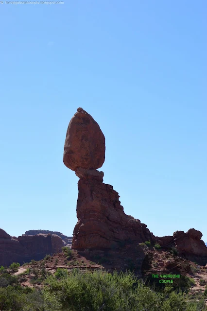
| Balanced Rock, Arches National Park |
Next up was the Balanced Rock, one of the park’s most iconic landmarks. Similar to the precariously Balanced Rock at Garden of The Gods in Colorado Springs, but of totally different shape.
 |
| Balanced Rock, Arches National Park |
The gravity-defying boulder here at Arches perches on a slender pedestal and it’s hard not to feel a little nervous standing beneath it.
 |
| Balanced Rock, Arches National Park |
We snapped a few photos and made a mental note to never underestimate the power of erosion.
 |
| Balanced Rock, Arches National Park |
We continue on the Arches Scenic Drive road from Balanced Rock towards the Windows Section, a short but unforgettable journey through some of the park’s most iconic landscapes.
 |
| Arches National Park, Moab, Utah |
As we leave the parking area near the gravity-defying Balanced Rock, we find ourselves on the winding Scenic Drive that offers stunning views at every turn.
 |
| Arches National Park, Moab, Utah |
The drive itself is only about 4 miles, but it’s packed with jaw-dropping scenery. Almost immediately, we are surrounded by towering red rock formations, their jagged edges and smooth curves glowing in the sunlight. The road meanders through a mix of open desert and clusters of sandstone fins, with the La Sal Mountains providing a dramatic backdrop in the distance.
 |
| Arches National Park, Moab, Utah |
Along the way, we pass several pullouts and viewpoints, each offering a new perspective on the park’s unique geology. One of the highlights is Garden of Eden, a serene area filled with oddly shaped rock formations that seem to defy logic. It’s a great spot to stretch our legs and take in the views.
 |
| Turret Arch |
As we approach the Windows Section, the landscape becomes even more dramatic. Here, the road leads to a loop that takes us right up to some of the park’s most famous arches, including Turret Arch, North Window and South Window. These massive arches frame the surrounding landscape like natural picture windows, offering breathtaking views of the Colorado Plateau.
The drive is relatively easy, with well-maintained roads and plenty of opportunities to stop and take photos.
 |
| Turret Arch, Windows Section |
We reach the Windows Section, home to some of the park’s most famous arches. The North Window and South Window, along with Turret Arch, form a trio of natural wonders that are as photogenic as they come. Turret Arch gets its name from the tall, tower-like formation that stands beside it, giving the whole scene a whimsical, almost castle-like vibe.
 |
| Parade of Elephants (Elephant Butte), Arches National Park |
The Parade of Elephants (Elephant Butte) is another distinctive rock formation located near the Windows Section. This Entrada Sandstone formation gets its name from its resemblance to a line of elephants walking in a procession, with massive, rounded sandstone "bodies" and arch-like gaps that resemble legs.
 |
| Parade of Elephants |
The Elephants are easily visible from nearby trails, making it a popular feature for visitors exploring the Windows Section, which also includes Turret Arch, North and South Windows and Double Arch.
 |
| North Window, Windows Section |
Nearby, the North and South Window arches frame the landscape like a pair of giant spectacles, offering breathtaking views of the surrounding red rock desert.
 |
| Under North Window Arch |
We hiked the short loop around the arches, pausing to take in the views and soak up the history. These formations have been shaped over millions of years by wind, water and time and standing beneath them felt like standing in the presence of something ancient and eternal.
 |
| Under North Window Arch |
Double Arch is another one of the park’s most iconic and photogenic formations. Located in the Windows Section, this unique structure is not actually two separate arches but rather two massive arches that share the same stone foundation, creating a dramatic and awe-inspiring sight. The larger of the two arches spans 148 feet (45 meters) wide and rises 104 feet (32 meters) high, while the smaller arch is slightly more modest in size but equally impressive.
 |
| Double Arch |
Double Arch was formed by water erosion from above, rather than the typical side erosion that creates most arches, giving it its distinctive, towering appearance. A short, easy hike from the parking area brings you right up to the base of the arches, where you can marvel at their sheer size and the way they frame the sky. It’s a must-see for anyone visiting Arches National Park and a favorite among photographers and nature lovers alike.
Arches National Park is part of the Colorado Plateau (Plato Colorado), a vast geological region covering parts of Utah, Arizona, Colorado and New Mexico. From the Windows Section of Arches National Park, the view of the Colorado Plateau is nothing short of spectacular. Stretching out in every direction, the plateau forms a vast, undulating sea of red rock, dotted with mesas, buttes and canyons that seem to go on forever. The layers of sedimentary rock tell a story millions of years in the making, with each stripe of color representing a different chapter in Earth’s history.
 |
| Colorado Plateau view from Windows Section |
As the sun moves across the sky, the light plays tricks on the landscape, casting shadows that deepen the canyons and highlighting the textures of the rock. It’s a view that makes you feel small in the best possible way, reminding you of the sheer scale and timeless beauty of the natural world. Standing there, you can’t help but feel a deep sense of awe - and maybe even a little gratitude - for being able to witness such a masterpiece.
Wolfe Ranch (38.7422°N, 109.4991°W) in Arches National Park is a historic homestead that offers a glimpse into the rugged pioneer life of the late 19th century. Built in 1898 by John Wesley Wolfe, a Civil War veteran from Ohio, the ranch was originally a simple, one-room log cabin with a corral and small outbuildings, situated near Salt Wash. Wolfe, along with his son Fred, lived here for over a decade, enduring the harsh desert conditions in hopes of making a living from cattle ranching. In 1906, Wolfe’s daughter, Flora Stanley and her family joined him, but she was appalled by the primitive conditions and convinced him to build a more suitable cabin, which still stands today.
 |
| Wolfe Ranch |
Wolfe Ranch is culturally significant as it represents the perseverance of early settlers in the unforgiving Utah desert and is one of the few remaining examples of frontier homesteading in the region. Nearby, visitors can also see Ute petroglyphs, carved into rock by Indigenous people long before the arrival of European settlers, adding to the area's deep historical and cultural value. Today, Wolfe Ranch serves as the starting point for the Delicate Arch Trail, one of the most famous hikes in the park.
 |
| Delicate Arch Trailhead |
The crown jewel of Arches National Park (and arguably our entire day) was Delicate Arch. This iconic arch is the symbol of Utah and seeing it in person is a bucket-list moment. The hike to the arch is a bit of a challenge - 3 miles round trip with some steep sections - but oh, is it worth it.
 |
| Information Board at Delicate Arch Trailhead at Arches National Park |
As we rounded the final bend, the arch came into view, framed by the vast expanse of the La Sal Mountains in the distance. It was one of those moments that takes your breath away and we sat there for a while, just taking it all in.
 |
| Delicate Arch Viewpoint, Arches National Park |
We get a distant view of Delicate Arch and surrounding rock formations from the Delicate Arch Viewpoint. Delicate Arch (far left) is the most recognizable feature, standing alone on a sandstone ridge. The rock formations to the right of Delicate Arch include several small hoodoos and eroded sandstone domes, which are characteristic of the Entrada Sandstone layer that forms much of the park’s unique landscape. The series of rounded rock formations further to the right are likely remnants of eroded fins, which are the precursors to arches. Over time, continued erosion and weathering may create new openings in these formations. This view highlights the rugged, windswept beauty of the park’s high desert terrain.
 |
| Delicate Arch |
Unforgettable Utah Route 313: The Dead Horse Mesa Scenic Byway
After a full day of exploring Arches, we weren’t ready to call it quits just yet. We’d heard that Dead Horse Point State Park was the place to be for sunset, so we hopped back into Shehzadi and made the short drive to the park on the stunning Utah Route 313.
Utah Route 313, also known as the Dead Horse Mesa Scenic Byway, is one of the most breathtaking drives in the American Southwest. This 22-mile route stretches from U.S. Highway 191 near Moab and winds through stunning red rock landscapes before reaching Dead Horse Point State Park and Canyonlands National Park. The drive offers an unforgettable journey through towering mesas, deep canyons and vast desert panoramas that showcase the rugged beauty of southeastern Utah.
Watch: Utah Route 313 Southwest USA - Dead Horse Mesa Scenic Byway U-313 going up
As you leave Highway 191, Route 313 begins its dramatic ascent through high desert terrain, revealing a mesmerizing landscape shaped by millions of years of geological activity. The road climbs switchbacks carved into the cliffs, offering stunning views of the surrounding Moab Valley, the Colorado River and the La Sal Mountains in the distance. The contrast between the red sandstone formations and the snow-capped peaks creates a spectacular visual experience.
Dead Horse Point: A Sunset for the Ages
 |
| Dead Horse Point State Park Entrance |
Dead Horse Point is a place steeped in legend and history.
 |
| Dead Horse Point State Park |
According to Native American lore, the area was once used as a natural corral for wild mustangs.
 |
| Information Board at Dead Horse Point State Park |
Cowboys would herd the horses onto the point, a narrow mesa with steep cliffs on all sides and then fence off the entrance.
 |
| Dead Horse Point State Park |
Legend has it that one group of horses was left corralled here and died of thirst within sight of the Colorado River below - a haunting story that gives the park its name.
 |
| Dead Horse Point State Park |
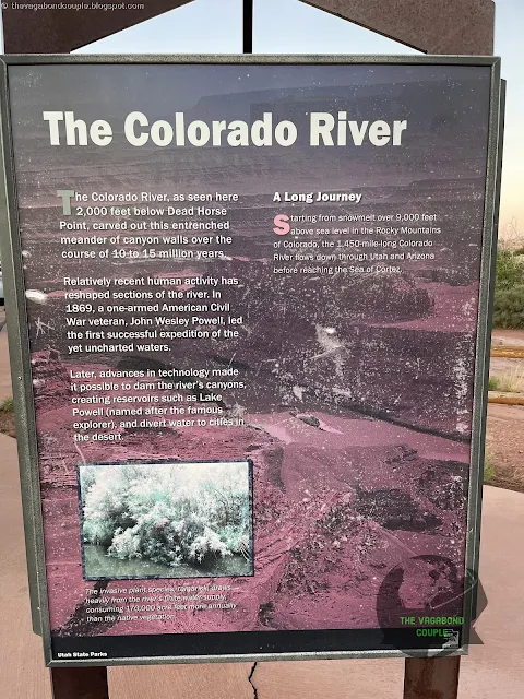
The park itself is situated high above a stunning bend of the Colorado river, with viewpoints that offer some of the most memorable vistas in the American Southwest.
 |
| Dead Horse Point State Park |
We started at the Visitor Center, where we learned more about the area’s geology and history, before heading out to the main overlook.
 |
| Dead Horse Point State Park |
The view from Dead Horse Point is nothing short of spectacular: a 2,000-foot drop to the Colorado River below, with the red rock canyons stretching out as far as the eye can see.
 |
| Dead Horse Point State Park |
As the sun began to set, the sky exploded into a riot of colors - pinks, oranges, purples and golds - that reflected off the canyon walls and the river below.
 |
| Dead Horse Point State Park |
It was one of the most beautiful sunsets we’ve ever seen and we felt incredibly lucky to witness it.
 |
| Dead Horse Point State Park |
We sat there in silence, letting the beauty of the moment sink in, until the last light faded and the stars began to appear.
 |
| Dead Horse Point State Park |
It was time to head back to our hotel in Moab. This sunset will be forever etched in our memories.
 |
| Dead Horse Point State Park |
Back to Moab: A Day Well Spent
As we drove back to Moab under a blanket of stars, we couldn’t stop talking about the day’s adventures. From the otherworldly landscapes of Arches to the haunting beauty of Dead Horse Point, it had been a day filled with wonder and awe.
Watch: Utah Route 313 Southwest USA - Dead Horse Mesa Scenic Byway U-313 coming down
We capped off the night with a quick dinner at a local diner (because sometimes you just need a greasy burger after a day of hiking) and crashed into bed, already dreaming of tomorrow’s adventures.
Day 2 at Moab: Canyonlands National Park
Rise and shine, fellow adventurers! The Vagabond Couple is back at it again, this time with an early start to tackle another one of Utah’s crown jewels: Canyonlands National Park. After a hearty breakfast of eggs, bacon and enough coffee to fuel a small army, we hopped into Shehzadi, our trusty Toyota Tundra and hit the road. Today’s mission? To explore the vast, rugged beauty of Canyonlands and soak up every bit of its geological grandeur, Native American history and jaw-dropping vistas.
The Drive to Canyonlands: A Journey Through Time
The drive from Moab to Canyonlands is about 30 miles (towards Dead Horse Point State Park but continue straight instead of turning left at the fork), but it feels like a journey through time. As we left town, the red rock cliffs of Moab slowly gave way to a more expansive, wild landscape. The road winds through a mix of desert scrub and towering rock formations, with the La Sal Mountains looming in the distance. It’s a drive that makes you feel small in the best possible way.
 |
| Wilson Arch off US-191 |
About halfway to the park, we passed by Wilson Arch, a massive sandstone arch that’s impossible to miss. We pulled over for a quick photo op (because, of course) and it got us even more excited for what lay ahead. As we got closer to Canyonlands, the landscape became more dramatic, with deep canyons and mesas stretching out as far as the eye could see.
Canyonlands National Park: A Land of Canyons, Mesas and Legends
 |
| Canyonlands National Park Entrance |
Canyonlands is divided into four districts, each with its own unique personality. We decided to focus on the Island in the Sky district, the most accessible and (in our opinion) the most iconic.
 |
| Canyonlands National Park |
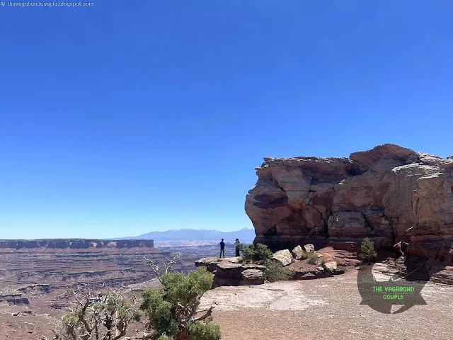
As we entered the park, we were greeted by the Shafer Canyon Overlook, a jaw-dropping viewpoint that offers a glimpse of the park’s vastness. The canyon below looked like a maze of red rock, carved over millions of years by the Colorado River and Green River.
 |
| Mesa Arch, Canyonlands |
Our first stop was the Mesa Arch, a short but incredibly rewarding hike. The arch frames a view of the canyons below and when the sunlight hits it just right, the underside of the arch glows like it’s on fire.
 |
| Canyonlands National Park |
July in Canyonlands National Park is a time of extreme heat and dramatic weather. Temperatures can occasionally exceed 100°F (38°C), especially in lower-elevation areas like the Colorado and Green River canyons.
 |
| Canyonlands National Park |
Brief but intense thunderstorms are common in July, often accompanied by lightning, strong winds and dangerous flash floods in narrow canyons and washes.
 |
| Canyonlands National Park |
The UV index is extremely high (often 10+), so sun protection (sunscreen, hats, sunglasses) is essential. Gusty winds are common in the afternoons, especially in open areas like the Island in the Sky district.
 |
| Canyonlands National Park |
It’s no wonder this spot is a favorite among photographers. We sat there for a while, soaking in the view and imagining what it must have been like for the Native Americans who once called this land home.
 |
| Canyonlands National Park |
Speaking of Native American history, Canyonlands is steeped in it. The park is part of the ancestral lands of the Pueblo, Ute and Navajo peoples, who have lived in and around these canyons for thousands of years.
 |
| Canyonlands National Park |
They left behind petroglyphs, pottery shards and other artifacts that tell the story of their deep connection to this land. As we hiked and explored, we couldn’t help but feel a sense of reverence for the people who came before us.
 |
| Canyonlands National Park |
Next up was the Grand View Point Overlook, the crown jewel of the Island in the Sky district.
 |
| Canyonlands National Park |
The name says it all - this viewpoint offers a panoramic view of the park’s labyrinth of canyons, mesas and buttes.
 |
| Canyonlands National Park |
It’s a place that makes you feel both tiny and infinite at the same time.
 |
| Canyonlands National Park |
We lingered here for a while, trying to take it all in, but honestly, no photo or description can do it justice. You just have to see it for yourself.
 |
| Canyonlands National Park |
We also made a quick stop at Upheaval Dome, a mysterious crater-like formation that scientists still can’t fully explain. More seriously, though, the Colorado Plateau, including Canyonlands, was uplifted during the Laramide Orogeny (70-40 million years ago).
 |
| Canyonlands National Park |
This uplift, combined with the erosive power of the Colorado and Green Rivers, carved the park's deep canyons and exposed its layered rocks.
 |
| Canyonlands National Park |
Salt Tectonics: Beneath the park lies the Paradox Formation, a thick layer of salt deposited during the Pennsylvanian period (over 300 million years ago).
 |
| Canyonlands National Park |
The salt is less dense than the overlying rocks and has flowed upward, creating domes and anticlines (structural traps formed by the folding of rock strata into arch-like shapes; synclines are the inverse of anticlines).
 |
| Canyonlands National Park |
This process, known as salt tectonics, has influenced the park's surface topography.
 |
| Canyonlands National Park |
Some say the Upheaval Dome is the result of a meteorite impact, while others believe it’s a salt dome that pushed its way to the surface. Whatever it is, it’s fascinating - and a little eerie.
 |
| Canyonlands National Park |
Canyonlands experiences a desert climate, with hot summers, cold winters and minimal precipitation (less than 10 inches annually).
 |
| Canyonlands National Park |
This arid environment contributes to the slow but persistent erosion of the landscape. Flash Floods: Despite the low rainfall, the park is prone to flash floods, which can rapidly erode rock and reshape the landscape.
 |
| Canyonlands National Park |
Groundwater: Groundwater plays a significant role in shaping the park's features, particularly through the dissolution of soluble rocks like limestone and the formation of caves and sinkholes.
 |
| Canyonlands National Park, Utah, USA (Panorama) |
Back to Moab: A Day of Reflection
After spending most of the hot day exploring Canyonlands, we circled back to Moab, our minds buzzing with everything we’d seen. The drive back was just as beautiful as the drive there, with the setting sun casting a golden glow over the red rock cliffs. We rolled into town feeling equal parts exhilarated and exhausted, ready for a low-key evening.
We grabbed dinner at a local joint and spent the rest of the evening relaxing at our hotel. As we sat on the balcony, watching the stars come out over Moab, we couldn’t stop talking about the day’s adventures. Arches, Dead Horse Point and Canyonlands have left us in awe and we felt so grateful to have experienced this beauty.
Day 3 at Moab: Off-roading on Sand Flats 4x4 & ATV Off-road Trail
 |
| Sand Flats Recreation Area Moab 4x4 Trail |
The next morning, we wake up in Moab to mark a week of being on the road. Shehzadi's odometer indicates we have now covered 2,347 miles from starting from home back in Hyattsville, Maryland. But we still have 7,000 miles and three weeks planned for our epic trans-America & Mexico trip!
 |
| Shehzadi's Odometer 8,742 miles |
But the adventure doesn’t stop here, folks! We were ready for some adventure, so we took Shehzadi off the pavement and onto the Sand Flats 4x4 & ATV Off-Road Trail.
 |
| Sand Flats Recreation Area Moab 4x4 Trail |
Moab is famous for its slickrock terrain and this trail did not disappoint.
 |
| Sand Flats Recreation Area Moab 4x4 Trail |
Rolling over waves of petrified sand dunes, we tackled steep inclines and heart-racing descents that felt like riding a roller-coaster in the middle of a Mars-like landscape.
 |
| Sand Flats Recreation Area Moab 4x4 Trail |
The views were simply breathtaking. To the west, the La Sal Mountains stood tall with their snow-capped peaks, a striking contrast to the sunbaked red rock below.
 |
| Sand Flats Recreation Area Moab 4x4 Trail |
To the east, the vast Colorado Plateau stretched endlessly, with deep canyons and sandstone fins catching the golden morning light.
 |
| Sand Flats Recreation Area Moab 4x4 Trail |
The famous "Lion’s Back" and "Hell’s Revenge" trails twisted in the distance, daring extreme off-roaders to attempt their challenging climbs.
 |
| Sand Flats Recreation Area Moab 4x4 Trail |
We stopped at a high point to take it all in - just us, the wide-open desert and the hum of Shehzadi’s engine cooling down from the adrenaline rush.
 |
| Sand Flats Recreation Area Moab 4x4 Trail |
This was Moab at its finest - wild, untamed and exhilarating.
The Drive From Moab to Kanab, Utah
From the Sand Flats Offroad 4x4 Trail at Moab, we head to our next destination of Kanab, Utah: see Moab to Kanab, Utah | I-70 West Vistas, Arches of Red Canyon in Dixie National Forest, Kodachrome Basin & Grosvenor Arch in Grand Staircase-Escalante. So stay tuned, fellow wanderers, because the next chapter of our journey promises to continue an epic ride. Until then, keep exploring, keep dreaming and remember: the world is full of wonders waiting to be discovered.
Reference route map of The Vagabond Couple's 9,000-mile USA & Mexico overland roundtrip: Map-1 and Map-2.
- The Vagabond Couple (and Shehzadi)
0 comments